Stockland Township, Iroquois County, Illinois
Stockland Township is one of twenty-six townships in Iroquois County, Illinois, USA. As of the 2010 census, its population was 243 and it contained 122 housing units.[2] Stockland Township formed as Crab Apple Township in September 1864, but changed its name to Stockland Township on an unknown date.
Stockland Township | |
|---|---|
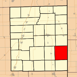 Location in Iroquois County | |
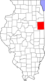 Iroquois County's location in Illinois | |
| Coordinates: 40°38′07″N 87°35′37″W | |
| Country | United States |
| State | Illinois |
| County | Iroquois |
| Established | September 1864 |
| Area | |
| • Total | 53.51 sq mi (138.6 km2) |
| • Land | 53.51 sq mi (138.6 km2) |
| • Water | 0 sq mi (0 km2) 0% |
| Elevation | 666 ft (203 m) |
| Population (2010) | |
| • Estimate (2016)[1] | 232 |
| • Density | 4.5/sq mi (1.7/km2) |
| Time zone | UTC-6 (CST) |
| • Summer (DST) | UTC-5 (CDT) |
| ZIP codes | 60953, 60966, 60967 |
| FIPS code | 17-075-72773 |
Geography
According to the 2010 census, the township has a total area of 53.51 square miles (138.6 km2), all land.[2]
Unincorporated towns
- Cutmer at 40.650314°N 87.600026°W
- Stockland at 40.614481°N 87.592803°W
(This list is based on USGS data and may include former settlements.)
Cemeteries
The township contains Sugar Creek Chapel Cemetery.
Airports and landing strips
- Wichman Airport
Landmarks
- Dawson Park
Political districts
- Illinois' 15th congressional district
- State House District 105
- State Senate District 53
gollark: htans.
gollark: htans?
gollark: <@331320482047721472> Do you not want my IfPFAtMDaPIUStL list?
gollark: I'm implementing a thing to solve wordsearches on hex grids.
gollark: So am I! For very loose definitions of productivity.
References
- "Stockland Township, Iroquois County, Illinois". Geographic Names Information System. United States Geological Survey. Retrieved 2010-01-17.
- United States Census Bureau 2007 TIGER/Line Shapefiles
- United States National Atlas
- "Population and Housing Unit Estimates". Retrieved June 9, 2017.
- "Population, Housing Units, Area, and Density: 2010 - County -- County Subdivision and Place -- 2010 Census Summary File 1". United States Census. Archived from the original on 2020-02-12. Retrieved 2013-05-28.
- "Census of Population and Housing". Census.gov. Retrieved June 4, 2016.
External links
Places adjacent to Stockland Township, Iroquois County, Illinois | |
|---|---|
Municipalities and communities of Iroquois County, Illinois, United States | ||
|---|---|---|
| Cities | Map of Illinois highlighting Iroquois County | |
| Villages | ||
| Townships | ||
| Unincorporated communities | ||
| Footnotes | ‡This populated place also has portions in an adjacent county or counties | |
This article is issued from Wikipedia. The text is licensed under Creative Commons - Attribution - Sharealike. Additional terms may apply for the media files.