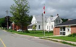
Stanley Parish, New Brunswick
Stanley is a civil parish[lower-alpha 1] in York County, New Brunswick, Canada.[2]
Stanley | |
|---|---|
 | |
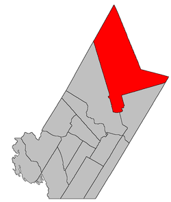 Location within York County, New Brunswick. | |
| Coordinates: 46.4975°N 66.71°W | |
| Country | |
| Province | |
| County | York |
| Established | 1837 |
| Area | |
| • Land | 1,222.02 km2 (471.82 sq mi) |
| Population (2016)[1] | |
| • Total | 832 |
| • Density | 0.7/km2 (2/sq mi) |
| • Pop 2011-2016 | |
| • Dwellings | 413 |
| Time zone | UTC-4 (AST) |
| • Summer (DST) | UTC-3 (ADT) |
For governance purposes it is divided between the village of Stanley, the incorporated rural community of Upper Miramichi,[3] and the local service district of the parish of Stanley.[4]
Delineation
Stanley Parish is defined in the Territorial Division Act[2] as being bounded:
- All that part of the County bounded southerly and westerly by a line running east from the northwest angle of the grant to D. Campbell and others, and a line running from said angle southerly along the various courses of the western rear line of the grants to D. Campbell and associates, and D. Lyman and associates, to the south branch of the Dunbar Stream; thence up the same to the rear line of lots fronting on the east side of the Cardigan Road;[lower-alpha 2] thence northerly along the various courses of the said rear line to the northeastern angle of lot number forty-four, granted to J.W. Jouett; thence north to the County line.
Communities
Parish population total does not include incorporated municipalities (in bold):
|
|
|
Demographics
Population
|
LanguageMother tongue (2016)[1]
|
gollark: If the power or water supply fail here, I'll probably be somewhat uncomfortable until they're restored, but be basically fine, at least as long as they're available somewhere not too far away.
gollark: No, the requirements on a space habitat are higher.
gollark: I probably don't want to be somewhere which relies on infrastructure continuously flawlessly operating for me to not die, considering.
gollark: That would probably be hard to run in real time on-device and would probably not matter if you're exploiting it anyway.
gollark: The consumer things will inevitably have poor security, probably backdoors, and the ability to accept feeds you don't really want for advertising.
See also
Notes
- Civil parishes served a variety of government functions until 1966, when the new Municipalities Act stripped them of their responsibilities; they continue to provide convenient boundaries for government uses, especially electoral districts and local service districts. Statistics Canada uses civil parishes as census subdivisions for all parts of the province that are not within municipalities and similar entities.
- Route 620[5]
References
- "Census Profile, 2016 Census: Stanley, Parish [Census subdivision], New Brunswick". Statistics Canada. Retrieved August 28, 2019.
- "Chapter T-3 Territorial Division Act". Government of New Brunswick. Retrieved 25 July 2020.
- "New Brunswick Regulation 2008-37 under the Municipalities Act (O.C. 2008-110)". Government of New Brunswick. Retrieved 25 July 2020.
- "New Brunswick Regulation 84-168 under the Municipalities Act (O.C. 84-582)". Government of New Brunswick. Retrieved 25 July 2020.
- "No. 328" (PDF). 2015 Designated Highway Maps. Government of New Brunswick. Retrieved 26 August 2016.
- Statistics Canada: 1996, 2001, 2006 census
- 2011 Statistics Canada Census Profile: Stanley Parish, New Brunswick
External links
Places adjacent to Stanley Parish, New Brunswick | |
|---|---|
| Subdivisions |
|
|---|---|
| Cities | |
| Counties | |
| |
This article is issued from Wikipedia. The text is licensed under Creative Commons - Attribution - Sharealike. Additional terms may apply for the media files.