South Kilkerran, South Australia
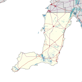
South Kilkerran is a locality in the Australian state of South Australia located on Yorke Peninsula between Maitland and Port Victoria.[1]
| South Kilkerran South Australia | |||||||||||||||
|---|---|---|---|---|---|---|---|---|---|---|---|---|---|---|---|
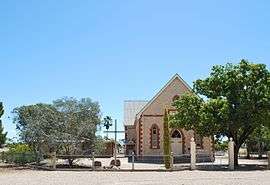 St John's Lutheran church at South Kilkerran | |||||||||||||||
 South Kilkerran | |||||||||||||||
| Coordinates | 34°26′33″S 137°35′18″E[1] | ||||||||||||||
| Population | 54 (2016 census)[2] | ||||||||||||||
| Established | 27 May 1999[3] | ||||||||||||||
| Postcode(s) | 5573 | ||||||||||||||
| Time zone | ACST (UTC+9:30) | ||||||||||||||
| • Summer (DST) | ACST (UTC+10:30) | ||||||||||||||
| Location | 9 km (6 mi) SW of Maitland | ||||||||||||||
| LGA(s) | Yorke Peninsula Council | ||||||||||||||
| Region | Yorke and Mid North[1] | ||||||||||||||
| County | Fergusson[1] | ||||||||||||||
| State electorate(s) | Narungga[4] | ||||||||||||||
| Federal Division(s) | Grey[5] | ||||||||||||||
| |||||||||||||||
| |||||||||||||||
| Footnotes | Adjoining localities[1] | ||||||||||||||
South Kilkerran is still the home of St John's Lutheran church.[7] It formerly also had a St Paul's Lutheran church,[8] and both churches had schools associated with them,[9] which are now closed.
The 2016 Australian census which was conducted in August 2016 reports that South Kilkerran had a population of 54 people.[2]
South Kilkerran is located within the federal division of Grey, the state electoral district of Narungga and the local government area of the Yorke Peninsula Council.[4][5]
References
- "Search results for 'South Kilkerran, LOCB' with the following datasets selected - 'Suburbs and localities', 'Counties', 'Local Government Areas', 'SA Government Regions' and 'Gazetteer'". Location SA Map Viewer. South Australian Government. Retrieved 22 May 2020.
- Australian Bureau of Statistics (27 June 2017). "South Kilkerran (State Suburb)". 2016 Census QuickStats.

- Kentish, Peter McLaren (27 May 1999), "GEOGRAPHICAL NAMES ACT 1991, Notice to Assign Boundaries and Names to Places (in the District Council of Yorke Peninsula)" (PDF), The South Australian Government Gazette, Government of South Australia: 2696, retrieved 22 May 2020 – via AustLII
- "District of Narungga Background Profile". Electoral Commission SA. Retrieved 21 May 2020.
- "Profile of the electoral division of Grey (SA)". Australian Electoral Commission. Retrieved 21 May 2020.
- "Monthly Climate Statistics for Maitland (nearest weather station)". Climate statistics for Australian locations. Bureau of Meteorology. Retrieved 21 May 2020.
- "St John's South Kilkerran". Maitland Lutheran Parish, South Australia. Retrieved 18 September 2015.
- "THE COUNTRY". The Advertiser. Adelaide. 20 February 1917. p. 10. Retrieved 18 September 2015 – via National Library of Australia.
- "SOUTH KILKERRAN". The Observer. Adelaide. 14 August 1915. p. 52. Retrieved 18 September 2015 – via National Library of Australia.
This article is issued from Wikipedia. The text is licensed under Creative Commons - Attribution - Sharealike. Additional terms may apply for the media files.