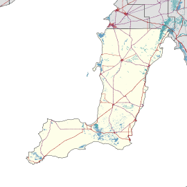
Point Turton, South Australia
Point Turton is a coastal town 114 kilometres (71 mi) west of Adelaide, South Australia.[3] It is located in the Yorke Peninsula Council.
| Point Turton South Australia | |||||||||||||||
|---|---|---|---|---|---|---|---|---|---|---|---|---|---|---|---|
Part of Point Turton | |||||||||||||||
 Point Turton | |||||||||||||||
| Coordinates | 34°56′49″S 137°21′11″E | ||||||||||||||
| Population |
| ||||||||||||||
| Established | 1876 | ||||||||||||||
| Postcode(s) | 5575[3] | ||||||||||||||
| LGA(s) | Yorke Peninsula Council | ||||||||||||||
| State electorate(s) | Narungga[4] | ||||||||||||||
| Federal Division(s) | Grey[5] | ||||||||||||||
| |||||||||||||||
Demographics
The 2016 Census recorded the resident population of Point Turton to be 305 people. Of these, 56.3% were male and 43.7% were female.[1]
The majority of residents (262 people, or 85.9%) are of Australian birth, with the largest international population being of English origin.[1]
The age distribution of Point Turton residents is skewed higher than the greater Australian population. 77.9% of residents were over 25 years in 2016, compared to the Australian average of 68.8%; and 22.1% were younger than 25 years, compared to the Australian average of 31.2%.[1]
Facilities
The Point Turton General Store is the main shopping facility in the town.
The Tavern on Turton is a hotel that opened in 2007.
The town also has a caravan park and some holiday cottages houses along the beachfront.
Attractions
Point Turton is notable for its fishing, being regularly featured on fishing programs.
References
- Australian Bureau of Statistics (27 June 2017). "Point Turton (UCL)". 2016 Census QuickStats. Retrieved 1 March 2018.

- Australian Bureau of Statistics (27 June 2017). "Point Turton (SSC)". 2016 Census QuickStats. Retrieved 1 March 2018.

- "Point Turton, South Australia". Postcodes-Australia. Retrieved 11 April 2011.
- Narungga (Map). Electoral District Boundaries Commission. 2016. Retrieved 1 March 2018.
- "Federal electoral division of Grey" (PDF). Australian Electoral Commission. Retrieved 24 July 2015.
- "New Ward Structure 2014". Yorke Peninsula Council. Archived from the original on 15 January 2016. Retrieved 21 October 2015.