South Flannigan Township, Hamilton County, Illinois
South Flannigan Township is one of twelve townships in Hamilton County, Illinois, USA. As of the 2010 census, its population was 116 and it contained 74 housing units.[2] It was formed from Flannigan Township.
South Flannigan Township | |
|---|---|
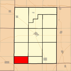 Location in Hamilton County | |
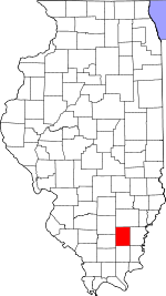 Hamilton County's location in Illinois | |
| Coordinates: 37°55′50″N 88°39′20″W | |
| Country | |
| State | |
| County | Hamilton |
| Established | November 3, 1885 |
| Area | |
| • Total | 18.41 sq mi (47.7 km2) |
| • Land | 18.38 sq mi (47.6 km2) |
| • Water | 0.04 sq mi (0.1 km2) 0.22% |
| Elevation | 531 ft (162 m) |
| Population (2010) | |
| • Estimate (2016)[1] | 112 |
| • Density | 6.3/sq mi (2.4/km2) |
| Time zone | UTC-6 (CST) |
| • Summer (DST) | UTC-5 (CDT) |
| ZIP codes | 62817, 62890, 62935 |
| FIPS code | 17-065-70785 |
Geography
According to the 2010 census, the township has a total area of 18.41 square miles (47.7 km2), of which 18.38 square miles (47.6 km2) (or 99.84%) is land and 0.04 square miles (0.10 km2) (or 0.22%) is water.[2]
Unincorporated towns
- University at 37.936437°N 88.609499°W
(This list is based on USGS data and may include former settlements.)
Cemeteries
The township contains these two cemeteries: Good Hope and Winn.
School districts
- Galatia Community Unit School District 1
- Hamilton County Community Unit School District 10
- Thompsonville Community Unit School District 174
Political districts
- Illinois's 19th congressional district
- State House District 117
- State Senate District 59
gollark: Or play the Soviet national anthem, but late at night when few people will be there.
gollark: Reasonably simple spec, safe parsing, no weird insanity like that, no whitespace sensitivity, still pretty human-readable like INI files.
gollark: I think TOML is generally a nice config format.
gollark: Because it doesn't use quotes, and implicit whitespace.
gollark: There is literally a website to explain the various ways YAML does multiline strings.
References
- "South Flannigan Township, Hamilton County, Illinois". Geographic Names Information System. United States Geological Survey. Retrieved 2010-07-06.
- United States Census Bureau 2009 TIGER/Line Shapefiles
- United States National Atlas
- "Population and Housing Unit Estimates". Retrieved June 9, 2017.
- "Population, Housing Units, Area, and Density: 2010 - County -- County Subdivision and Place -- 2010 Census Summary File 1". United States Census. Archived from the original on 2020-02-12. Retrieved 2013-05-28.
- "Census of Population and Housing". Census.gov. Retrieved June 4, 2016.
External links
- City-Data.com
- Illinois State Archives
- Township Officials of Illinois
- Hamilton County Historical Society
Places adjacent to South Flannigan Township, Hamilton County, Illinois | |
|---|---|
Municipalities and communities of Hamilton County, Illinois, United States | ||
|---|---|---|
| Cities | Map of Illinois highlighting Hamilton County | |
| Town | ||
| Villages | ||
| Townships | ||
| Unincorporated communities | ||
| Footnotes | ‡This populated place also has portions in an adjacent county or counties | |
This article is issued from Wikipedia. The text is licensed under Creative Commons - Attribution - Sharealike. Additional terms may apply for the media files.