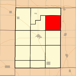
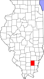
Beaver Creek Township, Hamilton County, Illinois
Beaver Creek Township is one of twelve townships in Hamilton County, Illinois, USA. As of the 2010 census, its population was 271 and it contained 126 housing units.[2]
Beaver Creek Township | |
|---|---|
 Location in Hamilton County | |
 Hamilton County's location in Illinois | |
| Coordinates: 38°10′21″N 88°25′37″W | |
| Country | |
| State | |
| County | Hamilton |
| Established | November 3, 1885 |
| Area | |
| • Total | 36.4 sq mi (94 km2) |
| • Land | 36.39 sq mi (94.2 km2) |
| • Water | 0.01 sq mi (0.03 km2) 0.03% |
| Elevation | 410 ft (125 m) |
| Population (2010) | |
| • Estimate (2016)[1] | 261 |
| • Density | 7.4/sq mi (2.9/km2) |
| Time zone | UTC-6 (CST) |
| • Summer (DST) | UTC-5 (CDT) |
| ZIP codes | 62828, 62835, 62859, 62887 |
| FIPS code | 17-065-04481 |
Geography
According to the 2010 census, the township has a total area of 36.4 square miles (94 km2), of which 36.39 square miles (94.2 km2) (or 99.97%) is land and 0.01 square miles (0.026 km2) (or 0.03%) is water.[2]
Unincorporated towns
- Blairsville at 38.168381°N 88.464216°W
- Bungay at 38.179214°N 88.408659°W
(This list is based on USGS data and may include former settlements.)
Extinct towns
- Jefferson City at 38.150325°N 88.461716°W
- New London at 38.168381°N 88.405603°W
(These towns are listed as "historical" by the USGS.)
Cemeteries
The township contains Springer Cemetery.
School districts
- Hamilton County Community Unit School District 10
- Norris City-Omaha-Enfield Community Unit School District 3
Political districts
- Illinois's 19th congressional district
- State House District 108
- State Senate District 54
gollark: Why?
gollark: It would have magic nanotechnology™ on board so it would magically™ self-repair.
gollark: The easiest way would probably just be to send scanned brains over via starwisp or something.
gollark: Quite possibly.
gollark: This is probably not accurate, as nobody has done it or gotten close to.
References
- United States Census Bureau 2008 TIGER/Line Shapefiles
- "Beaver Creek Township". Geographic Names Information System. United States Geological Survey. Retrieved 2009-09-24.
- United States National Atlas
- "Population and Housing Unit Estimates". Retrieved June 9, 2017.
- "Population, Housing Units, Area, and Density: 2010 - County -- County Subdivision and Place -- 2010 Census Summary File 1". United States Census. Archived from the original on 2020-02-12. Retrieved 2013-05-28.
- "Census of Population and Housing". Census.gov. Retrieved June 4, 2016.
External links
This article is issued from Wikipedia. The text is licensed under Creative Commons - Attribution - Sharealike. Additional terms may apply for the media files.