Songer Township, Clay County, Illinois
Songer Township is one of twelve townships in Clay County, Illinois, USA. As of the 2010 census, its population was 342 and it contained 160 housing units.[2]
Songer Township | |
|---|---|
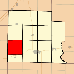 Location in Clay County | |
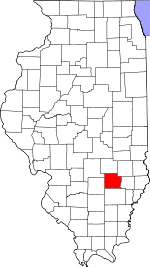 Clay County's location in Illinois | |
| Coordinates: 38°41′N 88°38′W | |
| Country | United States |
| State | Illinois |
| County | Clay |
| Established | November 5, 1861 |
| Area | |
| • Total | 37.42 sq mi (96.9 km2) |
| • Land | 37.31 sq mi (96.6 km2) |
| • Water | 0.11 sq mi (0.3 km2) 0.29% |
| Elevation | 535 ft (163 m) |
| Population (2010) | |
| • Estimate (2016)[1] | 332 |
| • Density | 9.2/sq mi (3.6/km2) |
| Time zone | UTC-6 (CST) |
| • Summer (DST) | UTC-5 (CDT) |
| ZIP codes | 62858, 62899 |
| FIPS code | 17-025-70486 |
Geography
According to the 2010 census, the township (T3N R5E) has a total area of 37.42 square miles (96.9 km2), of which 37.31 square miles (96.6 km2) (or 99.71%) is land and 0.11 square miles (0.28 km2) (or 0.29%) is water.[2]
Unincorporated towns
- Bethel (historical)
(This list is based on USGS data and may include former settlements.)
Cemeteries
The township contains these four cemeteries: Edwards Family, Oak Mound, Parker and Songer.
Major highways

Lakes
- Greendale Lake
School districts
- Flora Community Unit School District 35
Political districts
- Illinois' 19th congressional district
- State House District 108
- State Senate District 54
gollark: Macbooks cost more, but are actually very good now.
gollark: Oh. Chromebooks cost less than "good" laptops, though.
gollark: Anyway, what do you mean "lightbook"?
gollark: Yes.
gollark: Well, mine has a GPU.
References
- "Songer Township, Clay County, Illinois". Geographic Names Information System. United States Geological Survey. Retrieved 2010-01-10.
- United States Census Bureau 2007 TIGER/Line Shapefiles
- United States National Atlas
- "Population and Housing Unit Estimates". Retrieved June 9, 2017.
- "Population, Housing Units, Area, and Density: 2010 - County -- County Subdivision and Place -- 2010 Census Summary File 1". United States Census. Archived from the original on 2020-02-12. Retrieved 2013-05-28.
- "Census of Population and Housing". Census.gov. Retrieved June 4, 2016.
External links
Places adjacent to Songer Township, Clay County, Illinois | |
|---|---|
Municipalities and communities of Clay County, Illinois, United States | ||
|---|---|---|
| City | Map of Illinois highlighting Clay County | |
| Villages | ||
| Townships | ||
| Unincorporated communities | ||
| Ghost town | ||
| Footnotes | ‡This populated place also has portions in an adjacent county or counties | |
This article is issued from Wikipedia. The text is licensed under Creative Commons - Attribution - Sharealike. Additional terms may apply for the media files.