Pixley Township, Clay County, Illinois
Pixley Township is one of twelve townships in Clay County, Illinois, USA. As of the 2010 census, its population was 589 and it contained 284 housing units.[2]
Pixley Township | |
|---|---|
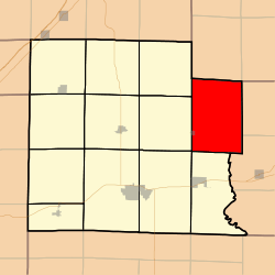 Location in Clay County | |
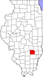 Clay County's location in Illinois | |
| Coordinates: 38°47′N 88°19′W | |
| Country | United States |
| State | Illinois |
| County | Clay |
| Established | November 5, 1861 |
| Area | |
| • Total | 45.09 sq mi (116.8 km2) |
| • Land | 45.07 sq mi (116.7 km2) |
| • Water | 0.02 sq mi (0.05 km2) 0.04% |
| Elevation | 453 ft (138 m) |
| Population (2010) | |
| • Estimate (2016)[1] | 561 |
| • Density | 13.1/sq mi (5.1/km2) |
| Time zone | UTC-6 (CST) |
| • Summer (DST) | UTC-5 (CDT) |
| ZIP codes | 62434, 62448, 62824, 62858, 62868, 62879 |
| FIPS code | 17-025-60261 |
Geography
According to the 2010 census, the township (T4N R8E) has a total area of 45.09 square miles (116.8 km2), of which 45.07 square miles (116.7 km2) (or 99.96%) is land and 0.02 square miles (0.052 km2) (or 0.04%) is water.[2]
Cities, towns, villages
- Sailor Springs (east three-quarters)
Unincorporated towns
(This list is based on USGS data and may include former settlements.)
Cemeteries
The township contains these twelve cemeteries: Ditter, Ingraham, Leonard, Levitte, McKinney, Reed, Saint Johns, Smith, Weidner, Wendelin-Holy Cross, Wesley and Woods.
School districts
- Clay City Community Unit District 10
- Jasper County Community Unit School District 1
- West Richland Community Unit School District 2
Political districts
- Illinois' 19th congressional district
- State House District 108
- State Senate District 54
gollark: This is inside my office compact machine, and has inside it a submachine containing autofishing.
gollark: Plus cups for coffee.
gollark: It produces fish, marshmallows, actual coffee, and baguettes.
gollark: I have found this rough picture of an old version of my coffee machine.
gollark: I'm a Minecraft vegetarian. I subsist off potatoes, or my coffee machine's bread output.
References
- "Pixley Township, Clay County, Illinois". Geographic Names Information System. United States Geological Survey. Retrieved 2010-01-10.
- United States Census Bureau 2007 TIGER/Line Shapefiles
- United States National Atlas
- "Population and Housing Unit Estimates". Retrieved June 9, 2017.
- "Population, Housing Units, Area, and Density: 2010 - County -- County Subdivision and Place -- 2010 Census Summary File 1". United States Census. Archived from the original on 2020-02-12. Retrieved 2013-05-28.
- "Census of Population and Housing". Census.gov. Retrieved June 4, 2016.
External links
Places adjacent to Pixley Township, Clay County, Illinois | |
|---|---|
Municipalities and communities of Clay County, Illinois, United States | ||
|---|---|---|
| City | Map of Illinois highlighting Clay County | |
| Villages | ||
| Townships | ||
| Unincorporated communities | ||
| Ghost town | ||
| Footnotes | ‡This populated place also has portions in an adjacent county or counties | |
This article is issued from Wikipedia. The text is licensed under Creative Commons - Attribution - Sharealike. Additional terms may apply for the media files.