Harter Township, Clay County, Illinois
Harter Township is one of twelve townships in Clay County, Illinois, USA. As of the 2010 census, its population was 6,394 and it contained 2,948 housing units.[2]
Harter Township | |
|---|---|
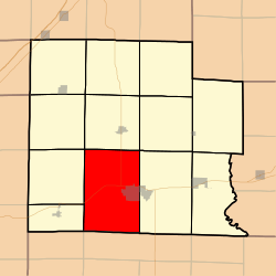 Location in Clay County | |
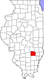 Clay County's location in Illinois | |
| Coordinates: 38°40′N 88°32′W | |
| Country | United States |
| State | Illinois |
| County | Clay |
| Established | November 5, 1861 |
| Area | |
| • Total | 55.97 sq mi (145.0 km2) |
| • Land | 55.86 sq mi (144.7 km2) |
| • Water | 0.1 sq mi (0.3 km2) 0.18% |
| Elevation | 482 ft (147 m) |
| Population (2010) | |
| • Estimate (2016)[1] | 6,168 |
| • Density | 114.5/sq mi (44.2/km2) |
| Time zone | UTC-6 (CST) |
| • Summer (DST) | UTC-5 (CDT) |
| ZIP codes | 62839, 62858, 62899 |
| FIPS code | 17-025-33266 |
Geography
According to the 2010 census, the township (T2&3N R6E) has a total area of 55.97 square miles (145.0 km2), of which 55.86 square miles (144.7 km2) (or 99.80%) is land and 0.1 square miles (0.26 km2) (or 0.18%) is water.[2]
Cities, towns, villages
- Flora (west three-quarters)
Cemeteries
The township contains these seven cemeteries: Elmwood, Garden of Memories, Golden, Jenkins, Logan Family, Meisenheimer and Saint Stephens.
Major highways


Airports and landing strips
- Clay County Hospital Heliport
Lakes
- Trago Lake
Landmarks
- Charley Brown Park
School districts
- Flora Community Unit School District 35
- North Clay Community Unit School District 25
Political districts
- Illinois' 19th congressional district
- State House District 108
- State Senate District 54
gollark: Are you going to buy our good™ bees?
gollark: Bee Rotation Has Been Initiated.
gollark: Capital Letters Directly Imply Correctness And/Or Goodness, As They Say.
gollark: You can't overthrow God, they've been dead since 1996.
gollark: Of course. You are unlikely to implode.
References
- "Harter Township, Clay County, Illinois". Geographic Names Information System. United States Geological Survey. Retrieved 2010-01-10.
- United States Census Bureau 2007 TIGER/Line Shapefiles
- United States National Atlas
- "Population and Housing Unit Estimates". Retrieved June 9, 2017.
- "Population, Housing Units, Area, and Density: 2010 - County -- County Subdivision and Place -- 2010 Census Summary File 1". United States Census. Archived from the original on 2020-02-12. Retrieved 2013-05-28.
- "Census of Population and Housing". Census.gov. Retrieved June 4, 2016.
External links
Places adjacent to Harter Township, Clay County, Illinois | |
|---|---|
Municipalities and communities of Clay County, Illinois, United States | ||
|---|---|---|
| City | Map of Illinois highlighting Clay County | |
| Villages | ||
| Townships | ||
| Unincorporated communities | ||
| Ghost town | ||
| Footnotes | ‡This populated place also has portions in an adjacent county or counties | |
This article is issued from Wikipedia. The text is licensed under Creative Commons - Attribution - Sharealike. Additional terms may apply for the media files.