Sims Township, Grant County, Indiana
Sims Township is one of 13 townships in Grant County, Indiana, United States. As of the 2010 census, its population was 1,779 and it contained 757 housing units.[1]
Sims Township | |
|---|---|
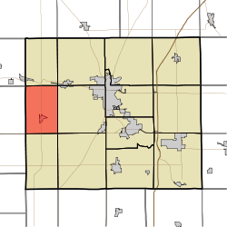 Location of Sims Township in Grant County | |
| Coordinates: 40°31′09″N 85°49′42″W | |
| Country | United States |
| State | Indiana |
| County | Grant |
| Government | |
| • Type | Indiana township |
| Area | |
| • Total | 24.08 sq mi (62.4 km2) |
| • Land | 24.08 sq mi (62.4 km2) |
| • Water | 0 sq mi (0 km2) 0% |
| Elevation | 860 ft (262 m) |
| Population (2010) | |
| • Total | 1,779 |
| • Density | 73.9/sq mi (28.5/km2) |
| GNIS feature ID | 0453849 |
Geography
According to the 2010 census, the township has a total area of 24.08 square miles (62.4 km2), all land.[1] The streams of Taylor Creek and Stoney Creek run through this township.
Cities and towns
Unincorporated towns
(This list is based on USGS data and may include former settlements.)
Adjacent townships
- Richland Township (north)
- Pleasant Township (northeast)
- Franklin Township (east)
- Liberty Township (southeast)
- Green Township (south)
- Union Township, Howard County (southwest)
- Jackson Township, Howard County (west)
- Jackson Township, Miami County (northwest)
Cemeteries
The township contains two cemeteries: Alel and Thraikill.
Major highways


gollark: In 20 years even the little display on your thermostat will be 8K, and need the future equivalent of an RTX 2080 to drive it.
gollark: Which defeats the point of a higher res display.
gollark: The extra pixel density just results in useless battery drain so it has moar pixel.
gollark: Well that sounds worthless.
gollark: (I mean, why did they make a laptop with a 180 degree hinge but a viewing-angle-limited 1366x768 panel?!)
References
- "Population, Housing Units, Area, and Density: 2010 - County -- County Subdivision and Place -- 2010 Census Summary File 1". United States Census. Archived from the original on 2020-02-12. Retrieved 2013-05-10.
External links
Municipalities and communities of Grant County, Indiana, United States | ||
|---|---|---|
| Cities | Map of Indiana highlighting Grant County | |
| Towns | ||
| Townships | ||
| CDPs | ||
| Unincorporated communities | ||
| Footnotes | ‡This populated place also has portions in an adjacent county or counties | |
This article is issued from Wikipedia. The text is licensed under Creative Commons - Attribution - Sharealike. Additional terms may apply for the media files.