Sharon, Queensland
Sharon is a locality in the Bundaberg Region, Queensland, Australia.[2] In the 2016 census Sharon had a population of 1,316 people.[1]
| Sharon Queensland | |||||||||||||||
|---|---|---|---|---|---|---|---|---|---|---|---|---|---|---|---|
 Sharon | |||||||||||||||
| Coordinates | 24.8761°S 152.2458°E | ||||||||||||||
| Population | 1,316 (2016 census)[1] | ||||||||||||||
| • Density | 24.33/km2 (63.00/sq mi) | ||||||||||||||
| Postcode(s) | 4670 | ||||||||||||||
| Area | 54.1 km2 (20.9 sq mi) | ||||||||||||||
| LGA(s) | Bundaberg Region | ||||||||||||||
| State electorate(s) | Burnett | ||||||||||||||
| Federal Division(s) | Flynn | ||||||||||||||
| |||||||||||||||
Geography
Sharon is approximately eight kilometres west of Bundaberg towards Gin Gin. The Sharon Gorge is a further four kilometres along the highway, and is home to a tranquil area with rainforests, ferns, palms and orchids.[3]
Manoo
The neighbourhood of Manoo is located in the south-western area of Sharon (24.8833°S 152.2333°E); it takes its name from the former Manoo railway station on the now closed Mount Perry railway line. The name Manoo is an Aboriginal word meaning clear straight track.[4]
History

The locality is named after the Sharon plain in Israel.[2]
St Stephen's Anglican church was dedicated on 30 April 1945 by Rural Dean Reverend N.C.C. Bertram. Its closure was approved in September 1991.[5]
In the 2011 census, Sharon had a population of 1,131 people.[6]
Heritage listings

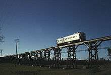
Sharon has the following heritage listings:
References
- Australian Bureau of Statistics (27 June 2017). "Sharon". 2016 Census QuickStats. Retrieved 15 April 2018.

- "Sharon - locality in Bundaberg Region (entry 44766)". Queensland Place Names. Queensland Government. Retrieved 28 December 2017.
- "Sharon - Queensland". Queensland.com. Archived from the original on 17 January 2018. Retrieved 14 April 2018.
- "Manoo - unbounded locality in the Bundaberg Region (entry 20832)". Queensland Place Names. Queensland Government. Retrieved 15 April 2018.
- "Closed Churches". Anglican Church Southern Queensland. Archived from the original on 3 April 2019. Retrieved 25 February 2019.
- Australian Bureau of Statistics (31 October 2012). "Sharon". 2011 Census QuickStats. Retrieved 14 November 2015.

- "Splitters Creek Railway Bridge (entry 600529)". Queensland Heritage Register. Queensland Heritage Council. Retrieved 7 July 2013.
External links
- "Sharon". Queensland Places. Centre for the Government of Queensland, University of Queensland.