Scheduled monuments in Derbyshire
This is a list of Scheduled Monuments in the English county of Derbyshire.
In the United Kingdom, a scheduled monument is a "nationally important" archaeological site or historic building that has been given protection against unauthorised change by being placed on a list (or "schedule") by the Secretary of State for Culture, Media and Sport; English Heritage takes the leading role in identifying such sites.[1] Scheduled monuments are defined in the Ancient Monuments and Archaeological Areas Act 1979 and the National Heritage Act 1983. They are also referred to as scheduled ancient monuments. There are about 20,000 Scheduled Monument entries on the list, which is maintained by English Heritage; more than one site can be included in a single entry.
While a scheduled monument can also be recognised as a listed building, English Heritage considers listed building status as a better way of protecting buildings than scheduled monument status. If a monument is considered by English Heritage to "no longer merit scheduling" it can be descheduled.[2]
Derbyshire has nearly 500 Scheduled Monuments including many stone cairns, stone circles, barrow burial mounds, lead mining relics, ancient settlements, and over 20 bridges.[3]
| Image | Name and reference | Feature | Location | Notes |
|---|---|---|---|---|
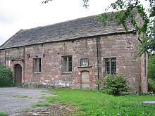 |
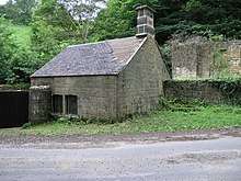
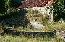
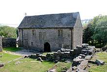
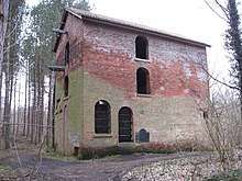
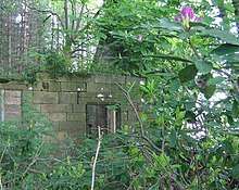
Alderwasley Chapel[4] | Chapel | Alderwasley, Amber Valley SK32385342 |
Also a Grade II listed building.[5] Built in the early 16th century by the Lord of the Manor, Thomas Lowe. In c. 1850 church services moved from St Margaret's Chapel to the newly built All Saints' Church. |
.jpg) |
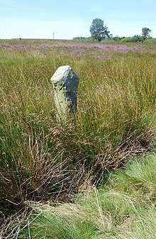
Aleck Low bowl barrow[6] | Barrow | Hartington, Derbyshire Dales SK17495945 |
|
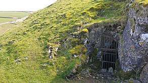
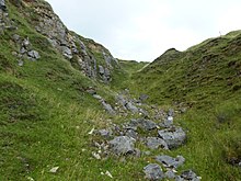
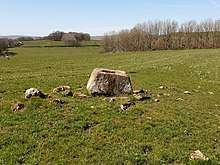
| Alport smelt mill[7] | Mining | Alport, Derbyshire Dales SK22386486 |
Remains of smelting furnaces from lead mining in the area. The mill was operational between 1845 and 1875.
500m NE of Alport village | |
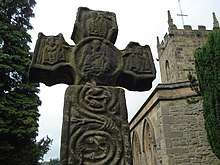 |
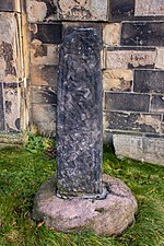
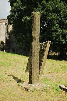
Anglian high cross in the churchyard of St Lawrence's Church, Eyam[8] | Cross | Eyam, Derbyshire Dales SK21797610 |
Also a Grade I listed building.[9] |
.jpg) |
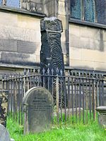
Anglian high cross in the churchyard of All Saints' Church, Bradbourne[10] | Cross | Bradbourne, Derbyshire Dales SK20815273 |
Also a Grade II listed building.[11] |
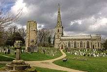
 |
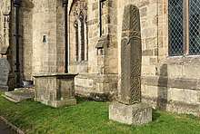
Anglian high cross in the churchyard of All Saints' Church, Bakewell[12] | Cross | Bakewell, Derbyshire Dales SK2157668466 |
Also a Grade I listed building.[13] |
 |
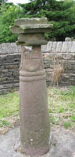
Anglian high cross in the churchyard of St Peter's Church, Hope[14] | Cross | Hope, High Peak SK17238345 |
Also a Grade II listed building.[15] 9th-century gritstone cross with Celtic decoration. |
 |
Anglo-Scandinavian high cross in the churchyard of St Thomas Becket Church[16] | Cross | Chapel-en-le-Frith, High Peak SK0576280813 |
Also a Grade II listed building.[17] |
 Shall Cross at Taxal |
Anglo-Scandinavian high cross known as the Shall Cross[18] | Cross | Whaley Bridge, High PeakSK0163579639 | 9th- or 10th-century gritstone cross. A sundial was installed on the shaft in the 18th or 19th century, in place of the original cross head. |
.jpg) |
Anglo-Scandinavian high cross from Two Dales, Darley, now in the churchyard of All Saints' Church, Bakewell[19] | Cross | Bakewell, Derbyshire DalesSK21556846 | Also a Grade I listed building.[20] |
| Anglo-Scandinavian high cross shaft and medieval cross base in the churchyard of All Saints' Church[21] | Cross | Brailsford, Derbyshire Dales SK2449841265 |
||
 |
Anthony Hill bowl barrow[22] | Barrow | Buxton, High Peak SK0465370662 |
A partial excavation by Thomas Bateman in 1851 revealed a boar's tusk and scattered human bone. The appearance and location indicate that it dates to the Bronze Age. |
 |
Aqueduct (Cromford Canal over Derby to Matlock railway)[23] | Aqueduct | Dethick, Lea and Holloway, Amber Valley SK3197455553 |
328m south-east of Aqueduct Cottage |
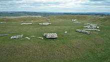 |
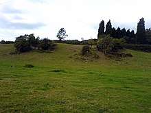
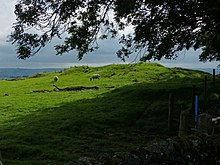
Arbor Low henge, large irregular stone circle, linear bank and bowl barrow[24] | Henge | Monyash, Derbyshire Dales SK1585263233 SK1603963549 |
A Neolithic henge including about 50 large limestone blocks which form an egg-shaped circle. |
 |
Arbourseats Veins and Sough, Wardlow Sough, Nay Green Mine and Washing Floors, Hading Vein and Seedlow Rake[25] | Mining | Litton, Derbyshire Dales SK1729674712 |
|
| Ash Tree Cave[26] | Cave | Whitwell, Bolsover SK5148576144 |
Excavations conducted since 1934 have discovered artefacts from the Palaeolithic, Mesolithic, Neolithic, Bronze Age, Iron Age and Roman times.
North of Hollin Hill, 2 miles NW of Creswell Crags | |
 |
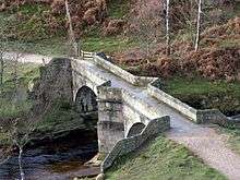
Ashford Bridge[27] | Bridge | Ashford-in-the-Water, Derbyshire Dales SK1988369597 |
Also a Grade II listed building.[28] |
| Atlow moated site, enclosures and causeway[29] | Moated site | Atlow, Derbyshire Dales SK2268848525 |
||
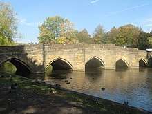 |
Bakewell Bridge[30] | Bridge | Bakewell, Derbyshire Dales SK2194968652 |
Also a Grade I listed building.[31] Spans the River Wye. |
| Bank Top bowl[32] and oval[33] barrows | Barrow | Kniveton, Derbyshire Dales SK2162851784 SK2161551725 |
||
| Barton Blount medieval settlement remains[34] | Settlement | Barton Blount, South Derbyshire SK2069534546 SK2083934701 SK2085835001 |
Including a chapel, decoy pond and part of the open field system. 340m North of Barton Hall. | |
.jpg) |
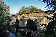
Baslow Bridge[35] | Bridge | Baslow, Derbyshire Dales SK2510472369 |
Also a Grade I listed building.[36] Spans the River Derwent. |
| Bassett Wood bowl barrow[37] | Barrow | Tissington, Derbyshire Dales SK1777051117 |
||
 |
Batham Gate, Roman road[38] | Road | Tideswell, Derbyshire Dales SK1284478975 SK1334679165 SK1380479339 |
Approx 1-mile-long course of Roman road on Tideswell Moor between Mount Pleasant Farm and Hulmes Vale Farm |
| Beans and Bacon, Old Eye, Fiery Dragon and Cod Beat lead mines and a limekiln[39] | Mining | Bonsall, Derbyshire Dales SK2557359244 SK2592959276 SK2597659136 |
480m south of Blakelow Farm | |
| Bee Low bowl barrow[40] | Barrow | Youlgreave, Derbyshire Dales SK1916064735 |
||
| Benty Grange hlaew[41] | Burial mound | Monyash, Derbyshire Dales SK1460664220 |
Site of a large Anglo-Saxon barrow, excavated in 1848 by Thomas Bateman, who discovered a richly furnished burial which included the Benty Grange helmet. | |
.jpg) |
Black Rakes, Welshmans Venture and Bondog Hole Mines, and Merry Tom and Thumper Sitch Levels[42] | Mining | Middleton-by-Wirksworth, Derbyshire Dales SK2653156156 |
|
.jpg) |
Blackstone's Low bowl barrow[43] | Barrow | Ballidon, Derbyshire Dales SK2103455413 |
|
| Blake Low bowl barrow[44] | Barrow | Great Longstone, Derbyshire Dales SK2192073530 |
||
 |
Boars Low bowl barrow[45] | Barrow | Tissington, Derbyshire Dales SK1693352588 |
|
| Bole Hill bowl barrow[46] | Barrow | Bakewell, Derbyshire Dales SK1828567703 |
||
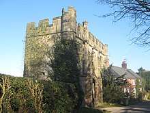
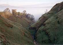
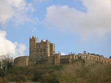 |
Bolsover Castle[47] | Castle | Old Bolsover, Bolsover SK47007070 |
Also a Grade I listed building.[48] Early 17th-century castle, built on the earthworks and ruins of the 12th-century tower keep castle and 11th-century motte-and-bailey castle. The first structure of the present castle was built between 1612 and 1617 by Sir Charles Cavendish. |
.jpg) |
Bonsall Leys lead mines[49] | Mining | Bonsall, Derbyshire Dales SK2656657476 SK2676157160 |
Ruins, pits, spoil heaps and buried remains of shallow lead mining as early as the 1540s. |
| Borther Low bowl barrow[50] | Barrow | Gratton, Derbyshire Dales SK1970760855 |
||
| Bostern Grange bowl barrow[51] | Barrow | Newton Grange, Derbyshire Dales SK1514453375 |
||
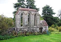
.jpg) |
Bowl barrow and wayside cross[52] | Cross | Pilsley, Derbyshire Dales SK2348770794 |
WSW of Pilsley |
| Bowl barrow east of Arbor Low[53] | Barrow | Monyash, Derbyshire Dales SK1611363520 |
||
| Bowl barrow in Foggy Lees Plantation[54] | Barrow | Middleton-by-Youlgreave, Derbyshire Dales SK1889663572 |
||
| Bowl barrow known as Priestcliffe Low[55] | Barrow | Taddington, Derbyshire Dales SK1349971909 |
200m west of Low End Farm | |
| Bowl barrow north of Manor House[56] | Barrow | Sheldon, Derbyshire Dales SK1683669252 |
||
.jpg) |
5 Bowl barrows on Calton Pastures[57][58][59][60][61] | Barrow | Edensor, Derbyshire Dales SK2337968560 SK2362668497 SK2395468308 SK2413368065 SK2446267628 |
Within 1 km of Calton Houses |
| Bowl barrow on Carsington Pasture[62] | Barrow | Carsington, Derbyshire Dales SK2440254254 |
800m south-east of Brassington Brickworks | |
| 2 Bowl barrows on Haddon Fields[63][64] | Barrow | Nether Haddon, Derbyshire Dales SK2148865357 SK2172866188 |
||
| Bowl barrow on Longside Moor[65] | Barrow | Holymoorside and Walton, North East Derbyshire SK3130168444 |
450m north of Harewood Grange | |
| 2 Bowl barrows on Longstone Moor[66][67] | Barrow | Great Longstone, Derbyshire Dales SK1899873643 SK1888473293 |
||
| Bowl barrow on Masson Hill[68] | Barrow | Bonsall, Derbyshire Dales SK2860758670 |
||
| 2 Bowl barrows on Withery Low[69][70] | Barrow | Wormhill, High Peak SK1022876519 SK1016576498 |
||
| Bowl barrow west of Castlegate Lane[71] | Barrow | Little Longstone, Derbyshire Dales SK1826372764 |
||
| Bowl barrow west of Manor House[72] | Barrow | Sheldon, Derbyshire Dales SK1692568974 |
||
| 2 bowl barrows at Osmaston Fields, north[73] | Barrow | Osmaston, Derbyshire Dales SK1839844701 |
||
| 2 bowl barrows at Pilsbury[74] | Barrow | Hartington, Derbyshire Dales SK1207663949 |
||
| 2 bowl barrows at Rockhurst[75] | Barrow | Aldwark, Derbyshire Dales SK2151957834 |
||
| 2 bowl barrows east of Hay Dale[76] | Barrow | Little Longstone, Derbyshire Dales SK1816872876 |
||
| 2 bowl barrows on Bole Hill[77][78] | Barrow | Wormhill, High Peak SK1071575692 SK1063075554 |
||
| 2 bowl barrows on Chelmorton Low[79] | Barrow | Chelmorton, Derbyshire Dales SK1141470623 |
||
| 2 bowl barrows on Stand Low[80] | Barrow | Kniveton, Derbyshire Dales SK2132850855 |
||
| Bradley Park bowl barrow[81] | Barrow | Bradley, Derbyshire Dales SK2402644584 |
||
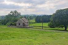
| Brampton Barn[82] | Barn | Brampton near Chesterfield SK3638471155 |
Late 16th/early 17th-century barn with large cruck trusses supporting a stone and slate roof. Also a Grade II listed building.[83] | |
| Bretby Castle fortified manor[84] | Castle | Bretby, South Derbyshire SK2935923169 |
Remains of manor house buildings from the 13th to 17th century with bank and ditch defences. | |
| Brightside lead mine[85] | Mining | Hassop, Derbyshire Dales SK2292473256 |
80m south-west of Brightside Cottage | |
 |
Bronze Age burial, ceremonial and settlement remains on Stanton Moor[86] | Settlement | Stanton, Derbyshire Dales SK2472363123 |
Prehistoric remains on the gritstone moorland of Stanton Moor including Nine Ladies stone circle, the King Stone standing stone, two other stone circles, two ring cairns and over 100 funerary cairns. Evidence of medieval, post-medieval and 19th- to early 20th-century activity. |
| Bronze Age field system[87] | Field system | Bamford, High Peak SK2077086292 |
400m south-east of Ladybower Inn | |
| Bronze Age settlement and ceremonial remains on Gibbet Moor[88] | Settlement | Baslow, Derbyshire Dales SK2796470887 |
980m north-east of Swiss Cottage | |
| Brundcliffe hlaew[89] | Burial mound | Hartington, Derbyshire Dales SK1588361470 |
||
| Brushfield Hough bowl barrow[90] | Barrow | Brushfield, Derbyshire Dales SK1679070944 |
||
 |
Bugsworth canal basin, tramway, quarry and limekilns[91] | Quarrying | Buxworth, High Peak SK0245282063 |
|
 |
Bull Ring henge, oval barrow and bowl barrow[92] | Henge | Dove Holes, High Peak SK0784678237 |
Neolithic circular earthwork about 50m across. It has a central flat area surrounded by a ditch and a bank. There are also two burial mounds about 20m from the henge. |
| Burr Tor prehistoric stock enclosure[93] | Enclosure | Great Hucklow, Derbyshire Dales SK1799378318 |
||
| Burton Moor bowl barrow[94] | Barrow | Bakewell, Derbyshire Dales SK2005967331 |
||
.jpg) |
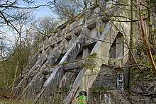
Butterley Works blast furnace complex[95] | Metalworks | Butterley near Ripley, Amber Valley SK4016251586 |
The blast furnaces, canal tunnel and underground wharf date back to the 1790s. |
| Cackle Mackle and Stadford Hollow lead mines[96] | Mining | Great Longstone, Derbyshire Dales SK1889474097 SK1917073975 |
On Longstone Moor | |
| 3 Cairns near Newbridge Farm[97][98][99] | Cairns | Baslow, Derbyshire Dales SK2846472263 SK2872072579 SK2820373573 |
400m north-west, 1500m north-west and 500m west of Newbridge Farm | |
| 2 Cairns near Raven Tor[100][101] | Cairns | Beeley, Derbyshire Dales SK2858567236 SK2798766509 |
450m north-east and 600m south of Raven Tor | |
| Cairn near Howden Reservoir Dam[102] | Cairns | Derwent, High Peak SK1692091891 |
550m south of Howden Reservoir dam wall; submerged when the reservoir is full. | |
| Cairn near Lady Wash Farm[103] | Cairns | Eyam, Derbyshire Dales SK2229078403 |
720m north-east of Lady Wash Farm | |
| Cairn near Offerton House[104] | Cairns | Offerton, Derbyshire Dales SK2055480826 |
800m WSW of Offerton House | |
| Cairn near Leam Hall Farm[105] | Cairns | Eyam, Derbyshire Dales SK2254978642 |
880m south-west of Leam Hall Farm | |
| Cairn cemetery on Gibbet Moor[106] | Cairns | Baslow, Derbyshire Dales SK2843670646 |
1100m south-west of Stonelow Farm | |
| Cairn complex near Dalebrook House[107] | Cairns | Brampton, North East Derbyshire SK2919670775 |
780m south of Dalebrook House | |
| Cairn on Bamford Edge, near Mooredge[108] | Cairns | Bamford, High Peak SK2084284857 |
500m NE of Mooredge | |
| Cairn on Bamford Edge, near Clough House[109] | Cairns | Bamford, High Peak SK2136984350 |
570m NE of Clough House | |
| Cairn on Bamford Moor, near Great Tor[110] | Cairns | Bamford, High Peak SK2139084775 |
500m East of Great Tor | |
| Cairn on Bamford Moor, near High Lees Farm[111] | Cairns | Bamford, High Peak SK2153184424 |
680m North of High Lees Farm | |
| Cairn on Bamford Moor, near Crow Chin[112] | Cairns | Bamford, High Peak SK2161585859 |
850m NW of Crow Chin | |
| 2 Cairns on Bamford Moor, near Clough House[110][110] | Cairns | Bamford, High Peak SK2139084775 SK2139084775 |
960m and 975m NE of Clough House | |
| 2 cairns on Beeley Moor[113] | Cairns | Beeley, Derbyshire Dales SK2897368223 |
East of Hell Bank Plantation | |
| 2 Cairns on Harland Edge[114][115] | Cairns | Beeley, Derbyshire Dales SK2930268574 SK2970068227 |
||
 |
Cairn on Ludworth Intakes[116] | Cairns | Ludworth, near Stockport SJ9898091310 |
|
| Cairn, near Stanage House[117] | Cairns | Eyam, Derbyshire Dales |
600m NE of Stanage House | |
| Cairnfield near Clod Hall Farm[118] | Cairns | Baslow, Derbyshire Dales SK2869573627 |
1400m NW of Clod Hall Farm | |
| 3 Cairnfields near Ramsley Lodge[119][119][119] | Cairns | Holmesfield, North East Derbyshire SK2841775207 SK2841775207 SK2841775207 |
180m NE, 400m NE and 860m NE of Ramsley Lodge | |
| Cairnfield near Saltersitch Bridge[120] | Cairns | Holmesfield, North East Derbyshire SK2887578237 |
320m North of Saltersitch Bridge, Eastern Moors | |
| Cairnfield near Syda Farm[121] | Cairns | Holymoorside and Walton, North East Derbyshire SK3144968812 |
390m South of Syda Farm | |
| Cairnfield near Offerton House[122] | Cairns | Offerton, Derbyshire Dales SK2102080747 |
470m SW of Offerton House | |
| 2 Cairnfields near High Lees Farm[123][124] | Cairns | Bamford, High Peak SK2174684322 SK2192984422 |
600m and 775m NNE of High Lees Farm | |
| Cairnfield near Highlow Hall[125] | Cairns | Highlow, Derbyshire Dales SK2131280123 |
600m West of Highlow Hall | |
| Cairnfield near Moor Edge Farm[126] | Cairns | Holmesfield, North East Derbyshire SK2895578700 |
615m West of Moor Edge Farm | |
| 3 Cairnfields near Stanage House[127][128][129] | Cairns | Eyam, Derbyshire Dales SK2183478260 SK2170578573 SK2170078852 |
580m ENE, 630m NE and 870m NE of Stanage House | |
| Cairnfield near Bumper Castle[130] | Cairns | Darley Dale, Derbyshire Dales SE5534692792 |
650m NW of Bumper Castle | |
| Cairnfield near Raven Tor[131] | Cairns | Beeley, Derbyshire Dales SK2880467399 |
700m NE of Raven Tor | |
| Cairnfield near Ladybower Inn[132] | Cairns | Bamford, High Peak SK2071685856 |
710m and 840m SE of Ladybower Inn | |
| Cairnfield near Nether Rodknoll Farm[133] | Cairns | Brampton, North East Derbyshire SK2963369958 |
800m West of Nether Rodknoll Farm | |
| Cairnfield near Lane End Farm[134] | Cairns | Offerton, Derbyshire Dales SK2030680702 |
870m NE of Lane End Farm | |
| Cairnfield near Green's House[135] | Cairns | Outseats, Derbyshire Dales SK2240684583 |
970m NW of Green's House | |
| Cairnfield and associated settlement[136] | Settlement | Eyam, Derbyshire Dales SK2282178974 |
450m SW of Leam Hall Farm | |
| Cairnfield and barrow on Rabbit Warren[137] | Cairns | Beeley, Derbyshire Dales SK2810368744 |
900m SE of Park Farm | |
| Cairnfield and embanked stone circle[138] | Cairns | Holmesfield, North East Derbyshire SK2843277268 |
550m East of Barbrook Reservoir | |
| Cairnfield and field system[139] | Cairns | Brampton, North East Derbyshire`` SK2926771013 |
530m South of Dalebrook House | |
| Cairnfield and field system[117] | Cairns | Baslow, Derbyshire Dales |
560m East of Park Gate Farm | |
| Cairnfield and field system, North of Eaglestone Flat[140] | Cairns | Curbar, Derbyshire Dales SK2665974859 |
450m SW of Swine Sty | |
| Cairnfield and field system on Eaglestone Flat[141] | Cairns | Curbar, Derbyshire Dales SK2619273761 |
100m SW of Eagle Stone | |
| Cairnfield and house platform[142] | Cairns | Beeley, Derbyshire Dales SK3078867529 |
400m SW of Harewood Grange Farm | |
| Cairnfield and quarry on Bamford Edge[143] | Cairns | Bamford, High Peak SK2109484582 |
720m North of Clough House | |
| Cairnfield and ring cairn[144] | Cairns | Offerton, Derbyshire Dales SK2124680623 |
490m South of Offerton Hall | |
| Cairnfield and ring cairn on Rabbit Warren[145] | Cairns | Beeley, Derbyshire Dales SK2777668760 |
650m SE of Park Farm | |
| Cairnfield and standing stones, East of Bunker's Hill Wood[146] | Cairns | Baslow, Derbyshire Dales SK2814569735 |
1 km NE of Park Farm | |
| Cairnfield on Beeley Moor, East of Hell Bank Plantation[117] | Cairns | Beeley, Derbyshire Dales |
||
| Cairnfield on Gibbet Moor, West of Umberley Brook[117] | Cairns | Baslow, Derbyshire Dales |
1.2 km SW of Dalebrook House | |
| Cairnfield with enclosure, house platform and ring cairn[147] | Cairns | Beeley, Derbyshire Dales SK2861967753 |
800m NE of Raven Tor | |
| Cairnfield near Leam Hall Farm[148] | Cairns | Eyam, Derbyshire Dales SK2285179241 |
320m West of Leam Hall Farm | |
| Cairnfield, field system and ring cairn[149] | Cairns | Baslow, Derbyshire Dales SK2848173467 |
1300m NNW of Newbridge Farm | |
| Cairnfield, field system and ring cairn[150] | Cairns | Baslow, Derbyshire Dales SK2821072459 |
650m East of Moorside Farm | |
| Cairnfield, linear clearance and ring cairn[151] | Cairns | Holmesfield, North East Derbyshire SK2890179059 |
720m NW of Moor Edge Farm | |
| Calke Park Tunnel[152] | Tunnel | Ticknall, South Derbyshire SK3551923695 |
||
| Calling Low bowl barrow[153] | Barrow | Youlgreave, Derbyshire Dales SK1748464874 |
||
| Callow Hall moated site[154] | Moated site | Callow, Derbyshire Dales SK2685951813 |
A large moated site with standing remains of buildings from the medieval manor. | |
| Callow prehistoric settlement and field system, Carr Head Moor[155] | Settlement | Hathersage, Derbyshire Dales SK2437682149 |
300m ENE of Toothill Farm | |
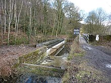
| Calver weir and water management system[156] | Waterworks | Calver, Derbyshire Dales SK2456175234 |
200m NE of Stocking Farm | |
| Camp Green ringwork[157] | Earthwork | Hathersage, Derbyshire Dales SK2346381895 |
||
 |
Carsington Pasture, Nickalum, Perseverance, West Head, Break Hollow and other small mines and medieval field boundaries[158] | Mining | Brassington, Derbyshire Dales` SK2461954034 |
|
| Castle Gresley motte and bailey castle[159] | Castle | Castle Gresley, South Derbyshire SK2793617895 |
||
| Castle Hill camp[160] | Settlement | South Wingfield, Amber Valley SK3857954129 |
||
| Castle Hill motte and bailey castle[161] | Castle | Holmesfield, North East Derbyshire SK3188577640 |
||
 |
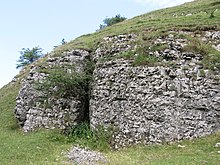
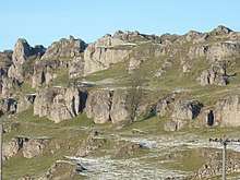
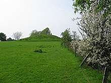
Castle Ring defended settlement[162] | Settlement | Harthill, Derbyshire Dales SK2206762837 |
Immediately north of Harthill Moor Farm. It now consists of an oval earthwork ditch (about 5m wide and 100m across) with inner and outer banks, up to 2m high. It hasn't been excavated but it is considered to be an integral part of the Bronze Age landscape of Harthill Moor. |
.jpg) |
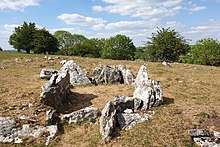
Chambered tomb and two bowl barrows on Minning Low[163] | Tomb | Ballidon, Derbyshire Dales SK2093557290 |
|
 |
Civil War redoubt[164] | Defences | Tissington, Derbyshire Dales SK1763352334 |
A square earthbank enclosure about 28m across used as a military defence. Tissington Hall was a Royalist garrison set up by Colonel Fitzherbert in 1643.
150m East of Tissington Hall |
| Coalpithole Rake[165] | Mining | Perryfoot near Sparrowpit, High Peak SK0989781114 |
||
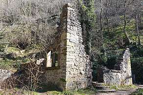
.jpg) |
Codnor Castle[166] | Castle | Codnor, Ripley, Amber Valley` SK4335849983 |
A ruined 13th-century castle. |
 |
Coke ovens[167] | Metalworks | Dronfield, North East Derbyshire SK3690578145 |
120m NE of Summerley House |
 |
Conksbury deserted medieval settlement[168] | Settlement | Youlgreave, Derbyshire Dales SK2107065489 |
The deserted medieval settlement at Conksbury was recorded in the Domesday Book (1086 AD) as Cranchesberie. The site consists of earthworks and buried remains of buildings. |
| Cop Low oval barrow[169] | Barrow | Hazlebadge near Little Hucklow, Derbyshire Dales SK1662779134 |
||
| Cop Rake and Moss Rake lead mines[170] | Mining | Bradwell, Derbyshire Dales SK1309480047 |
750m NE of Wheston House | |
| Cow Low bowl barrow[171] | Barrow | Chapel-en-le-Frith, High Peak SK0653778665 |
||
| Cow Low bowl barrow (Tunstead Quarry)[172] | Barrow | Buxton, High Peak SK1027472976 |
A sub-circular Bronze Age burial mound 29m by 25m and 1.7m high. During excavations in 1846, Thomas Bateman discovered several crouched skeletons, jet necklaces, a hexagonal cist and evidence of burials up to c.AD700. | |
 |
Cowdale Quarry limestone extraction and processing site[173] | Quarrying | King Sterndale, Buxton, High Peak SK0791672480 |
A lime extraction plant since the late 19th century. The quarry operated its traditional, coal-fired kilns until its closure in 1954. 540m NE of Staden Manor. |
 |
Cratcliff Rocks defended settlement[174] | Settlement | Birchover, Derbyshire Dales SK2258362381 |
A broadly round enclosure. A 5m wide ditch cut into the rock surrounds an area with various building platforms. The wider Harthill Moor prehistoric landscape includes Nine Stones Close stone circle. |
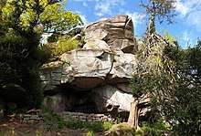 |
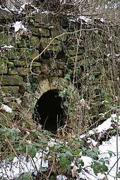
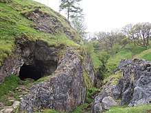
Cratcliff Rocks hermitage[175] | Cave | Birchover, Derbyshire Dales SK2274762343 |
A medieval hermit's cave from the 13th—14th century including a bas-relief crucifix carved inside the rock shelter. 18m wide by 17m deep. |
.jpg) |
Creswell Gorge Palaeolithic and later prehistoric sites, including Pinhole Cave, Mother Grundy's Parlour and Robin Hood's Cave[176] | Settlement | Whitwell, Bolsover SK5354474219 |
Creswell Crags is a limestone gorge on the border between Derbyshire and Nottinghamshire, near the villages of Creswell and Whitwell. The cliffs in the ravine contain several caves that were occupied during the last ice age, between around 43,000 and 10,000 years ago. Its caves contain the northernmost cave art in Europe. |
.jpg) |
Creswell Gorge Palaeolithic and later prehistoric sites, including Boat House Cave and Church Hole Cave[177] | Settlement | Whitwell, Bolsover SK5354474219 |
See above |
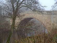
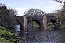 |
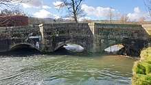
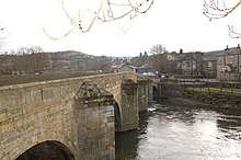
Cromford Bridge[178] | Bridge | Cromford, Derbyshire Dales SK3001357180 |
Spans the River Derwent. Also a Grade II* listed building.[179] |
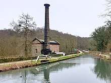 |
Cromford Canal engine house, engine and aqueduct[180] | Waterworks | Cromford, Derbyshire Dales SK3152255684 |
Within the World Heritage Site of Derwent Valley Mills. Includes Leawood Pump House, constructed in 1849 to raise water from the River Derwent into the Cromford Canal (which crosses the river over the aqueduct). The steam-powered beam engine moves 4 tonnes of water with every stroke of its piston (28 tonnes per minute). The Pump House is also a Grade II* listed building.[181] |
| Cromwell's Low bowl barrow[182] | Barrow | Tissington, Derbyshire Dales SK1534552671 |
||
| Cronkston Low bowl barrow[183] | Barrow | Hartington, Derbyshire Dales SK1168566308 |
||
| Crookstone Hill round cairn[184] | Cairns | Hope, High Peak SK1489788197 |
||
| Cross Low bowl barrow[185] | Barrow | Eaton and Alsop, Derbyshire Dales SK1618555531 |
||
| Cross ridge dyke[186] | Cross | Great Longstone, Derbyshire Dales SK2256373550 |
800m East of Bleaklow | |
| Cubley Hall moated site[187] | Moated site | Cubley, Derbyshire Dales SK1642137719 |
||
| Cup-marked stone[188] | Stone | Chisworth, High Peak SK0069290942 |
80m East of Robin Hood's Picking Rods | |
 |
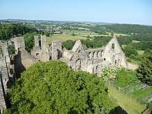
Dale Abbey[189] | Abbey | Dale Abbey, Erewash SK4362638778 |
The Augustinian canons moved to Dale Abbey in 1162 from their previous home at Calke Abbey. The remains comprise a 40-foot-high chancel window. Excavations have shown the church to have possessed transepts 100 feet in length, a crossing tower, a cloister 85 feet square and a nave of unknown length. |
 |
Darley Bridge[190] | Bridge | South Darley, Derbyshire Dales |
Also a Grade II* listed building.[191] |
| Dimin Dale Romano-British settlement and field system[192] | Settlement | Sheldon, Derbyshire Dales SK1688970251 |
South of Taddington Wood | |
 |
Doll Tor stone circle and cairn[193] | Henge | Stanton, Derbyshire Dales SK2383262873 |
Doll Tor, occasionally known as the Six Stones, is a small stone circle near Birchover, west of Stanton Moor in the Derbyshire Peak District. Dating from the Bronze Age, the circle consists of six standing stones. The site was excavated in 1852 by Thomas Bateman. |
 |
Dove Bridge[194][195] | Bridge | Doveridge, Derbyshire Dales SK1054834464 |
Spans the River Dove. Also a Grade II* listed building.[196] |
| Dovecote[197] | Dovecote | Netherseal, South Derbyshire SK2897512822 |
85m south of Netherseal Old Hall. Also a Grade II* listed building.[198] | |
 |
Dowel Cave[199] | Cave | Glutton Brige, Derbyshire Dales SK0755967595 |
Narrow cave c.10m deep. Excavation work done in the 1950s found evidence of the cave's use in Mesolithic, Neolithic, Bronze Age, Iron Age and Roman times. |
.jpg) |
Duffield Bridge[200] | Bridge | Duffield, Amber Valley SK3503442965 |
Also a Grade II listed building.[201] |
| Duncote Farm moated site[202] | Moated site | Biggin, Derbyshire Dales SK2657148042 |
||
 |
Eldon Hill bowl barrow[203] | Barrow | Peak Forest, High Peak SK1155881147 |
Bronze Age burial mound with a recent summit cairn above. Excavations in the 1860s and 1870s found several human skeletons in a tomb with stone structures. |
 |
Eldon Hill crushing circle, associated lead mining remains and palisaded enclosure[204] | Mining | Peak Forest, High Peak SK1175581132 |
7m wide crushing circle with remnants of paving and central edge runner stone. The site also includes remains of shafts and a stone shed. Site of mining of a lead ore vein called Burning Drake Vein. |
 |
Ellastone Bridge[205] | Bridge | Norbury, Derbyshire Dales SK1199942382 |
18th-century multi-span bridge across the River Dove between the villages of Norbury and Ellastone. Also a Grade II listed building.[206] |
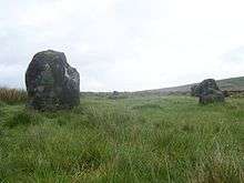
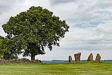
 Wet Withens |
Embanked stone circle known as Wet Withens, and adjacent cairn[207] | Henge | Eyam Moor, Derbyshire Dales SK2254379011 |
A prehistoric stone circle of about 10 orthostats (upright boulders) surrounded by an earthwork bank. Also known as Eyam Moor 1. |
| Embanked stone circle on Eyam Moor[208] | Henge | Eyam, Derbyshire Dales SK2316578945 |
340m south of Leam Hall Farm | |
| End Low bowl barrow[209] | Barrow | Hartington, Derbyshire Dales SK1560460562 |
`2 | |
| Engine Sough and associated nucleated lead mine[210] | Mining | Castleton, High Peak SK1274383253 |
500m South of Mam Tor | |
| Entrance to Long Sough, West of Allen's Hill[211] | Mining | Cromford, Derbyshire Dales SK2950156828 |
||
| Faucet Rake lead mines[212] | Mining | Castleton, High Peak SK1180282056 |
870m SW and 930m SE of Oxlow House | |
| Field system and stone circle on Rabbit Warren[213] | Henge | Beeley, Derbyshire Dales SK2807668436 |
1150m SE of Park Farm | |
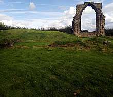
 |
Fin Cop promontory fort, bowl barrow and eighteenth century lime kiln with associated quarry[214] | Fort | Ashford in the Water, Derbyshire Dales SK1748170999 |
An Iron Age hill fort in Monsal Dale, constructed between 440BC and 390BC. |
| Fishponds[215] | Ponds | Mercaston, Derbyshire Dales SK2781842233 |
260m north-west of Mercaston Hall Farm | |
 |
Five Wells chambered tomb[216] | Tomb | Taddington, Derbyshire Dales SK1237771038 |
The mound was excavated by Thomas Bateman in 1846. |
| Four watchtowers SW of town[217] | Defences | Old Bolsover, Bolsover SK4716470441 |
||
 |
Fox Hole Cave[218] | Cave | Earl Sterndale, Derbyshire Dales SK0997566179 |
Near the summit of High Wheeldon hill, a National Trust property. The limestone cave has several chambers. Excavations since the 1920s discovered Palaeolithic, Mesolithic, Neolithic, Bronze Age and Roman objects. Some of the artefacts are on display in Buxton Museum. |
| Fox Low bowl barrow[219] | Barrow | Buxton, High Peak SK0672971236 |
A sub-circular cairn 16m by 14.5m and c.1.5m high. Partially excavated by Thomas Bateman in 1850 and found to contain human remains. The appearance and location indicate it to be of the Bronze Age. | |
| Friden Hollow bowl barrow[220] | Barrow | Middleton, Derbyshire Dales SK1743861325 |
||
| Fritchley Tunnel, Butterley Gangroad[221] | Tunnel | Crich, Amber Valley SK3585553013 |
Fritchley Tunnel is a disused railway tunnel, which is believed to be the oldest surviving example in the world.[222] The tunnel was constructed in 1793 by Benjamin Outram as part of the Butterley Gangroad. | |
 |
Froggatt Bridge[223] | Bridge | Calver, Derbyshire Dales SK2436876075 |
Crosses the River Derwent. Also a Grade II listed building.[224] |
| Galley Low bowl barrow[225] | Barrow | Brassington, Derbyshire Dales SK2179856486 |
||
| Gallowlow Lane bowl barrow[226] | Barrow | Ballidon, Derbyshire Dales SK2126156717 |
||
| Gautries Hill bowl barrow[227] | Barrow | Peak Forest, High Peak SK0987180982 |
||
| Gautries Rake[228] | Mining | Peak Forest, High Peak SK1009980821 |
||
| Gib Hill oval barrow and bowl barrow[229] | Barrow | Middleton, Derbyshire Dales SK1583463325 |
||
| Gorsey Low bowl barrow[230] | Barrow | Newton Grange, Derbyshire Dales SK1646753281 |
||
| Gorseydale lead mines[231] | Mining | Bonsall, Derbyshire Dales SK2487759726 |
300m north and 650m north west of Moor Farm | |
| Green Low bowl barrow, west[232] | Barrow | Aldwark, Derbyshire Dales SK2298758031 |
||
 |
Green Low chambered tomb[233] | Tomb | Aldwark, Derbyshire Dales SK2315458039 |
Chamber made of limestone slabs with a short paved entry passage. Excavated in 1843 by Thomas Bateman who found human and animal remains, sherds of Neolithic pottery and a polished greenstone axe. Another skeleton was found nearby. Roman coins and pottery were also found close by.
South of Aldwark Grange farm near the summit of Green Low hill. |
| Green Low ringcairn[234] | Cairns | Chapel-en-le-Frith, High Peak SK0840482989 |
||
 |
Grindleford Bridge[235] | Bridge | Grindleford, Derbyshire Dales SK2448077815 |
Spans the River Derwent. Also a Grade II listed building.[236] |
| Grindlow bowl barrow[238] | Barrow | Over Haddon, Derbyshire Dales SK2026366988 |
||
 |
Harboro' Cave[239] | Cave | Brassington, Derbyshire Dales SK2422155227 |
A natural cavern in Harboro' Rocks in which archaeologists have found evidence of human occupants since the Ice Age. According to Daniel Defoe, a lead miner's family was living in the cave in the early C18th.[240] |
 |
Hardwick Old Hall[241] | House | Ault Hucknall, Bolsover SK4617363660 |
The substantial ruins of Hardwick Old Hall, an Elizabethan great house. The Old Hall building mostly dates from 1587 until 1597, when Bess of Hardwick relocated to the newly built Hardwick New Hall (only 200m away). Also a Grade I listed building.[242]
c.14 km SE of Chesterfield |
| Harrod Low long barrow[243] | Barrow | Peak Forest, High Peak SK0984480592 |
||
| Harthill Moor bowl barrow[244] | Barrow | Harthill, Derbyshire Dales SK2219462544 |
A Bronze Age burial mound 20m long and 11m wide. It was partially excavated in 1877 by Jewitt and Greenwell. A limestone cist was found with the remains from two cremations. About 150m SE of Harthill Moor Farm. | |
| Hawks Low bowl barrow[245] | Barrow | Parwich, Derbyshire Dales SK1701456739 |
||
| Heavy Anti-aircraft gunsite[246] | Military | Elvaston, South Derbyshire SK4142532577 |
340m SE of Gardens Farm | |
| Henge complex NW of Hickens Bridge[247] | Henge | Shardlow and Great Wilne, South Derbyshire SK4281629942 |
||
%2C_Hermits_Wood%2C_Dale_Abbey%2C_Derbyshire_-_East_Midlands_of_England.jpg) |
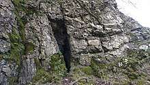
Hermitage at Dale Abbey[248] | Cave | Dale Abbey, Erewash SK4388438490 |
A hermit's cave (hermitage) cut into the rock, apparently by a baker from Derby in the 12th century.
170m SE of All Saints Church |
| High Field hlaew[249] | Burial mound | Brushfield, Derbyshire Dales SK1685972353 |
||
| High Rake Mine[250] | Mining | Little Hucklow, Derbyshire Dales SK1639377780 |
||
| Hill's Venture lead mine[251] | Mining | Peak Forest, High Peak SK1243379278 |
||
| Hillcarr Sough and associated lime kiln and paved track[252] | Mining | Stanton, Derbyshire Dales SK2584563732 |
||
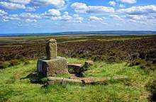
 |
Hob Hurst's House: a square, banked and ditched burial cairn with cist on Harland Edge[253] | Cairns | Beeley, Derbyshire Dales SK2874369235 |
A Bronze Age barrow on Beeley Moor near Bakewell. It is unique in that instead of the normal round shape, Hob Hurst's barrow is rectangular. Originally made with 13 stones, only five remain today. |
| Hollins Hill bowl barrow[254] | Barrow | Hartington, High Peak SK0604067909 |
||
 |
Holme Bridge[255] | Bridge | Bakewell, Derbyshire Dales SK2154268992 |
Also a Grade I listed building.[256] |
| Holmesfield moated site and headland[257] | Moated site | Holmesfield, North East Derbyshire SK3217277945 |
||
 |
Hoon Mount platformed bowl barrow[258] | Barrow | Hoon, South Derbyshire SK2300931818 |
|
| Hope Motte[259] | Fort | Hope, High Peak SK1715383433 |
||
 |
Hordron Edge stone circle[260] | Henge | Derwent, High Peak SK2152486851 |
540m SE of Cutthroat Bridge |
 |
Horsley Castle tower keep castle[261] | Castle | Horsley, Amber Valley SK3758043204 |
|
| How Grove Lead Mine[262] | Mining | Castleton, High Peak SK1484681785 |
||
| Hulland Old Hall moat, enclosure, chapel site and four fishponds[263] | Moated site | Hulland, Derbyshire Dales SK2406646427 |
||
| Iron Age settlement and cursus, SE of Aston-on-Trent[264] | Settlement | Aston Moor, Shardlow and Great Wilne, South Derbyshire SK4203829071 |
||
| Ivet Low bowl barrow[265] | Barrow | Hopton, Derbyshire Dales SK2596254392 |
||
| Kenslow Knoll bowl barrow[266] | Barrow | Middleton, Derbyshire Dales SK1842361717 |
||
 |
Kinderlow bowl barrow[267] | Barrow | Hayfield, High Peak SK0732486665 |
|
| Lady Low barrow[268] | Barrow | Chapel-en-le-Frith, High Peak SK0653278188 |
||
 |
Langwith Cave[269] | Cave | Scarcliffe, Bolsover SK5179969497 |
A round chamber approximately 6m across accessed by several passages. Excavations from 1903 to 1927 found Neolithic remains (from a human burial and a child's skull) as well as Palaeolithic remains (flint instruments, reindeer bones, woolly rhinoceros bones and a number of hearths). |
| Larks Low bowl barrow[270] | Barrow | Middleton, Derbyshire Dales SK2008662605 |
||
 |
Lathkill Dale and Mandale mines and soughs[271] | Mining | Youlgreave, Derbyshire Dales SK1923465968 |
Lathkill Dale and Mandale mines and soughs are a rare and well-preserved example of lead mining activity dating from the 13th century. They include ruins of engines houses, mine shafts and an aqueduct. The mines were closed by the 1860s after flooding proved too problematic. |
| Lead mill on north bank of Bar Brook[272] | Metalworks | Curbar, Derbyshire Dales SK2726073869 |
80m east of confluence with Sandyford Brook | |
| Lead mines[273] | Mining | Elton, Derbyshire Dales SK2092460394 |
600m and 980m SW of Oddo House Farm | |
| Lead smelt mill and wood-drying kiln in Froggatt Wood[274] | Metalworks | Froggatt, Derbyshire Dales SK2475577245 |
550m south of Haywood Farm | |
| Lead smelt mill in Linacre Wood[275] | Metalworks | Brampton, North East Derbyshire SK3399572490 |
160m East of Lower Linacre Reservoir dam | |
| Lead smelting site on Ramsley Moor[276] | Metalworks | Holmesfield, North East Derbyshire SK2940075635 |
600m SW of Foxlane Farm | |
| 3 lead working coes, a shaft and a dressing floor on Longstone Edge[277] | Metalworks | Great Longstone, Derbyshire Dales SK2132073141 |
||
| Lead workings in High Tor Recreation Ground[278] | Metalworks | Matlock, Derbyshire Dales SK2980358877 |
||
| Lean Low bowl barrow[279] | Barrow | Hartington, Derbyshire Dales SK1495362219 |
||
| Lees and Dove Rakes, Booth Lee Pipes and Sterndale Sough[280] | Mining | Taddington, Derbyshire Dales SK1564672697 |
||
| Liffs Low bowl barrow[281] | Barrow | Hartington, Derbyshire Dales SK1531257669 |
||
 |
Lismore Fields Mesolithic and Neolithic settlement[282] | Settlement | Buxton, High Peak SK0498473218 |
The first inhabitants of Buxton made their home at Lismore Fields 6,000 years ago. The Stone Age settlement was discovered in 1984 with remains of a Mesolithic timber roundhouse, Neolithic longhouses and one of the oldest pots ever found in Britain. Lismore Fields could be the earliest cereal cultivation site discovered in Britain.[283] |
| Little Pasture Mine[284] | Mining | Eyam, Derbyshire Dales SK2070977248 |
||
| Lock up and pinfold[285] | Enclosure | Sandiacre, Erewash SK4794837074 |
||
| Long Dale bowl barrow[286] | Barrow | Middleton, Derbyshire Dales SK1867460803 |
||
| Long Low bowl barrow[287] | Barrow | Grindlow, Derbyshire Dales SK1869377242 |
||
| Lord's Seat bowl barrow[288] | Barrow | Edale, High Peak SK1124983461 |
||
| Lower Thurvaston medieval settlement, including part of the open field system[289] | Settlement | Longford, Derbyshire Dales SK2309637177 |
||
 |
Lumford Mill, Bakewell[290] | Mill | Bakewell, Derbyshire Dales SK2104169327 |
Earthworks and structures for managing the water supply to Sir Richard Arkwright's third mill since 1777, including a weir, stream, pond, dam wall and tunnel. Also a Grade II listed building.[291] |
 |
Lumsdale Mills and associated water management features[292] | Waterworks | Matlock, Derbyshire Dales SK3130560840 |
Various mills and three ponds in Lumsdale Valley. Two C17th lead smelting mills; one on the site of what is now known as the Bone Mill and the other on the site of the later Paint Mill. Corn Mill, Saw Mill, Garton Mill (Lower Bleach Works) and Upper Bleach Works. |
 |
Mackworth medieval settlement including the castle gatehouse, part of the medieval open field system and a pinfold[293] | Settlement | Mackworth, Amber Valley SK3123837783 |
Mackworth Castle was a 14th- or 15th-century structure in Mackworth village near Derby. It was the home of the Mackworth family for several centuries. The gatehouse is a Grade I listed building.[294] |
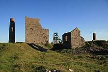 |
Magpie Mine, Dirty Red Soil, Maypit, Horsesteps and Great Red Soil lead mines[295] | Mining | Sheldon near Bakewell, Derbyshire Dales SK1724868074 |
Remains of lead mining workings from late C17th until 1958.[296] The monument includes the Cornish engine house ruins, renovated square chimney, closed mine shafts and a lime kiln.
700m South of the village of Sheldon |
 |
Market cross[297] | Cross | Chapel-en-le-Frith, High Peak SK0570880703 |
Also a Grade II listed building.[298] |
| Markland Grips promontory fort[299] | Fort | Elmton, Bolsover SK5090875043 |
||
 |
Matlock Bridge[300] | Bridge | Matlock, Derbyshire Dales SK2978860178 |
Spans the River Derwent. Also a Grade II* listed building.[301] |
| Maury Mine and Sough[302] | Mining | Taddington, Derbyshire Dales SK1480372969 |
||
| Meadow Place bowl barrow[303] | Barrow | Youlgreave, Derbyshire Dales SK2029965164 |
||
 |
Medieval church and cross near St George's Church[304] | Cross | Ticknall, South Derbyshire SK3515924042 |
45m south of St George's Church |
| Medieval cross base[305] | Cross | Beeley, Derbyshire Dales SK2969467703 |
780m SW of Arkwright Plantation | |
| Medieval enclosed field system and earlier remains at Sheffield Plantation[306] | Field system | Grindleford, Derbyshire Dales SK2565879225 |
||
| Medieval farmstead and field system [307] | Field system | Grindleford, Derbyshire Dales SK2546178807 |
525m South of Yarncliff Quarry | |
| Medieval field system and long houses at Lawrence Field[308] | Field system | Grindleford, Derbyshire Dales SK2519779546 |
||
| Medieval grange and field system[309] | Field system | Ballidon, Derbyshire Dales SK2009156616 |
200m South of Royston Grange | |
| Medieval hospital [310] | Hospital | Castleton, High Peak SK1554783329 |
530m SE of Losehill Hall | |
| Medieval iron working remains at Stanley monastic grange[311] | Metalworks | Stanley and Stanley Common, Erewash SK4257240654 |
||
| Medieval moated site, ridge and furrow, and mill site at Sturston[312] | Moated site | Offcote and Underwood, Derbyshire Dales SK2007746809 |
||
 |
Medieval settlement and associated field system[313] | Settlement | Ballidon, Derbyshire Dales SK2046554397 SK2024754556 |
Earthworks and buried remains of a medieval settlement (Anglo-Saxon estate at Ballidon granted by King Edgar in AD 963). Field boundaries and ridge and furrow farming. Restored Anglo-Norman church is a Grade II listed building.[314]
Immediately south of Ballidon village. |
| Medieval settlement and open field system[315] | Settlement | Hulland, Derbyshire Dales SK2433546998 |
Immediately north of Old Hall | |
| Medieval settlement and part of an open field system[316] | Settlement | Callow, Derbyshire Dales SK2672551981 |
250m NW of Callow Hall | |
| Medieval settlement [317] | Settlement | Smerrill, Derbyshire Dales SK2005461855 |
Immediately SE of Smerrill Grange | |
| Medieval settlement including part of open field system[318] | Settlement | Mapleton, Derbyshire Dales SK1672747692 |
200m South of Bank Farm | |
| Medieval settlement on the north western slopes of Cales Dale[319] | Settlement | Monyash, Derbyshire Dales SK1656264813 |
490m NW of Cales Farm | |
| Medieval settlement, including fishpond and open field system[320] | Settlement | Tissington, Derbyshire Dales SK1942052117 |
Immediately north and 240m south of Lea Cottage Farm | |
| Medieval settlement, including open field system[321] | Settlement | Hungry Bentley, Derbyshire Dales SK1787238669 |
Immediately West of Bentley Fields Farm | |
| Medieval settlement, including site of chapel and part of the open field system[322] | Settlement | Alkmonton, Derbyshire Dales SK1937437582 |
Immediately NE of Alkmonton Old Hall Farm | |
| Medieval town defences[323] | Defences | Old Bolsover, Bolsover SK4733970825 |
183m SE of church of St Mary and St Lawrence and 335m NE of Bolsover Castle | |
| Meerbrook sough portal[324] | Mining | Wirksworth, Derbyshire Dales SK3267155246 |
380m SW of Leashaw Farm | |
 |
Melandra Castle (Ardotalia) Roman fort[325] | Fort | Glossop, High Peak SK0093595049 |
Ardotalia (also known as Melandra, or Melandra Castle) is a Roman fort in Gamesley, near Glossop. |
 |
Melbourne Castle fortified manor and earlier medieval manorial remains[326] | Castle | Melbourne, South Derbyshire SK3891325203 |
A medieval castle built on the site of an earlier royal manor house in the reign of King John. Construction of the castle was started in 1311 and continued until 1322, but the work was never fully completed. Also a Grade II listed building.[327] |
| Middleton Moor platformed bowl barrow[328] | Barrow | Middleton, Derbyshire Dales SK2645755709 |
||
| Middleton Top winding engine house, wheels and wheel-pit[329] | Mining | Middleton, Derbyshire Dales SK2759955177 |
||
| Moat Low bowl barrow[330] | Barrow | Newton Grange, Derbyshire Dales SK1550853995 |
||
 |
Moated Yeaveley Preceptory, chapel and fishpond at Stydd Hall[331] | Moated site | Yeaveley, Derbyshire Dales SK1722740007 |
Founded in 1190. Preceptories like this were founded in order to raise revenues to fund the Knights Hospitaller's 12th- and 13th-century crusades to Jerusalem. Chapel remains are a Grade I listed building.[332] |
| Moated site[333] | Moated site | Edlaston and Wyaston, Derbyshire Dales SK1757842922 |
60m West of Edlaston Hall | |
| Moated site and fishponds[334] | Moated site | South Darley, Derbyshire Dales SK2798660545 |
300m NE of Snitterton Hall | |
| Moated site and two fishponds at Moat Wood[335] | Moated site | West Hallam, Erewash SK4386840518 |
||
| Moated site at Shirley Hall[336] | Moated site | Shirley, Derbyshire Dales SK2202541794 |
||
| Moated site in Mapperley Park Wood[337] | Moated site | Mapperley, Amber Valley SK4334242533 |
||
| Moated site north of Dannah Farm[338] | Moated site | Shottle and Postern, Amber Valley SK3117650474 |
||
| Moneystones bowl barrow north[339] | Barrow | Hartington, Derbyshire Dales SK1508361633 |
||
| Moneystones bowl barrow south[340] | Barrow | Hartington, Derbyshire Dales SK1516761524 |
||
 |
Monks Bridge[341] | Bridge | Egginton, South Derbyshire SK2684326989 |
|
| Moot Low bowl barrow[342] | Barrow | Brassington, Derbyshire Dales SK2393356564 |
||
| Morley Park Works[343] | Metalworks | Ripley, Amber Valley SK3800249189 |
||
| Motte and bailey castle on Castle Hill[344] | Castle | Bakewell, Derbyshire Dales SK2212068775 |
||
| Motte, South West of Morley House Farm[345] | Fort | Morley, Erewash SK3918640998 |
||
 |
Mouldridge Grange, earthworks[346] | Embankment | Brassington, Derbyshire Dales SK2016159255 |
Earthworks and buried remains of a medieval Augustinian monastic grange (farmstead). Immediately South of Mouldrige Grange Farm. |
| Mount Pleasant lead mines[347] | Mining | South Darley, Derbyshire Dales SK2633860892 |
Immediately south of Wensley | |
| Mugginton medieval settlement[348] | Settlement | Weston Underwood, Amber Valley SK2829543091 |
Includes part of an open field system. | |
 |
Navio Roman Fort and vicus[349] | Fort | Brough-on-Noe near Hope, High Peak SK1818682692 |
Originally built of timber and earthworks around 100 BC. It was rebuilt in stone around 150BC and was in use until around 350 AD. The site now consists of earthwork banks and ditches around an earthen platform, buried remains and a few exposed stone slabs. Excavations in 1903 revealed an underground chamber of the Principia or headquarters building. |
| Nether Haddon medieval settlement[350] | Settlement | Nether Haddon, Derbyshire Dales SK2276965840 |
Includes part of an open field system, Romano-British field system and lead mining remains. 600m SW of Haddon Hall. | |
| Nether Low bowl barrow[351] | Barrow | Chelmorton, Derbyshire Dales SK1088969177 |
||
| Nettly Knowe bowl barrow[352] | Barrow | Eaton and Alsop, Derbyshire Dales SK1522456112 |
||
| New Rake lead mines[353] | Mining | Castleton, High Peak SK1376482034 |
600m SE of Rowter Farm | |
| Newburgh Level at Red Rake Mine[354] | Mining | Calver, Derbyshire Dales SK2385874048 |
||
 |
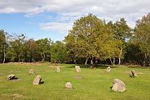
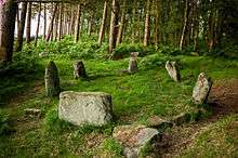
Nine Stone Close small stone circle[355] | Henge | Harthill, Derbyshire Dales SK2254262643 |
A Bronze Age stone circle near Winster. It is sometimes known as Grey Ladies. |
| North Lees Chapel[356] | Chapel | Outseats, Derbyshire Dales SK2333783552 |
||
| Northern Dale lead mines[357] | Mining | South Darley, Derbyshire Dales SK2671060022 |
||
 |
Odin Mine nucleated lead mine and ore works[358] | Mining | Castleton, High Peak SK1341283493 |
The oldest documented mine in Derbyshire and thought to be one of the oldest lead mines in England. 350m WNW of Knowlegates Farm. |
| Old Millclose engine house and associated features[359] | Mining | South Darley, Derbyshire Dales SK2578461832 |
Ruined buildings, earthworks and buried remains. The engine house was built in 1859 to pump water from the Old Millclose lead mine up the Watts engine shaft. 570m SW of Cowley Hall. | |
 |
One Arch Bridge[360] | Bridge | Edensor, Derbyshire Dales SK2607168442 |
Bridge over the River Derwent near Chatsworth, built in 1760 by James Paine. Also a Grade II* listed building.[361] |
| Osmaston Fields bowl barrow, south[362] | Barrow | Osmaston, Derbyshire Dales SK1865343991 |
||
| Oval Cairn at Gospel Hillocks, Cowdale[363] | Cairns | King Sterndale, Buxton, High Peak SK0862771485 |
One of two cairns lying c.100m apart. Measuring 28m x 18.5m and now less than 1m high. Neolithic in shape and nineteenth century excavations found a polished flint axe, buried human remains on a limestone slab and several jet buttons. A stone cist contained two further burials, fragments of Beaker pottery and flint flakes, suggesting reuse of the cairn into the early Bronze Age. | |
| Ox Low oval barrow[364] | Barrow | Peak Forest, High Peak SK1300380542 |
||
| Oxlow Rake lead mines[365] | Mining | Castleton, High Peak SK1285780329 |
||
 |
Padley Hall: a medieval great house[366] | House | Grindleford, Derbyshire Dales SK2471378996 |
Ruins of a large double courtyard house where, in 1588, two Catholic priests were discovered and then hanged, drawn and quartered in Derby. They became known as the 'Padley Martyrs'. |
| Palisaded hilltop enclosure[367] | Enclosure | Castleton, High Peak SK1561182072 |
230m SSE of Dirt Low | |
| Park Hall moated site, well and enclosure[368] | Moated site | Mapperley, Amber Valley SK4246043013 |
||
| Parsley Hay bowl barrow[369] | Barrow | Hartington, Derbyshire Dales SK1449163151 |
||
| Part of Goyt's Moss colliery[370] | Mining | Buxton, High Peak SK0145571773 |
Centered 220m south west of Derbyshire Bridge | |
| Peakshill or Oden sough[371] | Mining | Peak Forest, High Peak SK1172382953 |
||
| Perry Dale bowl barrow and long barrow[372] | Barrow | Peak Forest, High Peak SK1091981183 |
||
 |
Peveril Castle eleventh to fourteenth century tower keep castle[373] | Castle | Castleton, High Peak SK1485382540 |
A ruined 11th-century castle overlooking the village of Castleton. It was the main settlement of William Peverel. Also a Grade I listed building.[374] |
| Pike Low bowl barrow[375] | Barrow | Derwent, High Peak SK1803189747 |
||
 |
Pilsbury Castle Hills motte and bailey castle[376] | Castle | Pilsbury, Derbyshire Dales SK1138863867 |
Site of a Norman castle near the village of Pilsbury, overlooking the River Dove. |
| Pin Dale lead side veins[377] | Mining | Castleton, High Peak SK1582282340 |
||
| Pinxton Castle motte and fortified manor with moated site and five fishponds[378] | Castle | Pinxton, Bolsover SK4595456881 |
||
| Platform cairn, South of Hill Rake[379] | Cairns | Hazlebadge, Derbyshire Dales SK1731180320 |
||
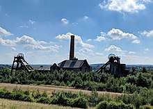 |
Pleasley Colliery[380] | Mining | Pleasley, Bolsover SK4986164354 |
A former coal mine since the 1870s and produced coal until 1983. Rare and only surviving pithead arrangement in the UK of two steam engines in the same engine house between two mine shafts. The wnginehouse, chimney and headstocks also constitute a Grade II listed building.[381] |
 |
Plumbley Colliery including Seldom Seen engine house[382] | Mining | Eckington, North East Derbyshire SK4208579944 |
600m NE of Roundhill Cottages |
| Prehistoric and Romano-British barrow and medieval animal pen[383] | Barrow | Ballidon, Derbyshire Dales SK2038456495 |
450m SE of Roystone Grange | |
| Prehistoric landscape on Big Moor and Ramsley Moor[384] | Landscape | Baslow, Derbyshire Dales SK2725575460 |
||
| Prehistoric standing stone[385] | Stone | Bamford, High Peak SK2201284694 |
1 km SW of triangulation point on High Neb | |
 |
Promontory fort on Combs Edge[386] | Fort | Chapel-en-le-Frith, High Peak SK0536478410 |
Castle Naze Iron Age hillfort on Combs Moss |
| Promontory fort, South of Ballcross Farm[387] | Cross | Bakewell, Derbyshire Dales SK2278469124 |
||
| Putwell Hill bowl barrow[388] | Barrow | Brushfield, Derbyshire Dales SK1709371824 |
||
| Putwell Hill Mine[389] | Mining | Little Longstone, Derbyshire Dales SK1742471754 |
||
| Railway embankment, North of Wirksworth[390] | Embankment | Cromford, Derbyshire Dales SK2894555519 |
||
| Rainslow Scrins[391] | Mining | Elton, Derbyshire Dales SK2215860210 |
470m SW of Leadmines Farm | |
| Ravensdale deer park, lodge, mill and fishpond[392] | Park | Mercaston, Derbyshire Dales SK2683643264 |
||
 |
Reconstructed packhorse bridge from Derwent Hall[393][394] | Bridge | Bamford, Hope Valley SK1692295123 |
When Ladybower Reservoir was built, Derwent's packhorse bridge spanning the River Derwent near the main gates of Derwent Hall, was removed stone by stone and rebuilt at Slippery Stones, at the head of Howden Reservoir. Also a Grade II listed building.[395] |
| Red lead mill, lead smelt mill, and corn mill[396] | Metalworks | Holymoorside and Walton, North East Derbyshire SK3257369394 |
East of Nether Loads Farm | |
| Remains of Nether Ratchwood and Rantor lead mines[397] | Mining | Middleton, Derbyshire Dales SK2838554943 |
200m West of Old Lane | |
| Ring cairn and cairn[398] | Cairns | Darley Dale, Derbyshire Dales SK2776265914 |
750m NW of Bumper Castle | |
| Ring cairn and cairn on Ramsley Moor[399] | Cairns | Holmesfield, North East Derbyshire SK2894775634 |
850m NE of Ramsley Lodge | |
| Ring cairn and cairnfield on Eaglestone Flat[400] | Cairns | Curbar, Derbyshire Dales SK2652973877 |
270m east of Eagle Stone | |
| Ring cairn on Bamford Moor[401] | Cairns | Bamford, High Peak SK2088585254 |
900m NE of Lydgate Farm | |
| Ringham Low bowl barrow[402] | Barrow | Middleton, Derbyshire Dales SK1790961938 |
||
| Ringwork in Castlehill Wood[403] | Earthwork | Glossop, High Peak SK0281195507 |
||
| Rockhurst long barrow and adjacent bowl barrow[404] | Barrow | Brassington, Derbyshire Dales SK2141657373 |
||
| Rodknoll fancy barrow[405] | Barrow | Brampton, North East Derbyshire SK3018169851 |
||
| Rolley Low bowl barrow[406] | Barrow | Great Longstone, Derbyshire Dales SK1844273621 |
||
| Roman fort[407] | Fort | Sawley, Erewash SK4750731351 |
180m East of All Saints' Church | |
| Roman fortlet[408] | Fort | Tintwistle, High Peak SK0642899012 |
320m East of Highstones | |
| Romano-British farmstead[409] | Settlement | Bamford, High Peak SK2091486576 |
475m East of Ladybower Inn | |
| Romano-British farmstead and post-medieval charcoal burning site[410] | Settlement | Derwent, High Peak SK2089886884 |
570m NE of Ladybower Inn | |
| Romano-British field system[411] | Field system | Ballidon, Derbyshire Dales SK2027656293 |
420m SE of Roystone Grange | |
| Romano-British field wall and embankment[412] | Field system | Ballidon, Derbyshire Dales SK1984256619 |
200m SW of Roystone Grange | |
 |
Romano-British settlement and field system at Rainster Rocks[413] | Settlement | Brassington, Derbyshire Dales SK2193054725 |
Site of settlement below the dolomitic limestone outcrop of Rainster Rocks with terraces, embankments, platforms and boulder field walls. |
| Romano-British settlement and field system[414] | Settlement | Ballidon, Derbyshire Dales SK1999356864 |
Immediately NW of Roystone Grange | |
| Romano-British settlement and field system[415] | Settlement | Ballidon, Derbyshire Dales SK1996356194 |
600m South of Roystone Grange | |
| Round barrow[416] | Barrow | Castleton, High Peak | 500m SW of Peveril Castle SK1470982218 | |
| 4 Round cairns near Hob Hurst's House[417][418][419][420] | Cairns | Beeley, Derbyshire Dales SK2898069209 SK2899369138 SK2859368272 SK2856268356 |
240m East, 275m South, 970m South and 890m SSW of Hob Hurst's House | |
| Round cairn near Crookhill Farm[421] | Cairns | Hope Woodlands, High Peak SK1824786951 |
430m West of Crookhill Farm | |
| Round cairn near New Barn[422] | Cairns | Taddington, Derbyshire Dales SK1465772979 |
460m North of New Barn | |
| 2 Round cairns near Offerton House[423][424] | Cairns | Offerton, Derbyshire Dales SK2077780661 SK2067880625 |
680m and 780m SW of Offerton House | |
| Round cairn and clearance cairn[425] | Cairns | Hope Woodlands, High Peak SK1794487116 |
770m NW of Crookhill Farm | |
| Round cairn at Gospel Hillocks, Cowdale[426] | Cairns | King Sterndale, Buxton, High Peak SK0870671575 |
One of two cairns lying c.100m apart, measuring 14m x 13m and c.1m high. It was opened in 1896 and found to contain a pit under a large slab with a crouched body covered with a mixture of clay, leaves and charcoal (associated with burnt bones). | |
| Round cairn between Coombes Edge and Cown Edge[427] | Cairns | Charlesworth, High Peak SK0204591892 |
||
| 2 Round cairns on Bridge-end Pasture[428][429] | Cairns | Hope Woodlands, High Peak SK1728687724 SK1764587742 |
300m and 600m NE of Two Thorne Fields Farm | |
| 2 Round cairns on Curbar Edge[430][431] | Cairns | Curbar, Derbyshire Dales SK2589475091 SK2549375596 |
||
| 6 Round cairns on Harland Edge[432][433][434][435][436][437] | Cairns | Beeley, Derbyshire Dales SK2883769198 SK2940868894 SK2889968754 SK2938268518 SK2938768257 SK2961168296 |
||
| Round Low bowl barrow[438] | Barrow | Brassington, Derbyshire Dales SK2388854898 |
||
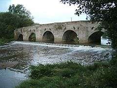
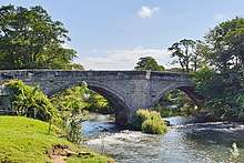
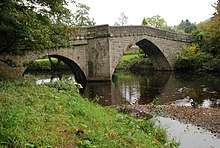
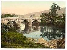
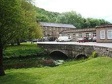
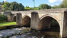
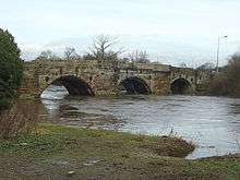
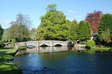
 Bridge over the River Derwent at Rowsley |
Rowsley Bridge | Bridge | Rowsley, Derbyshire Dales | |
| Roystone Grange bowl barrow | Barrow | Ballidon, Derbyshire Dales | ||
 Ruins of Trinity Chapel, Brackenfield |
Ruins of Trinity Chapel | Chapel | Brackenfield, North East Derbyshire | |
| Section of Roman road, Kirk Langley | Road | Kirk Langley, Amber Valley | NE of Moor Lane, Kirk Langley | |
| Section of Rykneld Street Roman road | Road | Denby, Amber Valley | South of Ticknall Hill | |
| Section of Rykneld Street Roman road | Road | Wingerworth, North East Derbyshire | 70m long, North of Redleadmill Brook | |
| Section of Rykneld Street Roman road | Road | Tupton, North East Derbyshire | 220m NE of Pear Tree Farm | |
| Settlement site | Settlement | Aston upon Trent, South Derbyshire | ||
| Settlement site and enclosures | Settlement | Twyford and Stenson, South Derbyshire | ||
| Sharp Low bowl barrow | Barrow | Tissington, Derbyshire Dales | ||
| Sharrow Hall moated site and associated road, driveway, dovecote, enclosures and ridge and furrow | Moated site | Osleston and Thurvaston, South Derbyshire | ||
| Sheepwash Bank and Dennis Knoll prehistoric settlement and field system | Settlement | Outseats, Derbyshire Dales | ||
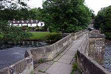
 Sheepwash Bridge over the River Wye, Ashford in the Water |
Sheepwash Bridge | Bridge | Ashford-in-the-Water, Derbyshire Dales | A medieval packhorse bridge with a stone sheep pen on one side. Lambs were held in the pen while the ewes were driven across the river to reach them, cleaning their fleeces on the way. |
| Shrunken medieval village and moated site at Thurvaston | Settlement | Osleston and Thurvaston, South Derbyshire | ||
| Site of bole near Harewood Grange | Metalworks | Beeley, Derbyshire Dales | 1400m West of Harewood Grange | |
| Site of bole and funerary cairn near Harewood Grange | Cairns | Beeley, Derbyshire Dales | 1120m West of Harewood Grange | |
| Slack, Mount Pleasant and Barmasters Grove lead mines | Mining | Bonsall, Derbyshire Dales | 390m SE of Blakelow Farm | |
| Slight univallate hillfort | Fort | Walton upon Trent, South Derbyshire | 230m SW of Old Hall Cottages | |
| Slight univallate hillfort and two bowl barrows on Mam Tor | Fort | Castleton, High Peak | ||
| Slitherstone and Linacre lead mines and a limekiln | Mining | Castleton, High Peak | 725m SW of Rowter Farm | |
| Small stone circle and central cairn on Eyam Moor | Cairns | Eyam, Derbyshire Dales | 370m South of Fern Cottage | |
| Small stone circle on Smelting Hill | Henge | Abney, Derbyshire Dalse | 560m NE of Lane End Farm | |
| Smerrill Barn bowl barrow | Barrow | Smerrill, Derbyshire Dales | ||
| Smerrill Moor bowl barrow | Barrow | Smerrill, Derbyshire Dales | ||
| Snake Mine nucleated lead mine | Mining | Middleton, Derbyshire Dales | 275m SSW of Hopton Quarries | |
| Snelslow Plantation bowl barrow | Barrow | Peak Forest, High Peak | ||
 Staden Low Enclosure |
Staden Low earthwork | Earthwork | Staden, Buxton, High Peak | A circular Neolithic earthwork excavated in 1926 by Mr R Woolescroft, who discovered a stone axe head, flint artefacts, pottery fragments and pieces of deer antler.[439] |
| Stainsby defended manorial complex including site of chapel | Settlement | Ault Hucknall, Bolsover | ||
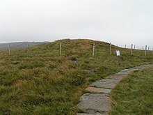
 Long Causeway, Stanage Edge |
Stanage Edge Roman road | Road | Outseats, Derbyshire Dales | Long Causeway which ran between Sheffield in South Yorkshire and Hathersage.[440] |
| Stand Low hlaew | Burial mound | Newton Grange, Derbyshire Dales | ||
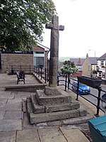
 Barlborough Village Cross |
Standing cross | Cross | Barlborough, Bolsover | |
| Standing cross in the churchyard of All Saints' Church | Cross | Bradbourne, Derbyshire Dales | ||
| Standing cross in the churchyard of St Mary's Church | Cross | Wirksworth, Derbyshire Dales | ||
 Taddington Cross |
Standing cross in the churchyard of St Michael and All Angels | Cross | Taddington, Derbyshire Dales | |
 Medieval standing cross in the churchyard of St Peter's Church |
Standing cross in the churchyard of St Peter's Church, Hope | Cross | Hope, High Peak | |
| Standing cross in the churchyard of St Peter's Church | Cross | Somersal Herbert, Derbyshire Dales | ||
| Standing cross in the churchyard of St Thomas Becket Church | Cross | Chapel-en-le-Frith, High Peak | ||
 Wheston Cross |
Standing cross known as Wheston Cross | Cross | Wheston, Derbyshire Dales | |
 Clowne Market Cross |
Standing cross, Clowne | Cross | Clowne, Bolsover | |
| Stoke Flat East prehistoric field system | Field system | Baslow, Derbyshire Dales | ||
| Stoke Flat South prehistoric field system | Field system | Baslow, Derbyshire Dales | ||
| Stoke Flat West prehistoric field system and stone circle | Field system | Froggatt, Derbyshire Dales | ||
| Stone circle near Crookhill Farm | Henge | Hope Woodlands, High Peak | 330m NW of Crookhill Farm | |
| Stone circle near High Lees Farm | Henge | Outseats, Derbyshire Dales | 960m NE of High Lees Farm | |
| Stone Edge smelt mill at Moss Farm | Metalworks | Ashover, North East Derbyshire | ||
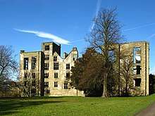
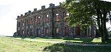 Sutton Scarsdale Hall |
 House | Sutton cum Duckmanton, North East Derbyshire | A Georgian ruined stately home in Sutton Scarsdale, just outside Chesterfield. The existing structure is believed to be the fourth or fifth built on the site. In 1724, Nicholas Leke, 4th Earl of Scarsdale commissioned the building of a design by architect Francis Smith. |
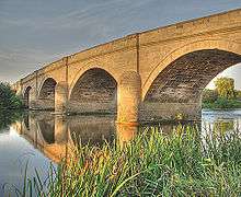 Swarkestone Bridge |
 Bridge | Swarkestone, South Derbyshire | Medieval bridge crossing the River Trent between the villages of Swarkestone and Stanton |
 Swarkestone Lows |
Swarkestone Lows round barrow cemetery and part of an aggregate field system | Barrow | Swarkestone, South Derbyshire | 300m NW of The Lowes Farm |
| Tapton Castle motte | Castle | Chesterfield | ||
| The Folly platform cairn | Cairns | Hope, High Peak | ||
| The Grey Ditch | Earthwork | Brough and Shatton, High Peak | ||
| The Tong bowl barrow and long barrow | Barrow | Wormhill, High Peak | ||
| The Warren Romano-British settlement | Settlement | Outseats, Derbyshire Dales | 320m NW of North Lees Hall | |
 Tides Low |
Tides Low bowl barrow, limekiln and standing stone | Barrow | Tideswell, Derbyshire Dales | |
 Tideslow Rake |
Tideslow Rake lead rake and lime kiln | Mining | Tideswell, Derbyshire Dales | |
| Tinker's Inn bowl barrow, north | Barrow | Clifton and Compton, Derbyshire Dales | ||
| Tinker's Inn bowl barrow, south | Barrow | Clifton and Compton, Derbyshire Dales | ||
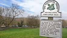 Castleton town ditch medieval defences |
Town defences | Defences | Castleton, High Peak | C13th earthwork bank and ditch remains
270m North and 350m NE of Peveril Castle |
| Tramway embankment | Embankment | Eckington, North East Derbyshire | ||
| Triple cairn, cairnfield and bole sites extending south westwards from Raven Tor | Cairns | Beeley, Derbyshire Dales | ||
| True Blue nucleated lead mine | Mining | Sheldon near Bakewell, Derbyshire Dales | Small mineworkings from C18th to early C20th. The monument includes earthworks of spoil heaps, capped shafts, settling pit, pond and coes.
600m ESE of Magpie Mine | |
| Tup Low bowl barrow | Barrow | Grindlow, Derbyshire Dales | ||
| Twelfth century tower keep castle | Castle | Duffield, Amber Valley | Includes sites of C11th motte and bailey castle, an Anglian cemetery and a Romano-British settlement | |
| Two hlaews at Haslin House | Burial mound | Buxton, High Peak | Pre-Christian burial mounds from the seventh century AD. The northernmost is 14m by 13m and 0.7m high and was partially excavated in 1850 by Thomas Bateman. It contained a small central cairn over a rock-cut grave, with human remains buried in a wooden coffin or surrounded by wooden planks. | |
| Two round cairns near Offerton House | Cairns | Offerton, Derbyshire Dales | 750m SW of Offerton House | |
 Round Hill barrow, near Twyford |
Twyford henge and Round Hill bowl barrow | Henge | Twyford and Stenson, South Derbyshire | |
 Viator Bridge, Milldale |
Viator's Bridge over the River Dove, Milldale | Bridge | Milldale, Derbyshire Dales | |
 Heath Wood |
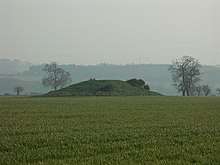
Viking Heath Wood barrow cemetery | Barrow | Ingleby, South Derbyshire | Heath Wood contains a series of 59 barrows (burial mounds), which are the only known Scandinavian cremation site in the British Isles.[441] |
| Village settlement and barrows East of Gardom's Edge | Settlement | Baslow, Derbyshire Dales | ||
| Vincent Knoll bowl barrow | Barrow | Hartington, Derbyshire Dales | ||
| Wardlow Hay Cop bowl barrow | Barrow | Wardlow, Derbyshire Dales | ||
| Watt's Grove Rake lead mines | Mining | Peak Forest, High Peak | 520m North of Sweetknoll | |
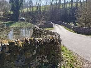
| Waymarker and clapper bridge | Bridge | Holmesfield, North East Derbyshire | 130m South of Barbrook Bridge | |
 Robin Hood's Picking Rods |
Wayside and a boundary cross known as Robin Hood's Picking Rods | Cross | Chisworth, High Peak | |
 Kinder Edale Cross |
Wayside and boundary cross known as Edale Cross | Cross | Hayfield, High Peak | |
 Lady's Cross |
Wayside and boundary cross known as Lady's Cross | Cross | Holmesfield, North East Derbyshire | |
 The Dipping Stone |
Wayside and boundary cross known as The Dipping Stone | Cross | Whaley Bridge, High Peak | |
| Wayside cross in Shillito Wood | Cross | Holmesfield, North East Derbyshire | ||
 Medieval wayside cross in St Peter's churchyard |
Wayside cross known as Eccles Cross | Cross | Hope, High Peak | The C13th cross was moved to St Peter's churchyard in 1966 from higher ground c.500m away by the lane to Eccles House Farm. |
 Whibbersley Cross |
Wayside cross known as Whibbersley Cross | Cross | Baslow, Derbyshire Dales | |
| Wayside cross west of Fox Lane | Cross | Holmesfield, North East Derbyshire | ||
| Wayside cross west of Saltersitch Bridge | Cross | Holmesfield, North East Derbyshire | ||
| White Cliff bowl barrow | Barrow | Little Longstone, Derbyshire Dales | ||
| White Rake long barrow and bowl barrow | Barrow | Great Longstone, Derbyshire Dales | ||
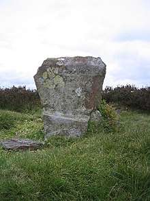
 Wind Low barrow and standing cross base |
Wind Low bowl barrow and standing cross | Cross | Wormhill, High Peak | Base of a medieval standing cross and barrow mound 16m by 12m. Excavation by Thomas Bateman in 1846 found Bronze Age human remains, jewellery & pottery fragments. |
| Windley Moated Manorial Complex | Moated site | Farnah Hall, Windley, Amber Valley | ||
 Wingfield Manor |
Wingfield Manor: a medieval great house | House | South Wingfield, Alfreton, Amber Valley | Construction of Wingfield Manor began in 1441 (for Treasurer to Henry VI, Sir Ralph Cromwell) but has been left deserted since the 1770s. |
| Winster Pitts and Drummer's Venture lead mines | Mining | Winster, Derbyshire Dales | ||
| Wolfscote Hill bowl barrow | Barrow | Hartington, Derbyshire Dales | ||
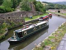
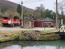 High Peak Junction Workshops by Cromford Canal |
Workshops, offices and terminus (Cromford and High Peak Railway) | Railway | Cromford, Derbyshire Dales | Within the World Heritage Site of Derwent Valley Mills.
Includes High Peak Junction workshops and Wharf Shed (where goods were transferred between canal barges and trains, on one of the world's oldest railways). |
| Wyaston hlaew | Burial mound | Edlaston and Wyaston, Derbyshire Dales |
References
- "The Schedule of Monuments". PastScape. Retrieved 4 February 2009.
- "Archaeological activities undertaken by English Heritage". English Heritage. Archived from the original on 26 November 2006. Retrieved 15 February 2009.
- "Search the List – Find listed buildings | Historic England". historicengland.org.uk. Retrieved 12 February 2020.
- Historic England. "Alderwasley Chapel (1007027)". National Heritage List for England. Retrieved 2 August 2020.
- Historic England. "Chapel of St Margaret (Grade II) (1109074)". National Heritage List for England. Retrieved 2 August 2020.
- Historic England. "Aleck Low bowl barrow (1010967)". National Heritage List for England. Retrieved 2 August 2020.
- Historic England. "Alport smelt mill (1009704)". National Heritage List for England. Retrieved 2 August 2020.
- Historic England. "Anglian high cross in St Laurence's churchyard (1008616)". National Heritage List for England. Retrieved 2 August 2020.
- Historic England. "Churchyard Cross 6 Metres East of Church Porch (Grade I) (1100263)". National Heritage List for England. Retrieved 2 August 2020.
- Historic England. "Anglian high cross in the churchyard of All Saints' Church (1008823)". National Heritage List for England. Retrieved 2 August 2020.
- Historic England. "Cross (200 Metres South of Church) (Grade II) (1109480)". National Heritage List for England. Retrieved 2 August 2020.
- Historic England. "Anglian high cross in the churchyard of All Saints' Church (1008617)". National Heritage List for England. Retrieved 6 August 2020.
- Historic England. "The Great Cross and Railed Enclosure (Grade I) (1316492)". National Heritage List for England. Retrieved 6 August 2020.
- Historic England. "Anglian high cross in the churchyard of St Peter's Church (1008828)". National Heritage List for England. Retrieved 2 August 2020.
- Historic England. "Cross Shaft 1 Metre South of St Peters Church (Grade II) (1121949)". National Heritage List for England. Retrieved 2 August 2020.
- Historic England. "Anglo Scandinavian high cross in the churchyard of St Thomas Becket Church (1008826)". National Heritage List for England. Retrieved 6 August 2020.
- Historic England. "Anglo-Scandinavian High Cross at West End of South Aisle of Church of St Thomas Becket (Grade II) (1052246)". National Heritage List for England. Retrieved 6 August 2020.
- Historic England. "Anglo Scandinavian high cross known as the Shall Cross (1008825)". National Heritage List for England. Retrieved 6 August 2020.
- Historic England. "Anglo-Scandinavian high cross from Two Dales, Darley, now in the churchyard of All Saints' Church (1008618)". National Heritage List for England. Retrieved 2 August 2020.
- Historic England. "Cross Situated 12 Metres to South of Porch of Church of All Saints (Grade I) (1316491)". National Heritage List for England. Retrieved 2 August 2020.
- Historic England. "Anglo-Scandinavian high cross shaft and medieval cross base in the churchyard of All Saints' Church (1008607)". National Heritage List for England. Retrieved 6 August 2020.
- Historic England. "Anthony Hill bowl barrow (1007761)". National Heritage List for England. Retrieved 6 August 2020.
- Historic England. "Aqueduct, 328m south east of Aqueduct Cottage (1007025)". National Heritage List for England. Retrieved 6 August 2020.
- Historic England. "rbor Low henge, large irregular stone circle, linear bank and bowl barrow (1011087)". National Heritage List for England. Retrieved 6 August 2020.
- Historic England. "Arbourseats Veins and Sough, Wardlow Sough, Nay Green Mine and Washing Floors, Hading Vein and Seedlow Rake (1412782)". National Heritage List for England. Retrieved 6 August 2020.
- Historic England. "Ash Tree Cave (1017583)". National Heritage List for England. Retrieved 6 August 2020.
- Historic England. "Ashford Bridge (1007055)". National Heritage List for England. Retrieved 6 August 2020.
- Historic England. "Mill Bridge (Grade II) (1109261)". National Heritage List for England. Retrieved 6 August 2020.
- Historic England. "Atlow moated site, enclosures and causeway (1011620)". National Heritage List for England. Retrieved 9 August 2020.
- Historic England. "Bakewell Bridge (1007078)". National Heritage List for England. Retrieved 9 August 2020.
- Historic England. "Bakewell Bridge (Grade I) (1148112)". National Heritage List for England. Retrieved 9 August 2020.
- Historic England. "Bank Top bowl barrow (1008938)". National Heritage List for England. Retrieved 9 August 2020.
- Historic England. "Bank Top oval barrow (1008937)". National Heritage List for England. Retrieved 9 August 2020.
- Historic England. "Barton Blount medieval settlement remains, including a chapel, decoy pond and part of the open field system, 340m north of Barton Hall (1016778)". National Heritage List for England. Retrieved 9 August 2020.
- Historic England. "Baslow Bridge (1007057)". National Heritage List for England. Retrieved 9 August 2020.
- Historic England. "Baslow Bridge (Grade I) (1088195)". National Heritage List for England. Retrieved 9 August 2020.
- Historic England. "Bassett Wood bowl barrow (1009169)". National Heritage List for England. Retrieved 9 August 2020.
- Historic England. "Batham Gate, Roman road (1007051)". National Heritage List for England. Retrieved 9 August 2020.
- Historic England. "Beans and Bacon, Old Eye, Fiery Dragon and Cod Beat lead mines and a limekiln 480m south of Blakelow Farm (1019041)". National Heritage List for England. Retrieved 9 August 2020.
- Historic England. "Bee Low bowl barrow (1008001)". National Heritage List for England. Retrieved 9 August 2020.
- Historic England. "Benty Grange hlaew (1013767)". National Heritage List for England. Retrieved 9 August 2020.
- Historic England. "Black Rakes, Welshmans Venture and Bondog Hole Mines, and Merry Tom and Thumper Sitch Levels (1412515)". National Heritage List for England. Retrieved 9 August 2020.
- Historic England. "Blackstone's Low bowl barrow (1010098)". National Heritage List for England. Retrieved 9 August 2020.
- Historic England. "Blake Low bowl barrow (1011856)". National Heritage List for England. Retrieved 9 August 2020.
- Historic England. "Boars Low bowl barrow (1013878)". National Heritage List for England. Retrieved 9 August 2020.
- Historic England. "Bole Hill bowl barrow (1011202)". National Heritage List for England. Retrieved 9 August 2020.
- Historic England. "Bolsover Castle: eleventh century motte and bailey castle, twelfth century tower keep castle and seventeenth century country house. (1012496)". National Heritage List for England. Retrieved 9 August 2020.
- Historic England. "Bolsover Castle (Grade I) (1108976)". National Heritage List for England. Retrieved 9 August 2020.
- Historic England. "Bonsall Leys lead mines (1017755)". National Heritage List for England. Retrieved 9 August 2020.
- Historic England. "Borther Low bowl barrow (1008002)". National Heritage List for England. Retrieved 9 August 2020.
- Historic England. "Bostern Grange bowl barrow (1009443)". National Heritage List for England. Retrieved 9 August 2020.
- Historic England. "Bowl barrow and wayside cross WSW of Pilsley (1009290)". National Heritage List for England. Retrieved 9 August 2020.
- Historic England. "Bowl barrow east of Arbor Low (1011089)". National Heritage List for England. Retrieved 10 August 2020.
- Historic England. "Bowl barrow in Foggy Lees Plantation (1008061)". National Heritage List for England. Retrieved 10 August 2020.
- Historic England. "Bowl barrow known as Priestcliffe Low, 200m west of Low End Farm (1020304)". National Heritage List for England. Retrieved 10 August 2020.
- Historic England. "Bowl barrow north of Manor House (1008957)". National Heritage List for England. Retrieved 10 August 2020.
- Historic England. "Bowl barrow on Calton Pastures, 1200m west of Calton Houses (1007994)". National Heritage List for England. Retrieved 10 August 2020.
- Historic England. "Bowl barrow on Calton Pastures, 950m west of Calton Houses (Grade yes) (1007995)". National Heritage List for England. Retrieved 10 August 2020.
- Historic England. "Bowl barrow on Calton Pastures, 625m WSW of Calton Houses (1007996)". National Heritage List for England. Retrieved 10 August 2020.
- Historic England. "Bowl barrow on Calton Pastures, 600m south-west of Calton Houses (1007997)". National Heritage List for England. Retrieved 10 August 2020.
- Historic England. "Bowl barrow on Calton Pastures, 850m south of Calton Houses (1007998)". National Heritage List for England. Retrieved 10 August 2020.
- Historic England. "Bowl barrow on Carsington Pasture, 800m south east of Brassington Brickworks (1020946)". National Heritage List for England. Retrieved 10 August 2020.
- Historic England. "Bowl barrow on Haddon Fields (1011858)". National Heritage List for England. Retrieved 10 August 2020.
- Historic England. "Bowl barrow on Haddon Fields (1017543)". National Heritage List for England. Retrieved 10 August 2020.
- Historic England. "Bowl barrow on Longside Moor, 450m north of Harewood Grange (1017919)". National Heritage List for England. Retrieved 10 August 2020.
- Historic England. "Bowl barrow on Longstone Moor (1008770)". National Heritage List for England. Retrieved 10 August 2020.
- Historic England. "Bowl barrow on Longstone Moor (1010801)". National Heritage List for England. Retrieved 10 August 2020.
- Historic England. "Bowl barrow on Masson Hill (1011201)". National Heritage List for England. Retrieved 11 August 2020.
- Historic England. "Bowl barrow on Withery Low (1008935)". National Heritage List for England. Retrieved 11 August 2020.
- Historic England. "Bowl barrow on Withery Low (1008936)". National Heritage List for England. Retrieved 11 August 2020.
- Historic England. "Bowl barrow west of Castlegate Lane (1008789)". National Heritage List for England. Retrieved 11 August 2020.
- Historic England. "Bowl barrow west of Manor House (1008956)". National Heritage List for England. Retrieved 11 August 2020.
- Historic England. "Two bowl barrows at Osmaston Fields, north (1010093)". National Heritage List for England. Retrieved 11 August 2020.
- Historic England. "Two bowl barrows at Pilsbury (1009166)". National Heritage List for England. Retrieved 11 August 2020.
- Historic England. "Two bowl barrows at Rockhurst (1008997)". National Heritage List for England. Retrieved 11 August 2020.
- Historic England. "Two bowl barrows east of Hay Dale (1008811)". National Heritage List for England. Retrieved 11 August 2020.
- Historic England. "One of two bowl barrows on Bole Hill (1008941)". National Heritage List for England. Retrieved 11 August 2020.
- Historic England. "One of two bowl barrows on Bole Hill (1008942)". National Heritage List for England. Retrieved 11 August 2020.
- Historic England. "Two bowl barrows on Chelmorton Low (1008932)". National Heritage List for England. Retrieved 11 August 2020.
- Historic England. "Two bowl barrows on Stand Low (1009025)". National Heritage List for England. Retrieved 11 August 2020.
- Historic England. "Bradley Park bowl barrow (1008067)". National Heritage List for England. Retrieved 11 August 2020.
- Historic England. "Brampton Barn (1004600)". National Heritage List for England. Retrieved 11 August 2020.
- Historic England. "Garage to Manor House called Brampton Barn (Grade II) (1031926)". National Heritage List for England. Retrieved 11 August 2020.
- Historic England. "Bretby Castle fortified manor (1011443)". National Heritage List for England. Retrieved 11 August 2020.
- Historic England. "Brightside lead mine, 80m south west of Brightside Cottage (1018688)". National Heritage List for England. Retrieved 11 August 2020.
- Historic England. "Bronze Age burial, ceremonial and settlement remains on Stanton Moor, and evidence for medieval, post-medieval and 19th to early 20th century activity (1009300)". National Heritage List for England. Retrieved 11 August 2020.
- Historic England. "Bronze Age field system, 400m south east of Ladybower Inn (1018214)". National Heritage List for England. Retrieved 11 August 2020.
- Historic England. "Bronze Age settlement and ceremonial remains on Gibbet Moor, 980m north east of Swiss Cottage (1019000)". National Heritage List for England. Retrieved 11 August 2020.
- Historic England. "Brundcliffe hlaew (1013225)". National Heritage List for England. Retrieved 11 August 2020.
- Historic England. "Brushfield Hough bowl barrow (1008814)". National Heritage List for England. Retrieved 11 August 2020.
- Historic England. "Bugsworth canal basin, tramway, quarry and limekilns (1021384)". National Heritage List for England. Retrieved 11 August 2020.
- Historic England. "Bull Ring henge, oval barrow and bowl barrow (1011204)". National Heritage List for England. Retrieved 12 August 2020.
- Historic England. "Burr Tor prehistoric stock enclosure (1007562)". National Heritage List for England. Retrieved 12 August 2020.
- Historic England. "Burton Moor bowl barrow (1017545)". National Heritage List for England. Retrieved 12 August 2020.
- Historic England. "Butterley Works blast furnaces, canal tunnel and underground wharf (1404832)". National Heritage List for England. Retrieved 12 August 2020.
- Historic England. "Cackle Mackle and Stadford Hollow lead mines on Longstone Moor (1017754)". National Heritage List for England. Retrieved 12 August 2020.
- Historic England. "Cairn 500m west of Newbridge Farm (1019510)". National Heritage List for England. Retrieved 14 August 2020.
- Historic England. "Cairn 400m north west of Newbridge Farm (1019511)". National Heritage List for England. Retrieved 14 August 2020.
- Historic England. "Cairn 1500m north west of Newbridge Farm (1019513)". National Heritage List for England. Retrieved 14 August 2020.
- Historic England. "Cairn 450m north east of Raven Tor (1019482)". National Heritage List for England. Retrieved 14 August 2020.
- Historic England. "Cairn 600m south of Raven Tor (1019480)". National Heritage List for England. Retrieved 14 August 2020.
- Historic England. "Cairn 550m south of Howden Reservoir Dam wall (1017663)". National Heritage List for England. Retrieved 14 August 2020.
- Historic England. "Cairn 720m north east of Lady Wash Farm (1018481)". National Heritage List for England. Retrieved 14 August 2020.
- Historic England. "Cairn 800m WSW Of Offerton House (1016999)". National Heritage List for England. Retrieved 14 August 2020.
- Historic England. "Cairn 880m south west of Leam Hall Farm (1018483)". National Heritage List for England. Retrieved 14 August 2020.
- Historic England. "Cairn cemetery on Gibbet Moor, 1100m south west of Stonelow Farm (1019906)". National Heritage List for England. Retrieved 14 August 2020.
- Historic England. "Cairn complex 780m south of Dalebrook House (1018997)". National Heritage List for England. Retrieved 14 August 2020.
- Historic England. "Cairn on Bamford Edge, 500m north east of Mooredge (1018083)". National Heritage List for England. Retrieved 14 August 2020.
- Historic England. "Cairn on Bamford Edge, 570m north east of Clough House (1018085)". National Heritage List for England. Retrieved 14 August 2020.
- Historic England. "Cairn on Bamford Moor, 975m north east of Clough House (1018217)". National Heritage List for England. Retrieved 14 August 2020.
- Historic England. "Cairn on Bamford Moor, 680m north of High Lees Farm (1018091)". National Heritage List for England. Retrieved 14 August 2020.
- Historic England. "Cairn on Bamford Moor, 850m north west of Crow Chin (1018219)". National Heritage List for England. Retrieved 14 August 2020.
- Historic England. "Two cairns on Beeley Moor, east of Hell Bank Plantation (1019484)". National Heritage List for England. Retrieved 14 August 2020.
- Historic England. "Cairn on Harland Edge (1008604)". National Heritage List for England. Retrieved 14 August 2020.
- Historic England. "Cairn on Harland Edge (1011795)". National Heritage List for England. Retrieved 14 August 2020.
- Historic England. "Cairn on Ludworth Intakes (1008596)". National Heritage List for England. Retrieved 14 August 2020.
- Historic England. "Details from listed building database ()". National Heritage List for England. Retrieved 14 August 2020.
- Historic England. "Cairnfield 1400m north west of Clod Hall Farm (1019512)". National Heritage List for England. Retrieved 14 August 2020.
- Historic England. "Cairnfield 180m north east of Ramsley Lodge (1017114)". National Heritage List for England. Retrieved 14 August 2020.
- Historic England. "Cairnfield 320m north of Saltersitch Bridge, Eastern Moors (1017111)". National Heritage List for England. Retrieved 14 August 2020.
- Historic England. "Cairnfield 390m south of Syda Farm (1019293)". National Heritage List for England. Retrieved 14 August 2020.
- Historic England. "Cairnfield 470m south west of Offerton House (1016626)". National Heritage List for England. Retrieved 14 August 2020.
- Historic England. "Cairnfield 600m NNE of High Lees Farm (1018092)". National Heritage List for England. Retrieved 14 August 2020.
- Historic England. "Cairnfield 775m NNE of High Lees Farm (1018093)". National Heritage List for England. Retrieved 14 August 2020.
- Historic England. "Cairnfield 600m west of Highlow Hall (1016997)". National Heritage List for England. Retrieved 14 August 2020.
- Historic England. "Cairnfield 615m west of Moor Edge Farm (1019905)". National Heritage List for England. Retrieved 14 August 2020.
- Historic England. "Cairnfield, 580m ENE of Stanage House (1018734)". National Heritage List for England. Retrieved 14 August 2020.
- Historic England. "Cairnfield 630m north east of Stanage House (1018482)". National Heritage List for England. Retrieved 14 August 2020.
- Historic England. "Cairnfield, 870m north east of Stanage House (1016809)". National Heritage List for England. Retrieved 14 August 2020.
- Historic England. "Cairnfield 500m north east of Bumper Castle (1009358)". National Heritage List for England. Retrieved 14 August 2020.
- Historic England. "Cairnfield 700m north east of Raven Tor (1019481)". National Heritage List for England. Retrieved 14 August 2020.
- Historic England. "Cairnfield 710m and 840m south east of Ladybower Inn (1018215)". National Heritage List for England. Retrieved 14 August 2020.
- Historic England. "Cairnfield 800m west of Nether Rodknoll Farm (1019877)". National Heritage List for England. Retrieved 14 August 2020.
- Historic England. "Cairnfield 870m north east of Lane End Farm (1020362)". National Heritage List for England. Retrieved 14 August 2020.
- Historic England. "Cairnfield 970m north west of Green's House (1018096)". National Heritage List for England. Retrieved 14 August 2020.
- Historic England. "Cairnfield and associated settlement, 450m south west of Leam Hall Farm (1018477)". National Heritage List for England. Retrieved 14 August 2020.
- Historic England. "Cairnfield and barrow on Rabbit Warren, 900m south east of Park Farm (1016418)". National Heritage List for England. Retrieved 14 August 2020.
- Historic England. "Cairnfield and embanked stone circle 550m east of Barbrook Reservoir (1020301)". National Heritage List for England. Retrieved 14 August 2020.
- Historic England. "Cairnfield and field system 530m south of Dalebrook House (1018998)". National Heritage List for England. Retrieved 14 August 2020.
- Historic England. "Cairnfield and field system north of Eaglestone Flat, 450m south west of Swine Sty (1017109)". National Heritage List for England. Retrieved 14 August 2020.
- Historic England. "Cairnfield and field system on Eaglestone Flat, 100m south west of Eagle Stone (1017110)". National Heritage List for England. Retrieved 14 August 2020.
- Historic England. "Cairnfield and house platform 400m south west of Harewood Grange Farm (1020305)". National Heritage List for England. Retrieved 14 August 2020.
- Historic England. "Cairnfield and quarry on Bamford Edge, 720m north of Clough House (1018084)". National Heritage List for England. Retrieved 14 August 2020.
- Historic England. "Cairnfield and ring cairn 490m south of Offerton Hall (1016627)". National Heritage List for England. Retrieved 14 August 2020.
- Historic England. "Details from listed building database (1016419)". National Heritage List for England. Retrieved 14 August 2020.
- Historic England. "Cairnfield and standing stones east of Bunker's Hill Wood, 1km north east of Park Farm (1018995)". National Heritage List for England. Retrieved 14 August 2020.
- Historic England. "Cairnfield with enclosure, house platform and ring cairn 800m north east of Raven Tor (1020233)". National Heritage List for England. Retrieved 14 August 2020.
- Historic England. "Details from listed building database (1018733)". National Heritage List for England. Retrieved 14 August 2020.
- Historic England. "Cairnfield, field system and ring cairn 1300m NNW of Newbridge Farm (1019971)". National Heritage List for England. Retrieved 14 August 2020.
- Historic England. "Cairnfield, field system and ring cairn 650m east of Moorside Farm (1019509)". National Heritage List for England. Retrieved 14 August 2020.
- Historic England. "Cairnfield, linear clearance and ring cairn 720m north west of Moor Edge Farm (1019904)". National Heritage List for England. Retrieved 14 August 2020.
- Historic England. "Calke Park Tunnel (1007029)". National Heritage List for England. Retrieved 14 August 2020.
- Historic England. "Calling Low bowl barrow (1008003)". National Heritage List for England. Retrieved 14 August 2020.
- Historic England. "Details from listed building database (1011437)". National Heritage List for England. Retrieved 14 August 2020.
- Historic England. "Callow prehistoric settlement and field system, Carr Head Moor, 300m ENE of Toothill Farm (1017506)". National Heritage List for England. Retrieved 14 August 2020.
- Historic England. "Calver weir and water management system 200m north east of Stocking Farm (1021447)". National Heritage List for England. Retrieved 14 August 2020.
- Historic England. "Camp Green ringwork (1011200)". National Heritage List for England. Retrieved 14 August 2020.
- Historic England. "Carsington Pasture, Nickalum, Perserverance, West Head, Break Hollow and other small mines and medieval field boundaries (1412922)". National Heritage List for England. Retrieved 14 August 2020.
- Historic England. "Castle Gresley motte and bailey castle (1011209)". National Heritage List for England. Retrieved 14 August 2020.
- Historic England. "Castle Hill camp (1007046)". National Heritage List for England. Retrieved 14 August 2020.
- Historic England. "Details from listed building database (1011211)". National Heritage List for England. Retrieved 14 August 2020.
- Historic England. "Castle Ring defended settlement (1008005)". National Heritage List for England. Retrieved 14 August 2020.
- Historic England. "A chambered tomb and two bowl barrows on Minning Low (1009102)". National Heritage List for England. Retrieved 14 August 2020.
- Historic England. "Civil War redoubt 150m east of Tissington Hall (1018870)". National Heritage List for England. Retrieved 11 August 2020.
- Historic England. "Coalpithole Rake (1412937)". National Heritage List for England. Retrieved 14 August 2020.
- Historic England. "Codnor Castle (1007047)". National Heritage List for England. Retrieved 14 August 2020.
- Historic England. "Coke ovens, 120m north east of Summerley House (1018379)". National Heritage List for England. Retrieved 14 August 2020.
- Historic England. "Conksbury deserted medieval settlement (1014589)". National Heritage List for England. Retrieved 14 August 2020.
- Historic England. "Cop Low oval barrow (1008057)". National Heritage List for England. Retrieved 14 August 2020.
- Historic England. "Details from listed building database (1019043)". National Heritage List for England. Retrieved 14 August 2020.
- Historic England. "Cow Low bowl barrow (1008998)". National Heritage List for England. Retrieved 14 August 2020.
- Historic England. "Cow Low bowl barrow (Tunstead Quarry) (1017541)". National Heritage List for England. Retrieved 14 August 2020.
- Historic England. "Cowdale Quarry limestone extraction and processing site 540m north east of Staden Manor (1399726)". National Heritage List for England. Retrieved 14 August 2020.
- Historic England. "Cratcliff Rocks defended settlement (1008006)". National Heritage List for England. Retrieved 14 August 2020.
- Historic England. "Cratcliff Rocks hermitage (1008008)". National Heritage List for England. Retrieved 14 August 2020.
- Historic England. "Palaeolithic and later prehistoric sites at Creswell Gorge including Pinhole Cave, Mother Grundy's Parlour and Robin Hood's Cave See also NOTTINGHAMSHIRE 183 (1003770)". National Heritage List for England. Retrieved 16 August 2020.
- Historic England. "Palaeolithic and later prehistoric sites at Creswell Gorge, including Boat House Cave and Church Hole Cave See also DERBYSHIRE 275 (1006384)". National Heritage List for England. Retrieved 16 August 2020.
- Historic England. "Cromford Bridge (1007058)". National Heritage List for England. Retrieved 16 August 2020.
- Historic England. "Cromford Bridge (over River Derwent) (Grade II*) (1263846)". National Heritage List for England. Retrieved 16 August 2020.
- Historic England. "Cromford Canal engine house, engine and aqueduct (1007040)". National Heritage List for England. Retrieved 16 August 2020.
- Historic England. "HIGH PEAK PUMP HOUSE (Grade II*) (1247889)". National Heritage List for England. Retrieved 16 August 2020.
- Historic England. "Cromwell's Low bowl barrow (1010968)". National Heritage List for England. Retrieved 16 August 2020.
- Historic England. "Cronkston Low bowl barrow (1017540)". National Heritage List for England. Retrieved 16 August 2020.
- Historic England. "Crookstone Hill round cairn (1008069)". National Heritage List for England. Retrieved 16 August 2020.
- Historic England. "Cross Low bowl barrow (1011009)". National Heritage List for England. Retrieved 16 August 2020.
- Historic England. "Cross ridge dyke, 800m east of Bleaklow (1018476)". National Heritage List for England. Retrieved 16 August 2020.
- Historic England. "Details from listed building database (1011619)". National Heritage List for England. Retrieved 16 August 2020.
- Historic England. "Cup-marked stone 80m east of Robin Hood's Picking Rods (1008599)". National Heritage List for England. Retrieved 16 August 2020.
- Historic England. "Dale Abbey (1007061)". National Heritage List for England. Retrieved 16 August 2020.
- Historic England. "Darley Bridge (1007062)". National Heritage List for England. Retrieved 16 August 2020.
- Historic England. "Darley Bridge (over River Derwent) (Grade II*) (1248041)". National Heritage List for England. Retrieved 16 August 2020.
- Historic England. "Details from listed building database (1017834)". National Heritage List for England. Retrieved 16 August 2020.
- Historic England. "Doll Tor Stone Circle and Cairn (1017664)". National Heritage List for England. Retrieved 16 August 2020.
- Historic England. "Dove Bridge (see also Staffordshire 260) (1007066)". National Heritage List for England. Retrieved 16 August 2020.
- Historic England. "Dove Bridge (see also Derbyshire 56) (1003808)". National Heritage List for England. Retrieved 16 August 2020.
- Historic England. "Dove Bridge (Grade II*) (1237731)". National Heritage List for England. Retrieved 16 August 2020.
- Historic England. "Dovecote 85m south of Netherseal Old Hall (1016949)". National Heritage List for England. Retrieved 16 August 2020.
- Historic England. "Pigeoncote at Old Hall Cottages (Grade II*) (1096418)". National Heritage List for England. Retrieved 16 August 2020.
- Historic England. "Dowel Cave (1011923)". National Heritage List for England. Retrieved 16 August 2020.
- Historic England. "Duffield Bridge (1007063)". National Heritage List for England. Retrieved 16 August 2020.
- Historic England. "Duffield Church Bridge (Grade II) (1158235)". National Heritage List for England. Retrieved 16 August 2020.
- Historic England. "Duncote Farm Moated Site (1011435)". National Heritage List for England. Retrieved 16 August 2020.
- Historic England. "Eldon Hill Bowl Barrow (1008063)". National Heritage List for England. Retrieved 16 August 2020.
- Historic England. "Eldon Hill crushing circle, associated lead mining remains and palisaded enclosure on Eldon Hill (1020992)". National Heritage List for England. Retrieved 16 August 2020.
- Historic England. "Ellastone Bridge (1003766)". National Heritage List for England. Retrieved 16 August 2020.
- Historic England. "Ellastone Bridge (Grade II) (1204386)". National Heritage List for England. Retrieved 16 August 2020.
- Historic England. "Embanked Stone Circle Known As Wet Withens, And Adjacent Cairn (1018480)". National Heritage List for England. Retrieved 16 August 2020.
- Historic England. "Embanked Stone Circle On Eyam Moor, 340M South Of Leam Hall Farm (1018479)". National Heritage List for England. Retrieved 16 August 2020.
- Historic England. "End Low Bowl Barrow (1010998)". National Heritage List for England. Retrieved 16 August 2020.
- Historic England. "Details from listed building database (1014596)". National Heritage List for England. Retrieved 16 August 2020.
- Historic England. "Entrance To Long Sough West Of Allen'S Hill (1014595)". National Heritage List for England. Retrieved 16 August 2020.
- Historic England. "Faucet Rake Lead Mines 870M South West And 930M South East Of Oxlow House (1019005)". National Heritage List for England. Retrieved 16 August 2020.
- Historic England. "Field system and stone circle on Rabbit Warren, 1150m south east of Park Farm (1016417)". National Heritage List for England. Retrieved 16 August 2020.
- Historic England. "Fin Cop promontory fort, bowl barrow and eighteenth century lime kiln with associated quarry (1011205)". National Heritage List for England. Retrieved 16 August 2020.
- Historic England. "Fishponds 260m north west of Mercaston Hall Farm (1020944)". National Heritage List for England. Retrieved 16 August 2020.
- Historic England. "Five Wells chambered tomb (1008940)". National Heritage List for England. Retrieved 16 August 2020.
- Historic England. "Four watchtowers SW of town (1007045)". National Heritage List for England. Retrieved 16 August 2020.
- Historic England. "Fox Hole Cave (1011922)". National Heritage List for England. Retrieved 16 August 2020.
- Historic England. "Fox Low bowl barrow (1008921)". National Heritage List for England. Retrieved 16 August 2020.
- Historic England. "Friden Hollow bowl barrow (1008004)". National Heritage List for England. Retrieved 16 August 2020.
- Historic England. "Fritchley Tunnel, Butterley Gangroad (1422984)". National Heritage List for England. Retrieved 16 August 2020.
- Historic England. "Fritchley Tunnel, Butterley Gangroad (1422984)". National Heritage List for England. Retrieved 19 March 2015.
- Historic England. "Froggatt Bridge (1007056)". National Heritage List for England. Retrieved 16 August 2020.
- Historic England. "Froggatt Bridge (Grade II) (1311423)". National Heritage List for England. Retrieved 16 August 2020.
- Historic England. "Galley Low bowl barrow (1010100)". National Heritage List for England. Retrieved 16 August 2020.
- Historic England. "Gallowlow Lane bowl barrow (1010101)". National Heritage List for England. Retrieved 16 August 2020.
- Historic England. "Gautries Hill bowl barrow (1008065)". National Heritage List for England. Retrieved 16 August 2020.
- Historic England. "Gautries Rake (1412938)". National Heritage List for England. Retrieved 16 August 2020.
- Historic England. "Gib Hill oval barrow and bowl barrow (1011088)". National Heritage List for England. Retrieved 16 August 2020.
- Historic England. "Gorsey Low bowl barrow (1009168)". National Heritage List for England. Retrieved 16 August 2020.
- Historic England. "Gorseydale lead mines, 300m north and 650m north west of Moor Farm (1016291)". National Heritage List for England. Retrieved 16 August 2020.
- Historic England. "Green Low bowl barrow, west. (1010103)". National Heritage List for England. Retrieved 16 August 2020.
- Historic England. "Green low chambered tomb (1009444)". National Heritage List for England. Retrieved 16 August 2020.
- Historic England. "Green low ringcairn (1009521)". National Heritage List for England. Retrieved 16 August 2020.
- Historic England. "Grindleford Bridge (1007059)". National Heritage List for England. Retrieved 16 August 2020.
- Historic England. "Grindleford Bridge (Grade II) (1311400)". National Heritage List for England. Retrieved 16 August 2020.
- Historic England. "Grindleford Bridge (Grade II) (1109825)". National Heritage List for England. Retrieved 16 August 2020.
- Historic England. "Grindlow bowl barrow (1011859)". National Heritage List for England. Retrieved 16 August 2020.
- Historic England. "Harboro' cave (1007044)". National Heritage List for England. Retrieved 16 August 2020.
- "Peak District Information - Harboro Rocks".
- Historic England. "Hardwick Old Hall: an Elizabethan great house (1015889)". National Heritage List for England. Retrieved 16 August 2020.
- Historic England. "Hardwick Old Hall (1052337)". National Heritage List for England. Retrieved 16 August 2020.
- Historic England. "Harrod Low long barrow (1008064)". National Heritage List for England. Retrieved 16 August 2020.
- Historic England. "Harthill Moor bowl barrow (1009435)". National Heritage List for England. Retrieved 16 August 2020.
- Historic England. "Hawks Low bowl barrow (1010999)". National Heritage List for England. Retrieved 16 August 2020.
- Historic England. "Heavy anti-aircraft gunsite 340m south east of gardens farm (1019871)". National Heritage List for England. Retrieved 16 August 2020.
- Historic England. "Henge complex NW of Hickens Bridge (1007034)". National Heritage List for England. Retrieved 16 August 2020.
- Historic England. "Hermitage 170m south east of All Saints Church (1019632)". National Heritage List for England. Retrieved 16 August 2020.
- Historic England. "High Field hlaew (1008818)". National Heritage List for England. Retrieved 16 August 2020.
- Historic England. "High Rake Mine (1412940)". National Heritage List for England. Retrieved 16 August 2020.
- Historic England. "Hill's Venture lead mine (1017650)". National Heritage List for England. Retrieved 16 August 2020.
- Historic England. "Hillcarr Sough and associated lime kiln and paved track (1015204)". National Heritage List for England. Retrieved 16 August 2020.
- Historic England. "Hob Hurst's House: a square, banked and ditched burial cairn with cist on Harland Edge (1008600)". National Heritage List for England. Retrieved 16 August 2020.
- Historic England. "Hollins Hill bowl barrow (1009571)". National Heritage List for England. Retrieved 16 August 2020.
- Historic England. "Holm Bridge (1007054)". National Heritage List for England. Retrieved 16 August 2020.
- Historic England. "Holme bridge (1247518)". National Heritage List for England. Retrieved 16 August 2020.
- Historic England. "Details from listed building database (1011621)". National Heritage List for England. Retrieved 16 August 2020.
- Historic England. "Hoon mount platformed bowl barrow (1011203)". National Heritage List for England. Retrieved 16 August 2020.
- Historic England. "Hope Motte (1017661)". National Heritage List for England. Retrieved 16 August 2020.
- Historic England. "Hordron Edge stone circle, 540m south east of Cutthroat Bridge (1018367)". National Heritage List for England. Retrieved 16 August 2020.
- Historic England. "Horsley Castle tower keep castle (1009293)". National Heritage List for England. Retrieved 16 August 2020.
- Historic England. "How Grove Lead Mine (1402079)". National Heritage List for England. Retrieved 16 August 2020.
- Historic England. "Details from listed building database (1010029)". National Heritage List for England. Retrieved 16 August 2020.
- Historic England. "Details from listed building database (1003279)". National Heritage List for England. Retrieved 16 August 2020.
- Historic England. "Ivet Low bowl barrow (1009014)". National Heritage List for England. Retrieved 16 August 2020.
- Historic England. "Kenslow Knoll bowl barrow (1007993)". National Heritage List for England. Retrieved 16 August 2020.
- Historic England. "Kinderlow bowl barrow (1008068)". National Heritage List for England. Retrieved 16 August 2020.
- Historic England. "Lady Low barrow (1008920)". National Heritage List for England. Retrieved 16 August 2020.
- Historic England. "Langwith Cave (1011954)". National Heritage List for England. Retrieved 16 August 2020.
- Historic England. "Larks Low bowl barrow (1008060)". National Heritage List for England. Retrieved 16 August 2020.
- Historic England. "Lathkill Dale and Mandale mines and soughs (1016755)". National Heritage List for England. Retrieved 16 August 2020.
- Historic England. "Lead mill on north bank of Bar Brook, 80m east of confluence with Sandyford Brook (1009705)". National Heritage List for England. Retrieved 16 August 2020.
- Historic England. "Lead mines 600m and 980m south west of Oddo House Farm (1019045)". National Heritage List for England. Retrieved 16 August 2020.
- Historic England. "Lead smelt mill and wood-drying kiln in Froggatt Wood, 550m south of Haywood Farm (1009706)". National Heritage List for England. Retrieved 16 August 2020.
- Historic England. "Lead smelt mill in Linacre Wood, 160m east of Lower Linacre Reservoir dam (1009707)". National Heritage List for England. Retrieved 16 August 2020.
- Historic England. "Lead smelting site on Ramsley Moor, 600m south west of Foxlane Farm (1009709)". National Heritage List for England. Retrieved 16 August 2020.
- Historic England. "A group of three lead working coes, a shaft and a dressing floor on Longstone Edge (1014593)". National Heritage List for England. Retrieved 16 August 2020.
- Historic England. "Lead workings in High Tor Recreation Ground (1009710)". National Heritage List for England. Retrieved 16 August 2020.
- Historic England. "Lean Low bowl barrow (1010930)". National Heritage List for England. Retrieved 16 August 2020.
- Historic England. "Lees and Dove Rakes, Booth Lee Pipes and Sterndale Sough (1412889)". National Heritage List for England. Retrieved 16 August 2020.
- Historic England. "Liffs Low bowl barrow (1010969)". National Heritage List for England. Retrieved 16 August 2020.
- Historic England. "Details from listed building database (1007019)". National Heritage List for England. Retrieved 16 August 2020.
- "Lismore Fields Buxton Spa History Ancient Settlement Civilisation". lismore-fields. Retrieved 12 February 2020.
- Historic England. "Little Pasture Mine (1412778)". National Heritage List for England. Retrieved 16 August 2020.
- Historic England. "Lock up and pinfold (1007042)". National Heritage List for England. Retrieved 16 August 2020.
- Historic England. "Long Dale bowl barrow (1007992)". National Heritage List for England. Retrieved 16 August 2020.
- Historic England. "Details from listed building database (1008059)". National Heritage List for England. Retrieved 16 August 2020.
- Historic England. "Lord's Seat bowl barrow (1008055)". National Heritage List for England. Retrieved 16 August 2020.
- Historic England. "Lower Thurvaston medieval settlement, including part of the open field system (1017362)". National Heritage List for England. Retrieved 16 August 2020.
- Historic England. "Lumford Mill, Bakewell (1012436)". National Heritage List for England. Retrieved 16 August 2020.
- Historic England. "Lumford Mill (original building only) (Grade II) (1132647)". National Heritage List for England. Retrieved 16 August 2020.
- Historic England. "Lumsdale Mills and associated water management features (1417570)". National Heritage List for England. Retrieved 16 August 2020.
- Historic England. "Mackworth medieval settlement including the castle gatehouse, part of the medieval open field system and a pinfold (1017258)". National Heritage List for England. Retrieved 16 August 2020.
- Historic England. "Gatehouse to Mackworth Castle (1158635)". National Heritage List for England. Retrieved 16 August 2020.
- Historic England. "Magpie, Dirty Red Soil, Maypit, Horsesteps and Great Red Soil lead mines and a limekiln, 590m south east of Johnson Lane Farm (1019490)". National Heritage List for England. Retrieved 16 August 2020.
- "Magpie Mine, Sheldon". Peak District Mines Historical Society. Retrieved 11 August 2020.
- Historic England. "Market cross (1012877)". National Heritage List for England. Retrieved 16 August 2020.
- Historic England. "Market Cross (Grade II) (1052216)". National Heritage List for England. Retrieved 16 August 2020.
- Historic England. "Markland Grips promontory fort (1011428)". National Heritage List for England. Retrieved 16 August 2020.
- Historic England. "Matlock Bridge (1004596)". National Heritage List for England. Retrieved 16 August 2020.
- Historic England. "Matlock Bridge (over River Derwent) (Grade II*) (1247890)". National Heritage List for England. Retrieved 16 August 2020.
- Historic England. "Maury Mine and Sough (1412310)". National Heritage List for England. Retrieved 16 August 2020.
- Historic England. "Meadow Place bowl barrow (1008000)". National Heritage List for England. Retrieved 16 August 2020.
- Historic England. "Medieval church and cross 45m south of St George's Church (1018355)". National Heritage List for England. Retrieved 16 August 2020.
- Historic England. "Medieval cross base 780m south west of Arkwright Plantation (1019295)". National Heritage List for England. Retrieved 16 August 2020.
- Historic England. "Medieval enclosed field system and earlier remains at Sheffield Plantation (1017666)". National Heritage List for England. Retrieved 16 August 2020.
- Historic England. "Medieval farmstead and field system 525m south of Yarncliff Quarry (1018273)". National Heritage List for England. Retrieved 16 August 2020.
- Historic England. "Medieval field system and long houses at Lawrence Field (1021041)". National Heritage List for England. Retrieved 16 August 2020.
- Historic England. "Medieval grange and field system, 200m south of Royston Grange (1018088)". National Heritage List for England. Retrieved 16 August 2020.
- Historic England. "Medieval hospital 530m south east of Losehill Hall (1018869)". National Heritage List for England. Retrieved 16 August 2020.
- Historic England. "Medieval iron working remains at Stanley monastic grange (1019633)". National Heritage List for England. Retrieved 16 August 2020.
- Historic England. "Medieval moated site, ridge and furrow, and mill site at Sturston (1429700)". National Heritage List for England. Retrieved 16 August 2020.
- Historic England. "Medieval settlement and associated field system immediately south of Ballidon village (1021244)". National Heritage List for England. Retrieved 11 August 2020.
- Historic England. "Church of All Saints (Grade II) (1109343)". National Heritage List for England. Retrieved 16 August 2020.
- Historic England. "Medieval settlement and open field system immediately north of Old Hall (1019398)". National Heritage List for England. Retrieved 16 August 2020.
- Historic England. "Medieval settlement and part of an open field system, 250m north west of Callow Hall (1019491)". National Heritage List for England. Retrieved 16 August 2020.
- Historic England. "Medieval settlement immediately south east of Smerrill Grange (1019044)". National Heritage List for England. Retrieved 16 August 2020.
- Historic England. "Medieval settlement including part of open field system, 200m south of Bank Farm (1018871)". National Heritage List for England. Retrieved 16 August 2020.
- Historic England. "Medieval settlement on the north western slopes of Cales Dale, 490m north west of Cales Farm (1021245)". National Heritage List for England. Retrieved 16 August 2020.
- Historic England. "Medieval settlement, including fishpond and open field system, immediately north and 240m south of Lea Cottage Farm (1019405)". National Heritage List for England. Retrieved 16 August 2020.
- Historic England. "Medieval settlement, including open field system, immediately west of Bentley Fields Farm (1018618)". National Heritage List for England. Retrieved 16 August 2020.
- Historic England. "Medieval settlement, including site of chapel and part of the open field system, immediately north east of Alkmonton Old Hall Farm (1018617)". National Heritage List for England. Retrieved 16 August 2020.
- Historic England. "Medieval town defences, 183m south east of church of St Mary and St Lawrence, and 335m north east of Bolsover Castle (1007053)". National Heritage List for England. Retrieved 16 August 2020.
- Historic England. "Meerbrook sough portal 380m south west of Leashaw Farm (1017652)". National Heritage List for England. Retrieved 16 August 2020.
- Historic England. "Melandra Castle Roman fort (1004595)". National Heritage List for England. Retrieved 16 August 2020.
- Historic England. "Melbourne Castle fortified manor and earlier medieval manorial remains (1008610)". National Heritage List for England. Retrieved 16 August 2020.
- Historic England. "Castle Farmhouse and ruins of Melbourne Castle and outbuildings (Grade II) (1204011)". National Heritage List for England. Retrieved 16 August 2020.
- Historic England. "Middleton Moor platformed bowl barrow (1009028)". National Heritage List for England. Retrieved 16 August 2020.
- Historic England. "Middleton Top winding engine house, wheels and wheel-pit (1007038)". National Heritage List for England. Retrieved 16 August 2020.
- Historic England. "Moat Low bowl barrow (1011008)". National Heritage List for England. Retrieved 16 August 2020.
- Historic England. "Moated preceptory, chapel and fishpond at Stydd Hall (1015708)". National Heritage List for England. Retrieved 16 August 2020.
- Historic England. "Remains of Chapel of St Mary and St John the Baptist to South of Stydd Hall (1109732)". National Heritage List for England. Retrieved 16 August 2020.
- Historic England. "Moated site 60m west of Edlaston Hall (1019492)". National Heritage List for England. Retrieved 16 August 2020.
- Historic England. "Moated site and fishponds 300m north east of Snitterton Hall (1019529)". National Heritage List for England. Retrieved 16 August 2020.
- Historic England. "Moated site and two fishponds at Moat Wood (1011439)". National Heritage List for England. Retrieved 16 August 2020.
- Historic England. "Moated site at Shirley Hall (1412369)". National Heritage List for England. Retrieved 16 August 2020.
- Historic England. "Moated site in Mapperley Park Wood (1010504)". National Heritage List for England. Retrieved 16 August 2020.
- Historic England. "Details from listed building database (1011623)". National Heritage List for England. Retrieved 16 August 2020.
- Historic England. "Moneystones bowl barrow north (1010949)". National Heritage List for England. Retrieved 16 August 2020.
- Historic England. "Moneystones bowl barrow south (1010971)". National Heritage List for England. Retrieved 16 August 2020.
- Historic England. "Monks Bridge (see also STAFFORDSHIRE 261) (1007077)". National Heritage List for England. Retrieved 16 August 2020.
- Historic England. "Moot Low bowl barrow (1009015)". National Heritage List for England. Retrieved 16 August 2020.
- Historic England. "Details from listed building database (1007039)". National Heritage List for England. Retrieved 16 August 2020.
- Historic England. "Motte and bailey castle on Castle Hill (1013543)". National Heritage List for England. Retrieved 16 August 2020.
- Historic England. "Motte south-west of Morley House Farm (1011447)". National Heritage List for England. Retrieved 16 August 2020.
- Historic England. "Details from listed building database (1020947)". National Heritage List for England. Retrieved 16 August 2020.
- Historic England. "Mount Pleasant lead mines, immediately south of Wensley (1017756)". National Heritage List for England. Retrieved 16 August 2020.
- Historic England. "Mugginton medieval settlement and part of an open field system (1020945)". National Heritage List for England. Retrieved 16 August 2020.
- Historic England. "Details from listed building database (1017505)". National Heritage List for England. Retrieved 16 August 2020.
- Historic England. "Details from listed building database (1020648)". National Heritage List for England. Retrieved 16 August 2020.
- Historic England. "Nether Low bowl barrow (1011207)". National Heritage List for England. Retrieved 16 August 2020.
- Historic England. "Nettly Knowe bowl barrow (1009002)". National Heritage List for England. Retrieved 16 August 2020.
- Historic England. "New Rake lead mines 600m south east of Rowter Farm (1019004)". National Heritage List for England. Retrieved 16 August 2020.
- Historic England. "Newburgh Level at Red Rake Mine (1007030)". National Heritage List for England. Retrieved 16 August 2020.
- Historic England. "Nine Stone Close small stone circle (1008007)". National Heritage List for England. Retrieved 16 August 2020.
- Historic England. "North Lees Chapel (1020172)". National Heritage List for England. Retrieved 16 August 2020.
- Historic England. "Northern Dale lead mines (1021431)". National Heritage List for England. Retrieved 16 August 2020.
- Historic England. "Details from listed building database (1014870)". National Heritage List for England. Retrieved 16 August 2020.
- Historic England. "Old Millclose engine house and associated features, 570m south west of Cowley Hall (1017750)". National Heritage List for England. Retrieved 16 August 2020.
- Historic England. "One Arch Bridge (1007065)". National Heritage List for England. Retrieved 16 August 2020.
- Historic England. "One Arch Bridge (Grade II*) (1052356)". National Heritage List for England. Retrieved 16 August 2020.
- Historic England. "Osmaston Fields bowl barrow, south (1010094)". National Heritage List for England. Retrieved 16 August 2020.
- Historic England. "Oval Cairn at Gospel Hillocks, Cowdale (1012481)". National Heritage List for England. Retrieved 16 August 2020.
- Historic England. "Ox Low oval barrow (1008062)". National Heritage List for England. Retrieved 16 August 2020.
- Historic England. "Oxlow Rake lead mines (1019001)". National Heritage List for England. Retrieved 16 August 2020.
- Historic England. "Padley Hall: a medieval great house (1017587)". National Heritage List for England. Retrieved 16 August 2020.
- Historic England. "Details from listed building database (1020306)". National Heritage List for England. Retrieved 16 August 2020.
- Historic England. "Park Hall moated site, well and enclosure (1011618)". National Heritage List for England. Retrieved 16 August 2020.
- Historic England. "Details from listed building database (1008983)". National Heritage List for England. Retrieved 16 August 2020.
- Historic England. "Part of Goyt's Moss colliery, centered 220m south west of Derbyshire Bridge (1014868)". National Heritage List for England. Retrieved 16 August 2020.
- Historic England. "Details from listed building database (1017751)". National Heritage List for England. Retrieved 16 August 2020.
- Historic England. "Perry Dale bowl barrow and long barrow (1009310)". National Heritage List for England. Retrieved 16 August 2020.
- Historic England. "Peveril Castle eleventh to fourteenth century tower keep castle (1010829)". National Heritage List for England. Retrieved 16 August 2020.
- Historic England. "Peveril Castle curtain walls and fragmentary foundations (1250966)". National Heritage List for England. Retrieved 16 August 2020.
- Historic England. "Pike Low bowl barrow (1008070)". National Heritage List for England. Retrieved 16 August 2020.
- Historic England. "Pilsbury Castle Hills motte and bailey castle (1011199)". National Heritage List for England. Retrieved 16 August 2020.
- Historic England. "Pin Dale lead side veins (1017651)". National Heritage List for England. Retrieved 16 August 2020.
- Historic England. "Details from listed building database (1010025)". National Heritage List for England. Retrieved 16 August 2020.
- Historic England. "Platform cairn south of Hill Rake (1011208)". National Heritage List for England. Retrieved 16 August 2020.
- Historic England. "Pleasley Colliery (1015641)". National Heritage List for England. Retrieved 16 August 2020.
- Historic England. "Enginehouse, chimney and headstocks at the former Pleasley Colliery (Grade II) (1045855)". National Heritage List for England. Retrieved 16 August 2020.
- Historic England. "Plumbley Colliery including Seldom Seen engine house, 600m north east of Roundhill Cottages (1017746)". National Heritage List for England. Retrieved 16 August 2020.
- Historic England. "Prehistoric and Romano-British barrow and medieval animal pen, 450m south east of Roystone Grange (1018474)". National Heritage List for England. Retrieved 16 August 2020.
- Historic England. "Prehistoric landscape on Big Moor and Ramsley Moor (1004599)". National Heritage List for England. Retrieved 16 August 2020.
- Historic England. "Prehistoric standing stone 1,030m south west of triangulation point on High Neb (1018095)". National Heritage List for England. Retrieved 16 August 2020.
- Historic England. "Promontory fort on Combs Edge (1009294)". National Heritage List for England. Retrieved 16 August 2020.
- Historic England. "Details from listed building database (1011430)". National Heritage List for England. Retrieved 16 August 2020.
- Historic England. "Putwell Hill bowl barrow (1008816)". National Heritage List for England. Retrieved 16 August 2020.
- Historic England. "Putwell Hill Mine (1412909)". National Heritage List for England. Retrieved 16 August 2020.
- Historic England. "Railway embankment N of Wirksworth (1007031)". National Heritage List for England. Retrieved 16 August 2020.
- Historic England. "Rainslow Scrins 470m south west of Leadmines Farm (1017749)". National Heritage List for England. Retrieved 16 August 2020.
- Historic England. "Ravensdale deer park, lodge, mill and fishpond (1021232)". National Heritage List for England. Retrieved 16 August 2020.
- Historic England. "Reconstructed packhorse bridge from Derwent Hall See also SOUTH YORKSHIRE 1267 (1003278)". National Heritage List for England. Retrieved 16 August 2020.
- Historic England. "Reconstructed packhorse bridge from Derwent Hall See also DERBYSHIRE 18 (1003747)". National Heritage List for England. Retrieved 16 August 2020.
- Historic England. "Packhorse bridge (Grade II) (1087992)". National Heritage List for England. Retrieved 16 August 2020.
- Historic England. "Red lead mill, lead smelt mill, and corn mill to the east of Nether Loads Farm (1009708)". National Heritage List for England. Retrieved 16 August 2020.
- Historic England. "Remains of Nether Ratchwood and Rantor lead mines, 200m west of Old Lane (1009712)". National Heritage List for England. Retrieved 16 August 2020.
- Historic England. "Ring cairn and cairn 750m north west of Bumper Castle (1019294)". National Heritage List for England. Retrieved 16 August 2020.
- Historic England. "Ring cairn and cairn on Ramsley Moor, 850m north east of Ramsley Lodge (1017115)". National Heritage List for England. Retrieved 16 August 2020.
- Historic England. "Details from listed building database (1017112)". National Heritage List for England. Retrieved 16 August 2020.
- Historic England. "Ring cairn on Bamford Moor, 900m north east of Lydgate Farm (1017836)". National Heritage List for England. Retrieved 16 August 2020.
- Historic England. "Ringham Low bowl barrow (1008009)". National Heritage List for England. Retrieved 16 August 2020.
- Historic England. "Details from listed building database (1011431)". National Heritage List for England. Retrieved 16 August 2020.
- Historic England. "Rockhurst long barrow and adjacent bowl barrow (1008939)". National Heritage List for England. Retrieved 16 August 2020.
- Historic England. "Rodknoll fancy barrow (1007999)". National Heritage List for England. Retrieved 16 August 2020.
- Historic England. "Rolley Low bowl barrow (1008955)". National Heritage List for England. Retrieved 16 August 2020.
- Historic England. "Roman fort 200yds (182m) E of All Saints' Church (1007033)". National Heritage List for England. Retrieved 16 August 2020.
- Historic England. "Roman fortlet 320m east of Highstones (1019061)". National Heritage List for England. Retrieved 16 August 2020.
- Historic England. "Romano-British farmstead 475m east of Ladybower Inn (1020412)". National Heritage List for England. Retrieved 16 August 2020.
- Historic England. "Romano-British farmstead and post-medieval charcoal burning site 570m north east of Ladybower Inn (1020413)". National Heritage List for England. Retrieved 16 August 2020.
- Historic England. "Romano-British field system, 420m south east of Roystone Grange (1018089)". National Heritage List for England. Retrieved 16 August 2020.
- Historic England. "Romano-British field wall and embankment, 200m south west of Roystone Grange (1018090)". National Heritage List for England. Retrieved 16 August 2020.
- Historic England. "Romano-British settlement and field system at Rainster Rocks (1018475)". National Heritage List for England. Retrieved 16 August 2020.
- Historic England. "Romano-British settlement and field system immediately north west of Roystone Grange (1018086)". National Heritage List for England. Retrieved 16 August 2020.
- Historic England. "Romano-British settlement and field system, 600m south of Roystone Grange (1018087)". National Heritage List for England. Retrieved 16 August 2020.
- Historic England. "Round barrow 500m south west of Peveril Castle (1020085)". National Heritage List for England. Retrieved 16 August 2020.
- Historic England. "Round cairn 240m east of Hob Hurst's House (1020087)". National Heritage List for England. Retrieved 16 August 2020.
- Historic England. "Round cairn 275m south east of Hob Hurst's House (1020088)". National Heritage List for England. Retrieved 16 August 2020.
- Historic England. "Round cairn 970m south of Hob Hurst's House (1017001)". National Heritage List for England. Retrieved 16 August 2020.
- Historic England. "Round cairn 890m SSW of Hob Hurst's House (1017000)". National Heritage List for England. Retrieved 16 August 2020.
- Historic England. "Round cairn 430m west of Crookhill Farm (1019907)". National Heritage List for England. Retrieved 16 August 2020.
- Historic England. "Details from listed building database (1020086)". National Heritage List for England. Retrieved 16 August 2020.
- Historic England. "Round cairn 680m south west of Offerton House (1016625)". National Heritage List for England. Retrieved 16 August 2020.
- Historic England. "Round cairn 780m south west of Offerton House (1016624)". National Heritage List for England. Retrieved 16 August 2020.
- Historic England. "Round cairn and clearance cairn 770m north west of Crookhill Farm (1019908)". National Heritage List for England. Retrieved 16 August 2020.
- Historic England. "Round cairn at Gospel Hillocks, Cowdale (1012595)". National Heritage List for England. Retrieved 16 August 2020.
- Historic England. "Round cairn between Coombes Edge and Cown Edge (1009048)". National Heritage List for England. Retrieved 16 August 2020.
- Historic England. "Round cairn on Bridge-end Pasture, 300m north-east of Two Thorne Fields Farm (1008072)". National Heritage List for England. Retrieved 16 August 2020.
- Historic England. "Round cairn on Bridge-end Pasture, 600m north-east of Two Thorne Fields Farm (1008071)". National Heritage List for England. Retrieved 16 August 2020.
- Historic England. "Round cairn on Curbar Edge (1008597)". National Heritage List for England. Retrieved 16 August 2020.
- Historic England. "Round cairn on Curbar Edge (1008598)". National Heritage List for England. Retrieved 16 August 2020.
- Historic England. "Round cairn on Harland Edge (1008601)". National Heritage List for England. Retrieved 16 August 2020.
- Historic England. "Round cairn on Harland Edge (1008602)". National Heritage List for England. Retrieved 16 August 2020.
- Historic England. "Round cairn on Harland Edge (1008603)". National Heritage List for England. Retrieved 16 August 2020.
- Historic England. "Round cairn on Harland Edge (1008605)". National Heritage List for England. Retrieved 16 August 2020.
- Historic England. "Round cairn on Harland Edge (1008606)". National Heritage List for England. Retrieved 16 August 2020.
- Historic England. "Round cairn on Harland Edge (1008609)". National Heritage List for England. Retrieved 16 August 2020.
- Historic England. "Round Low bowl barrow (1013648)". National Heritage List for England. Retrieved 16 August 2020.
- "Staden Low". www.wondersofthepeak.org.uk. Retrieved 13 February 2020.
- Historic England. "Stanage Edge Roman road, Outseats (1007052)". National Heritage List for England. Retrieved 11 May 2020.
- Richards, Julian; et al. (2004). "Excavations at the Viking barrow cemetery at Heath Wood, Ingleby, Derbyshire" (PDF). The Antiquaries Journal (84): 23–116.