Holymoorside
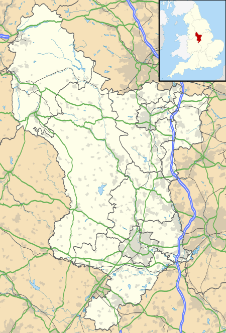
Holymoorside is a small village in North East Derbyshire, England, approximately two miles west of Chesterfield. It is located at 53.21 North, -1.49 West. The civil parish is called Holymoorside and Walton. The population of this parish taken at the 2011 Census was 2,223.[1] Close to the boundary of the Peak District National Park, Chatsworth House lies seven miles to the west of the village.
| Holymoorside | |
|---|---|
 The 2006 Well Dressing in Holymoorside | |
 Holymoorside Location within Derbyshire | |
| Population | 2,223 (2011) |
| Civil parish |
|
| District | |
| Shire county | |
| Region | |
| Country | England |
| Sovereign state | United Kingdom |
| Post town | CHESTERFIELD |
| Postcode district | S42 |
| Dialling code | 01246 |
| Police | Derbyshire |
| Fire | Derbyshire |
| Ambulance | East Midlands |
| UK Parliament | |
History
Holymoorside once hosted four public houses but only two remain: The Lamb Inn and The Bull's Head. The Lamb Inn was part of a butcher's business dating back to 1851, with the present design of the pub dating from 1953 when the shop moved to new premises on New Road. The Bull's Head has roots dating back to 1881. There was once a chip shop next to the Lamb Inn, but this burnt down on a bank holiday Monday in 1935.
The Old Star, an additional pub on Loads Road but now a private residence dating back to 1820, was notorious for the suicide, by cutting the throat, of a landlord in 1886. Its owners, Chesterfield Borough Council, sold the pub at auction in April 1921, when Mrs H. Dickens secured the sale with a bid of £1500. The Old Star closed in 1959 with a local newspaper report at the time stating that it had been licensed for 300 years.
The Woodman's Arms was an alehouse, which only sold beer and not spirits or wines. As the name suggests, the landlord's main occupation was a woodcutter and timber merchant. The earliest mention of the premises in the local trade directories was in 1862. Now a private residence, the building still stands as Sycamore House, on Loads Road near the Lamb Inn.
The village has two churches, reflecting the religious history of the "Holy Moor". Holymoorside Country Store, run by the Kendall family is the only surviving shop in the village. The oldest building in the village is Hipper Hall, an early 17th-century farmhouse with an even older tithe barn which has fallen in to a state of disrepair. However Harewood Grange and Chander Hill Farm date back as far as 1207.
The Manloves were proprietors of the cotton thread mill which was built towards the end of the 18th century. This mill employed many of the women and girls of the village, whilst the men and boys worked in the tin mine. The mill buildings, which were three storeys high and were acquired by the Manlove Brothers around 1840, were prosperous for about 50 years, employing 200 people at its peak, but closed in 1902 and now hardly a trace remains of their existence. After 1902 the site was demolished, and in 1930 a row of houses called Riverside Crescent replaced the mill.
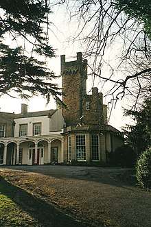
Belmont House was a large private residence just off Chatsworth Road. It was built in the 18th Century and had a large tower and flying buttresses. The tower was rumoured to be haunted and local legend has it that a cannon was fired from the top of the tower towards Gladwin's Mark a few miles south. Belmont was demolished in the early 2000s and new apartments have been built on the site.
Holymoorside Primary School moved to its present site in the Doghole hamlet area of Holymoor Road in June 2002.
Customs
The traditional Derbyshire custom of well dressing is maintained in Holymoorside. The Well Dressing is on display in late August. As well as well dressing, nativity scenes are also displayed in the shelter on Cotton Mill Hill around Christmas.
"Holymoorside and Walton Arts Festival Society" arrange events throughout the year, including the scarecrow making event in August each year which involves the whole village. The local scout group also holds community events such as the Christmas Fair and 10K run in May.
Political Representation
Since 2009, the local Derbyshire County Council representative has been Mr Stuart Ellis who is a member of the Conservative Party. Local amenities are provided by Holymoorside and Walton Parish Council, under the district council of North East Derbyshire.
The district councillors are Martin Thacker MBE JP and Peter Elliot.[2]
Lee Rowley has been the Conservative MP for North East Derbyshire since 2017.
School
There has been a school in Holymoorside since 12 February 1872, which was constructed and funded by the mill-owning "Manlove" family.[3] The school was situated on New Road before moving to its current location in the Doghole hamlet area of Holymoor Road in June 2002.[4] The old school buildings have been converted into apartments. The original school bell hangs from the wall in the current school's reception area.
The school site was previously an orchard, which had been compulsorily purchased by the council in 1931. Proposals to construct an Approved school in the 1950s were not followed through and the site continued use as an orchard full of apple trees and several greenhouses used to grow fruit and vegetables for a local market stall. Construction began in 1999.
The school features eleven classrooms, a music room, library and a large hall used for assemblies, dining and PE. There is also a 52 place nursery. The grounds of the school include a turning circle, playgrounds with climbing frames, a large field for sports, and a pond and a wood to the North of the site used for Forest School activities.[5]
The school was rated 'Good' by Ofsted in 2018.[6]
Local Folklore and Supernatural Activity
The village lies on the Eastern edge of Beeley Moor, which has many tales associated with it, including a lost traveller who can be heard moaning on the first full moon in March. In addition, there is a large beast-like animal that has been known to dart in front of cars on the moors.[7]
There are several tales of the supernatural throughout the village. An area near the River Hipper called Little Blackpool is reputedly haunted by a hooded figure and the ghost of a murder victim and her dog.[8] The figure of Mary Queen of Scots has been seen at Hipper Hall. Monks from Beauchief Abbey have been sighted walking along Chander Hill Lane and near Harewood Grange, where there was a monastery farm.[9][10]
Local legend has it that there is a tunnel from Chander Hill Farm under Holy Moor to Harewood Grange.
Hunger Hill Pumping Station is notorious locally for satanic rituals that once took place there. Today the site, nestled down in a wooded valley, has a distinctive eerie feeling to it and unusual mists have shown up on photographs taken inside the abandoned building.[11]
Walton Holymoorside Primary School is haunted by lights turning themselves on in the evenings when the school is locked up, along with loud banging noises and footsteps in an alleyway when no one is on the site.[12]
References

- "Civil Parish population 2011". Neighbourhood Statistics. Office for National Statistics. Retrieved 26 March 2016.
- "NE Derbyshire Councillors 2019-2023" (PDF).
- Entwistle, Ronald (1976). A History of Holymoorside - Past and Present. 51 Holymoor Road, Holymoorside, Derbyshire: Ronald Entwistle. p. 79.CS1 maint: location (link)
- "Walton Holymoorside Primary School | Welcoming – Helping – Progressing – Smiling". Retrieved 23 August 2019.
- 3cohosting. "Forest School Club | Walton Holymoorside Primary School". Retrieved 23 August 2019.
- "Ofsted Report 2018 | Walton Holymoorside Primary School". Retrieved 23 August 2019.
- "ghosts and legend of britain - a haunted calendar - spring and easter". www.paranormaldatabase.com. Retrieved 23 August 2019.
- "Hauntings H". STRANGE NORTH-EAST DERBYSHIRE. Retrieved 23 August 2019.
- "Hauntings C". STRANGE NORTH-EAST DERBYSHIRE. Retrieved 23 August 2019.
- "Hauntings H". STRANGE NORTH-EAST DERBYSHIRE. Retrieved 23 August 2019.
- Geocaching. "Geocaching - The Official Global GPS Cache Hunt Site". www.geocaching.com. Retrieved 23 August 2019.
- "Hauntings W". STRANGE NORTH-EAST DERBYSHIRE. Retrieved 23 August 2019.
| Wikimedia Commons has media related to Holymoorside. |