Satrokala
Satrokala is a town and commune in Madagascar. It belongs to the district of Ihosy, which is a part of Ihorombe Region. The population of the commune was estimated to be approximately 10,000 in 2001 commune census.[2]
Satrokala | |
|---|---|
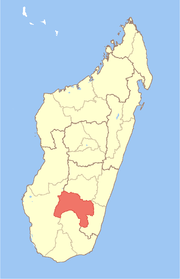
 Satrokala Location in Madagascar | |
| Coordinates: 22°3′S 45°37′E | |
| Country | |
| Region | Ihorombe |
| District | Ihosy |
| Elevation | 806 m (2,644 ft) |
| Population (2001)[2] | |
| • Total | 10,000 |
| Time zone | UTC3 (EAT) |
Only primary schooling is available. The majority 70% of the population of the commune are farmers, while an additional 30% receives their livelihood from raising livestock. The most important crops are cassava and peanuts, while other important agricultural products are beans, rice and taro.[2]
References and notes
- Estimated based on DEM data from Shuttle Radar Topography Mission
- "ILO census data". Cornell University. 2002. Retrieved 2008-04-24.
gollark: I have lots of money, so it is legal, actually.
gollark: Hypothetically.
gollark: Duping glitch.
gollark: An emoji of a nonexistent thing. 🦄 exists, see.
gollark: I will NOT name a price, as it would be DISHONEST to sell you things which DO NOT exist.
This article is issued from Wikipedia. The text is licensed under Creative Commons - Attribution - Sharealike. Additional terms may apply for the media files.