Ihosy District
Ihosy is a district in south-eastern Madagascar. It is a part of Ihorombe Region and borders the districts of Ikalamavony in north, Ambalavao in northeast, Ivohibe in east, Iakora in southeast, Betroka in south, Benenitra in southwest, Sakaraha and Ankazoabo Sud in west and Beroraha in northwest. The area is 17,358 km2 (6,702 sq mi) and the population was estimated to be 106,591 in 2001.[1] The district is further divided into 17 communes.
Ihosy District | |
|---|---|
District | |
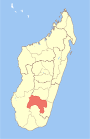
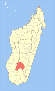 Location in Madagascar | |
| Coordinates: 22°24′S 46°07′E | |
| Country | |
| Region | Ihorombe |
| Area | |
| • Total | 17,358 km2 (6,702 sq mi) |
| Population (2001)[1] | |
| • Total | 106,591 |
| • Density | 6.1/km2 (16/sq mi) |
| • Ethnicities | Bara |
| Time zone | UTC3 (EAT) |
References and notes
- "Madagascar Administrative units". GeoHive. Retrieved 2008-04-28.
gollark: The last time I did compression I just used some random LZW library off the interwebs.
gollark: That way they don't need to be recorded.
gollark: There's a simple solution: limit the size of the world.If your turtle encounters blocks let's say more than 100 blocks from world spawn, have it destroy them.
gollark: I think, so clearly I must be, right?
gollark: Well, I am too.
This article is issued from Wikipedia. The text is licensed under Creative Commons - Attribution - Sharealike. Additional terms may apply for the media files.