San Ginesio
San Ginesio is a comune (municipality) in the Province of Macerata in the Italian region Marche, located about 60 kilometres (37 mi) southwest of Ancona and about 25 kilometres (16 mi) southwest of Macerata. As of 31 December 2004, it had a population of 3,872 and an area of 77.7 square kilometres (30.0 sq mi).[4]
San Ginesio | |
|---|---|
| Comune di San Ginesio | |
 View of San Ginesio | |
 Coat of arms | |
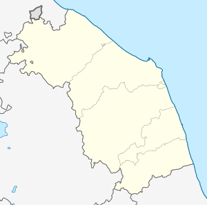
Location of San Ginesio 
| |
 San Ginesio Location of San Ginesio in Italy  San Ginesio San Ginesio (Marche) | |
| Coordinates: 43°6′N 13°19′E | |
| Country | Italy |
| Region | Marche |
| Province | Macerata (MC) |
| Government | |
| • Mayor | Giuliano Ciabocco |
| Area | |
| • Total | 78.02 km2 (30.12 sq mi) |
| Elevation | 690 m (2,260 ft) |
| Population (28 February 2017)[3] | |
| • Total | 3,438 |
| • Density | 44/km2 (110/sq mi) |
| Demonym(s) | Ginesini |
| Time zone | UTC+1 (CET) |
| • Summer (DST) | UTC+2 (CEST) |
| Postal code | 62026 |
| Dialing code | 0733 |
| Patron saint | St. Genesius of Rome |
| Saint day | August 25 |
| Website | Official website |
San Ginesio borders the following municipalities: Camporotondo di Fiastrone, Cessapalombo, Colmurano, Fiastra, Gualdo, Ripe San Ginesio, Sant'Angelo in Pontano, Sarnano, Tolentino.
Main sights
Churches in the town include
- Abbazia di Santa Maria delle Macchie
- San Francesco
- San Tommaso e Barnaba
- Santuario di San Liberato
- Santa Maria in Vepretis
- Sant'Agostino
gollark: I hope that, should I bother to actually get this anywhere near finished, my reactor autooptimizer, will come up with such ridiculous designs.
gollark: Well, as someone without ways to obtain redstone other than witches and automining, not really, but cool nevertheless.
gollark: Madness.
gollark: Also, is this accurate? https://ftb.gamepedia.com/Fission_Reactor#Reactor_Cell
gollark: Er, what I mean is, does the heat calculation bit do that?
References
- "Superficie di Comuni Province e Regioni italiane al 9 ottobre 2011". Istat. Retrieved 16 March 2019.
- "San Ginesio". Tuttitalia (in Italian).
- "Popolazione Residente al 1° Gennaio 2018". Istat. Retrieved 16 March 2019.
- All demographics and other statistics: Italian statistical institute Istat.
This article is issued from Wikipedia. The text is licensed under Creative Commons - Attribution - Sharealike. Additional terms may apply for the media files.