Samarda
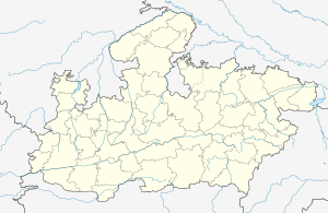
Samarda, also spelled Samardha, is a village in the Bhopal district of Madhya Pradesh, India. It is located in the Huzur tehsil and the Phanda block.[1]
Samarda Samardha | |
|---|---|
village | |
 Samarda  Samarda | |
| Coordinates: 23.3322478°N 77.5827175°E | |
| Country | India |
| State | Madhya Pradesh |
| District | Bhopal |
| Tehsil | Huzur |
| Elevation | 463 m (1,519 ft) |
| Population (2011) | |
| • Total | 372 |
| Time zone | UTC+5:30 (IST) |
| ISO 3166 code | IN-MP |
| 2011 census code | 482430 |
The village is the site of an ecotourism operations supported by Government of Madhya Pradesh. It is popular with Bhopal-based corporate staff for team-building exercises.[2]
Demographics
According to the 2011 census of India, Samarda has 86 households. The effective literacy rate (i.e. the literacy rate of population excluding children aged 6 and below) is 78.81%.[3]
| Total | Male | Female | |
|---|---|---|---|
| Population | 372 | 211 | 161 |
| Children aged below 6 years | 70 | 39 | 31 |
| Scheduled caste | 0 | 0 | 0 |
| Scheduled tribe | 36 | 20 | 16 |
| Literates | 238 | 155 | 83 |
| Workers (all) | 152 | 121 | 31 |
| Main workers (total) | 106 | 99 | 7 |
| Main workers: Cultivators | 21 | 21 | 0 |
| Main workers: Agricultural labourers | 44 | 43 | 1 |
| Main workers: Household industry workers | 0 | 0 | 0 |
| Main workers: Other | 41 | 35 | 6 |
| Marginal workers (total) | 46 | 22 | 24 |
| Marginal workers: Cultivators | 3 | 2 | 1 |
| Marginal workers: Agricultural labourers | 38 | 16 | 22 |
| Marginal workers: Household industry workers | 0 | 0 | 0 |
| Marginal workers: Others | 5 | 4 | 1 |
| Non-workers | 220 | 90 | 130 |
gollark: It works quite well for its intended task!
gollark: Once I made a Rust program!
gollark: I use other things too!
gollark: PARADOX!
gollark: So now we agree on you disagreeing with me.
References
- "RFP Document for Establishing Operating and Maintaining Lok Seva Kendra" (PDF). E-Governance Society Bhopal District. Archived from the original (PDF) on 4 March 2016. Retrieved 25 July 2015.
- Samardha, Madhya Pradesh Ecotourism Development Board.
- "District Census Handbook - Bhopal" (PDF). 2011 Census of India. Directorate of Census Operations, Madhya Pradesh. Retrieved 20 July 2015.
This article is issued from Wikipedia. The text is licensed under Creative Commons - Attribution - Sharealike. Additional terms may apply for the media files.