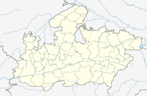
Saista Khedi
Saista Khedi is a village in the Bhopal district of Madhya Pradesh, India. It is located in the Huzur tehsil and the Phanda block.[1]
Saista Khedi | |
|---|---|
village | |
 Saista Khedi  Saista Khedi | |
| Coordinates: 23.1938753°N 77.2203966°E | |
| Country | India |
| State | Madhya Pradesh |
| District | Bhopal |
| Tehsil | Huzur |
| Elevation | 517 m (1,696 ft) |
| Population (2011) | |
| • Total | 713 |
| Time zone | UTC+5:30 (IST) |
| ISO 3166 code | MP-IN |
| 2011 census code | 482491 |
The Baba Dayadas temple, constructed with funding in crores from the villagers, is located in Saista Khedi. A special prayer, which is conducted in the temple every Monday evening, attracts people from the entire village as well as neighbouring areas.
Demographics
According to the 2011 census of India, Saista Khedi has 152 households. The effective literacy rate (i.e. the literacy rate of population excluding children aged 6 and below) is 89.05%.[2]
| Total | Male | Female | |
|---|---|---|---|
| Population | 713 | 382 | 331 |
| Children aged below 6 years | 74 | 39 | 35 |
| Scheduled caste | 200 | 105 | 95 |
| Scheduled tribe | 0 | 0 | 0 |
| Literates | 569 | 318 | 251 |
| Workers (all) | 270 | 208 | 62 |
| Main workers (total) | 230 | 198 | 32 |
| Main workers: Cultivators | 156 | 134 | 22 |
| Main workers: Agricultural labourers | 22 | 18 | 4 |
| Main workers: Household industry workers | 4 | 4 | 0 |
| Main workers: Other | 48 | 42 | 6 |
| Marginal workers (total) | 40 | 10 | 30 |
| Marginal workers: Cultivators | 24 | 3 | 21 |
| Marginal workers: Agricultural labourers | 15 | 6 | 9 |
| Marginal workers: Household industry workers | 0 | 0 | 0 |
| Marginal workers: Others | 1 | 1 | 0 |
| Non-workers | 443 | 174 | 269 |
gollark: Do you WANT that?
gollark: I wonder if Emu War Online's ever going to happen.
gollark: That's ibis-kestrel-rat.
gollark: I have to admit that the lack of emus is troubling.
gollark: If you want hyperbolic geometry, you could try HyperRogue in the meantime.
References
- "RFP Document for Establishing Operating and Maintaining Lok Seva Kendra" (PDF). E-Governance Society Bhopal District. Archived from the original (PDF) on 4 March 2016. Retrieved 25 July 2015.
- "District Census Handbook - Bhopal" (PDF). 2011 Census of India. Directorate of Census Operations, Madhya Pradesh. Retrieved 20 July 2015.
This article is issued from Wikipedia. The text is licensed under Creative Commons - Attribution - Sharealike. Additional terms may apply for the media files.