Amrabad Kalan
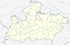
Amrabad Kalan is a village in the Bhopal district of Madhya Pradesh, India. It is located in the Huzur tehsil and the Phanda block.[1]
Amrabad Kalan | |
|---|---|
village | |
 Amrabad Kalan  Amrabad Kalan | |
| Coordinates: 23.1121386°N 77.438643°E | |
| Country | India |
| State | Madhya Pradesh |
| District | Bhopal |
| Tehsil | Huzur |
| Population (2011) | |
| • Total | 734 |
| Time zone | UTC+5:30 (IST) |
| ISO 3166 code | MP-IN |
| Census code | 482535 |
Demographics
According to the 2011 census of India, Amrabad Kalan has 153 households. The effective literacy rate (i.e. the literacy rate of population excluding children aged 6 and below) is 75.45%.[2]
| Total | Male | Female | |
|---|---|---|---|
| Population | 734 | 350 | 384 |
| Children aged below 6 years | 119 | 55 | 64 |
| Scheduled caste | 73 | 32 | 41 |
| Scheduled tribe | 24 | 11 | 13 |
| Literates | 464 | 264 | 200 |
| Workers (all) | 239 | 165 | 74 |
| Main workers (total) | 165 | 154 | 11 |
| Main workers: Cultivators | 53 | 53 | 0 |
| Main workers: Agricultural labourers | 9 | 5 | 4 |
| Main workers: Household industry workers | 0 | 0 | 0 |
| Main workers: Other | 103 | 96 | 7 |
| Marginal workers (total) | 74 | 11 | 63 |
| Marginal workers: Cultivators | 3 | 2 | 1 |
| Marginal workers: Agricultural labourers | 3 | 3 | 0 |
| Marginal workers: Household industry workers | 0 | 0 | 0 |
| Marginal workers: Others | 68 | 6 | 62 |
| Non-workers | 495 | 185 | 310 |
gollark: And longer strings appear less frequently.
gollark: It's processing a limited amount of bytes/second of randomness.
gollark: Of course it does.
gollark: `cat /dev/urandom | base64 | grep cats`
gollark: ```5JBrVCj1kkeWCTi3mhgBVFGonbDcatsd2gpR6lszyI5HOk1r6OfnbeYU6KGlUDS88pDWp85Jz65TLFy5ypxAymX1QhTnmru/YHaXcatsBxHU6fFpAQJH58pBiwwvLZ1nzLWY10CNJRd3gMmpso6v3a6FoWAI74GvZgbz/55KjLcatsdgqh9gh5MHn3/ydYtvzECtm4H0mctA5E9Nmfcf2PHEFDC9sSv+h/PEtTN1Sbjv3F3ynIsTcUC3CjDH+XmJEUNEShpjcXp7t90WpKFAp+HEZym0phQeOBcats5UgBcUQ7Qarx1mmWcatsP1xvSt9qdjCzlzpiVtSdo4kwDN/6Vs6Aq7frbvDxgvQ4mjEJ0bZ192U4Ug419pgUgNrLhWiCtle7uxGxCkYCTbtwUu14wYUO0Hj30v5Nc6mUd9ZYUVgoV1bqshlUjldgYMNNwc7dqcats6HBrEV83MUUX4urRqoQzMYgfMG9GYSJuZjFgJHeTSzwuaqccatsIy7YunQBsKhwVAZceSAarwApBNBpfqB4ojAXxVuirJ3lF7EnbAtVMm16hTRxBcats6csQs+XC8MAWJ+LRE2CLTmi5GEE8d6OzehZXNYnqKw0WUS9FJT3d8FrTs5tLNWkhA7DTCwqaKl1NUNBX/Je7mGh1MZBcxrDdDcats0aEXLTKXPrUV```
References
- "RFP Document for Establishing Operating and Maintaining Lok Seva Kendra" (PDF). E-Governance Society Bhopal District. Archived from the original (PDF) on 4 March 2016. Retrieved 25 July 2015.
- "District Census Handbook - Bhopal" (PDF). 2011 Census of India. Directorate of Census Operations, Madhya Pradesh. Retrieved 20 July 2015.
This article is issued from Wikipedia. The text is licensed under Creative Commons - Attribution - Sharealike. Additional terms may apply for the media files.