Karhod Khurd
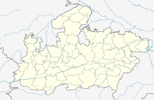
Karhod Khurd is a village in the Bhopal district of Madhya Pradesh, India. It is located in the Huzur tehsil and the Phanda block.[1]
Karhod Khurd | |
|---|---|
village | |
 Karhod Khurd  Karhod Khurd | |
| Coordinates: 23.4291968°N 77.4874049°E | |
| Country | India |
| State | Madhya Pradesh |
| District | Bhopal |
| Tehsil | Huzur |
| Elevation | 459 m (1,506 ft) |
| Population (2011) | |
| • Total | 980 |
| Time zone | UTC+5:30 (IST) |
| ISO 3166 code | MP-IN |
| 2011 census code | 482402 |
Demographics
According to the 2011 census of India, Karhod Khurd has 223 households. The effective literacy rate (i.e. the literacy rate of population excluding children aged 6 and below) is 67.31%.[2]
| Total | Male | Female | |
|---|---|---|---|
| Population | 980 | 515 | 465 |
| Children aged below 6 years | 154 | 76 | 78 |
| Scheduled caste | 52 | 29 | 23 |
| Scheduled tribe | 317 | 166 | 151 |
| Literates | 556 | 320 | 236 |
| Workers (all) | 379 | 239 | 140 |
| Main workers (total) | 290 | 222 | 68 |
| Main workers: Cultivators | 66 | 52 | 14 |
| Main workers: Agricultural labourers | 203 | 155 | 48 |
| Main workers: Household industry workers | 2 | 1 | 1 |
| Main workers: Other | 19 | 14 | 5 |
| Marginal workers (total) | 89 | 17 | 72 |
| Marginal workers: Cultivators | 1 | 1 | 0 |
| Marginal workers: Agricultural labourers | 82 | 14 | 68 |
| Marginal workers: Household industry workers | 2 | 0 | 2 |
| Marginal workers: Others | 4 | 2 | 2 |
| Non-workers | 601 | 276 | 325 |
gollark: With two players there are two "valid" cursor positions, which you have to distinguish between and process properly.
gollark: Not really.
gollark: It'll get mouse_move events from both, meaning that depending on how it's done you would end up with it working "correctly" but with multiple things selected, randomly flicker between them, or it might implode or something.
gollark: Well, there's a 200ms throttle or something, and processing more events is bad for the server.
gollark: I shall have to somehow block mouse_move events inside potatOS.
References
- "RFP Document for Establishing Operating and Maintaining Lok Seva Kendra" (PDF). E-Governance Society Bhopal District. Archived from the original (PDF) on 4 March 2016. Retrieved 25 July 2015.
- "District Census Handbook - Bhopal" (PDF). 2011 Census of India. Directorate of Census Operations, Madhya Pradesh. Retrieved 20 July 2015.
This article is issued from Wikipedia. The text is licensed under Creative Commons - Attribution - Sharealike. Additional terms may apply for the media files.