Saint Patrick Parish, New Brunswick
Saint Patrick is a civil parish in Charlotte County, New Brunswick, Canada,[2] located west of St. George and Saint Andrews.
Saint Patrick St. Patrick | |
|---|---|
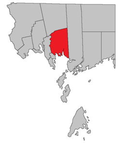 Location within Charlotte County. | |
| Country | |
| Province | |
| County | Charlotte County |
| Established | 1756 |
| Area | |
| • Land | 236.89 km2 (91.46 sq mi) |
| Population (2016)[1] | |
| • Total | 689 |
| • Density | 2.9/km2 (8/sq mi) |
| • Pop 2011-2016 | |
| • Dwellings | 545 |
| Time zone | UTC-4 (AST) |
| • Summer (DST) | UTC-3 (ADT) |
The local service district (LSD) and Census subdivision of the same name have the same boundaries as the parish.[3]
History
Saint Patrick Parish was established in 1786, when it included Dumbarton Parish until 1856.
Delineation
Saint Patrick Parish is defined in the Territorial Division Act[2] as being bounded:
- West and northwest by Saint Andrews Parish and Saint Croix Parish; east by the west line of the grant to Philip Bailey and others, and its northerly prolongation; north by a line commencing at the most southern angle of lot number five, granted to John Gilman, on the southwestern side of Digdeguash River; thence northeasterly along the southeasterly line of said lot to the Digdeguash River; thence down stream along the same to the lower line of the lot granted to John Campbell; thence along the same easterly to the rear thereof; thence northerly along the rear of the said last mentioned lot to meet the westerly prolongation of the line dividing the lots ten and eleven in the Clarence Hill grant plan, and thence easterly along the said line dividing the lots number ten and number eleven to the eastern boundary of the parish; and south by Passamaquoddy bay, including all the islands west of the east line of the said parish within two miles of the shore.
Communities
Parish population total does not include incorporated municipalities (in bold).
|
|
|
Bodies of water and Islands
This is a list of rivers, lakes, streams, creeks, marshes and Islands that are at least partially in this parish
|
|
|
Demographics
Population
| Canada census – Saint Patrick Parish, New Brunswick community profile | |||
|---|---|---|---|
| 2016 | 2011 | 2006 | |
| Population: | 689 (+6.5% from 2011) | 647 (-10.3% from 2006) | 721 (+6.5% from 2001) |
| Land area: | 236.89 km2 (91.46 sq mi) | 236.88 km2 (91.46 sq mi) | 236.76 km2 (91.41 sq mi) |
| Population density: | 2.9/km2 (7.5/sq mi) | 2.7/km2 (7.0/sq mi) | 3.0/km2 (7.8/sq mi) |
| Median age: | 53.9 (M: 53.2, F: 54.1) | 48.5 (M: 50.1, F: 47.8) | 44.3 (M: 45.9, F: 43.1) |
| Total private dwellings: | 545 | 349 | 526 |
| Median household income: | $.N/A | $.N/A | $43,854 |
| Notes: 2011 income data for this area has been suppressed for data quality or confidentiality reasons. – References: 2016[4] 2011[5] 2006[6] earlier[7] | |||
|
|
| |||||||||||||||||||||||||||
| [8][1] | |||||||||||||||||||||||||||||
Language
| Canada Census Mother Tongue - Saint Patrick Parish, New Brunswick[8] | ||||||||||||||||||
|---|---|---|---|---|---|---|---|---|---|---|---|---|---|---|---|---|---|---|
| Census | Total | English |
French |
English & French |
Other | |||||||||||||
| Year | Responses | Count | Trend | Pop % | Count | Trend | Pop % | Count | Trend | Pop % | Count | Trend | Pop % | |||||
2011 |
645 |
625 | 96.90% | 15 | 2.33% | 0 | 0.00% | 5 | 0.77% | |||||||||
2006 |
715 |
700 | 97.90% | 15 | 2.10% | 0 | 0.00% | 0 | 0.00% | |||||||||
2001 |
670 |
645 | 96.27% | 0 | 0.00% | 10 | 1.49% | 15 | 2.24% | |||||||||
1996 |
640 |
610 | n/a | 95.31% | 0 | n/a | 0.00% | 0 | n/a | 0.00% | 30 | n/a | 4.69% | |||||
Access Routes
Highways and numbered routes that run through the parish, including external routes that start or finish at the parish limits:[9]
|
|
|
|
gollark: *But*, generating an interesting one takes many, many runs, and *checking for* an interesting one takes one run.
gollark: Yes.
gollark: You would seed it with initial data determinstically.
gollark: Because *you* can run it once to verify faster than *they* can run it enough to generate an "interesting" pattern.
gollark: ?
See also
Notes
References
- "Census Profile, 2016 Census: Saint Patrick, Parish [Census subdivision], New Brunswick". Statistics Canada. Retrieved 7 September 2019.
- "Chapter T-3 Territorial Division Act". Government of New Brunswick. Retrieved 14 August 2020.
- "New Brunswick Regulation 84-168 under the Municipalities Act (O.C. 84-582)". Government of New Brunswick. Retrieved 14 August 2020.
- "2016 Community Profiles". 2016 Canadian Census. Statistics Canada. 21 February 2017. Retrieved 7 September 2019.
- "2011 Community Profiles". 2011 Canadian Census. Statistics Canada. 5 July 2013. Retrieved 17 March 2014.
- "2006 Community Profiles". 2006 Canadian Census. Statistics Canada. 30 March 2011. Retrieved 17 March 2014.
- "2001 Community Profiles". 2001 Canadian Census. Statistics Canada. 17 February 2012.
- Statistics Canada: 1996, 2001, 2006, 2011 census
- Atlantic Canada Back Road Atlas ISBN 978-1-55368-618-7 Pages 4, 12
Places adjacent to Saint Patrick Parish, New Brunswick | ||||||||||
|---|---|---|---|---|---|---|---|---|---|---|
| ||||||||||
| Subdivisions |
|
|---|---|
| Cities | |
| Counties | |
| |
This article is issued from Wikipedia. The text is licensed under Creative Commons - Attribution - Sharealike. Additional terms may apply for the media files.