Saint-Sixte, Quebec
Saint-Sixte is a small town in the region of Outaouais, Quebec, Canada. It has a population of under 500. It is internationally known for its old-fashioned sugar shacks.
Saint-Sixte | |
|---|---|
Municipality | |
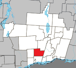
 Location within Papineau RCM | |
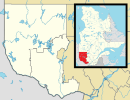
 Saint-Sixte Location in western Quebec | |
| Coordinates: 45°42′N 75°13′W[1] | |
| Country | Canada |
| Province | Quebec |
| Region | Outaouais |
| RCM | Papineau |
| Constituted | February 7, 1893 |
| Government | |
| • Mayor | André Bélisle |
| • Federal riding | Argenteuil—Papineau—Mirabel |
| • Prov. riding | Papineau |
| Area | |
| • Total | 87.60 km2 (33.82 sq mi) |
| • Land | 85.33 km2 (32.95 sq mi) |
| Population (2016)[3] | |
| • Total | 469 |
| • Density | 5.5/km2 (14/sq mi) |
| • Pop 2011-2016 | |
| • Dwellings | 227 |
| Time zone | UTC−5 (EST) |
| • Summer (DST) | UTC−4 (EDT) |
| Postal code(s) | J0X 3B0 |
| Area code(s) | 819 |
| Highways | |
| Website | www |
Demographics
| Canada census – Saint-Sixte, Quebec community profile | |||
|---|---|---|---|
| 2016 | 2011 | ||
| Population: | 469 (2.0% from 2011) | 460 (-1.3% from 2006) | |
| Land area: | 85.33 km2 (32.95 sq mi) | 81.28 km2 (31.38 sq mi) | |
| Population density: | 5.5/km2 (14/sq mi) | 5.7/km2 (15/sq mi) | |
| Median age: | 47.5 (M: 47.7, F: 47.2) | 43.2 (M: 44.3, F: 42.3) | |
| Total private dwellings: | 227 | 204 | |
| Median household income: | $60,544 | $47,983 | |
| References: 2016[4] 2011[5] earlier[6] | |||
| Year | Pop. | ±% |
|---|---|---|
| 1986 | 388 | — |
| 1991 | 456 | +17.5% |
| 1996 | 456 | +0.0% |
| 2001 | 439 | −3.7% |
| 2006 | 466 | +6.2% |
| 2011 | 460 | −1.3% |
| 2016 | 469 | +2.0% |
| Source: Statistics Canada | ||
gollark: Not exactly.
gollark: I don't particularly, but I *can* read Wikipedia pages!
gollark: Do you know what "gravitomagnetism" is?
gollark: Ah, so it's just keyword-based!
gollark: This is just entirely stuff on the "Lense–Thirring effect"? What does that have to do with anything?
References
- Reference number 92443 of the Commission de toponymie du Québec (in French)
- Geographic code 80070 in the official Répertoire des municipalités (in French)
- "(Code 2480070) Census Profile". 2016 census. Statistics Canada. 2017.
- "2016 Community Profiles". 2016 Canadian Census. Statistics Canada. February 21, 2017. Retrieved 2020-01-30.
- "2011 Community Profiles". 2011 Canadian Census. Statistics Canada. July 5, 2013. Retrieved 2020-01-30.
- "2001 Community Profiles". 2001 Canadian Census. Statistics Canada. February 17, 2012.
This article is issued from Wikipedia. The text is licensed under Creative Commons - Attribution - Sharealike. Additional terms may apply for the media files.