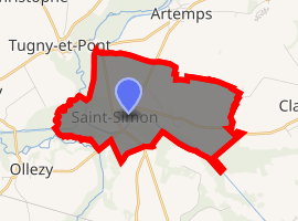
Saint-Simon, Aisne
Saint-Simon is a commune in the Aisne department in Hauts-de-France in northern France.
Saint-Simon | |
|---|---|
The town hall of Saint-Simon | |
 Coat of arms | |
Location of Saint-Simon 
| |
 Saint-Simon  Saint-Simon | |
| Coordinates: 49°44′44″N 3°10′34″E | |
| Country | France |
| Region | Hauts-de-France |
| Department | Aisne |
| Arrondissement | Saint-Quentin |
| Canton | Ribemont |
| Government | |
| • Mayor (2008–2014) | Jean Lefevre |
| Area 1 | 6.34 km2 (2.45 sq mi) |
| Population (2017-01-01)[1] | 635 |
| • Density | 100/km2 (260/sq mi) |
| Time zone | UTC+01:00 (CET) |
| • Summer (DST) | UTC+02:00 (CEST) |
| INSEE/Postal code | 02694 /02640 |
| Elevation | 62–89 m (203–292 ft) (avg. 68 m or 223 ft) |
| 1 French Land Register data, which excludes lakes, ponds, glaciers > 1 km2 (0.386 sq mi or 247 acres) and river estuaries. | |
History
This place was the property of the House of Rouvroy, who became the Duke of Saint-Simon.
Population
| Year | Pop. | ±% |
|---|---|---|
| 1760 | 43 | — |
| 1793 | 262 | +509.3% |
| 1800 | 315 | +20.2% |
| 1806 | 321 | +1.9% |
| 1821 | 404 | +25.9% |
| 1831 | 540 | +33.7% |
| 1836 | 586 | +8.5% |
| 1841 | 597 | +1.9% |
| 1846 | 578 | −3.2% |
| 1851 | 619 | +7.1% |
| 1856 | 596 | −3.7% |
| 1861 | 600 | +0.7% |
| 1866 | 600 | +0.0% |
| 1872 | 654 | +9.0% |
| 1876 | 718 | +9.8% |
| 1881 | 695 | −3.2% |
| 1886 | 695 | +0.0% |
| 1891 | 615 | −11.5% |
| 1896 | 606 | −1.5% |
| 1901 | 556 | −8.3% |
| 1906 | 583 | +4.9% |
| 1911 | 572 | −1.9% |
| 1921 | 377 | −34.1% |
| 1926 | 438 | +16.2% |
| 1931 | 527 | +20.3% |
| 1936 | 512 | −2.8% |
| 1946 | 495 | −3.3% |
| 1954 | 559 | +12.9% |
| 1962 | 606 | +8.4% |
| 1968 | 564 | −6.9% |
| 1975 | 530 | −6.0% |
| 1982 | 600 | +13.2% |
| 1990 | 687 | +14.5% |
| 1999 | 651 | −5.2% |
| 2008 | 632 | −2.9% |
| 2012 | 605 | −4.3% |
| 2013 | 607 | +0.3% |
| 2014 | 617 | +1.6% |
| 2015 | 621 | +0.6% |
gollark: To what?
gollark: =pup plot x=y²
gollark: It literally just means "conscious".
gollark: How do you even know what's <@!241757436720054273> and what isn't?
gollark: Oopsie.
See also
References
- "Populations légales 2017". INSEE. Retrieved 6 January 2020.
| Wikimedia Commons has media related to Saint-Simon, Aisne. |
This article is issued from Wikipedia. The text is licensed under Creative Commons - Attribution - Sharealike. Additional terms may apply for the media files.