Cuirieux
Cuirieux is a commune in the Aisne department in Hauts-de-France in northern France.
Cuirieux | |
|---|---|
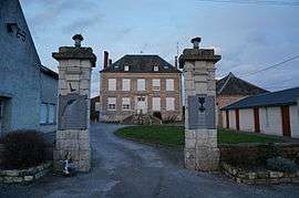 The town hall and war memorials of Cuirieux | |
Location of Cuirieux 
| |
 Cuirieux  Cuirieux | |
| Coordinates: 49°40′54″N 3°48′56″E | |
| Country | France |
| Region | Hauts-de-France |
| Department | Aisne |
| Arrondissement | Laon |
| Canton | Marle |
| Intercommunality | Pays de la Serre |
| Government | |
| • Mayor (2008–2014) | Patrick Felzinger |
| Area 1 | 6.46 km2 (2.49 sq mi) |
| Population (2017-01-01)[1] | 157 |
| • Density | 24/km2 (63/sq mi) |
| Time zone | UTC+01:00 (CET) |
| • Summer (DST) | UTC+02:00 (CEST) |
| INSEE/Postal code | 02248 /02350 |
| Elevation | 74–121 m (243–397 ft) (avg. 83 m or 272 ft) |
| 1 French Land Register data, which excludes lakes, ponds, glaciers > 1 km2 (0.386 sq mi or 247 acres) and river estuaries. | |
Population
| Year | Pop. | ±% |
|---|---|---|
| 1962 | 169 | — |
| 1968 | 147 | −13.0% |
| 1975 | 119 | −19.0% |
| 1982 | 131 | +10.1% |
| 1990 | 142 | +8.4% |
| 1999 | 143 | +0.7% |
| 2008 | 164 | +14.7% |
gollark: Yes, but it has to be as cool as countries.
gollark: All COOL countries have their own navigation satellites, so the EU has to be cool and have them too.
gollark: https://www.usegalileo.eu/EN/
gollark: Apparently some EU department decided that it was going to spend money on advertising the EU satellite navigation system to consumers. I don't know why they thought random people would care. It's kind of funny.
gollark: https://en.wikipedia.org/wiki/Crab_(unit) ← Rust (photometric)
See also
References
| Wikimedia Commons has media related to Cuirieux. |
- "Populations légales 2017". INSEE. Retrieved 6 January 2020.
This article is issued from Wikipedia. The text is licensed under Creative Commons - Attribution - Sharealike. Additional terms may apply for the media files.