Saint-Cyr, Saône-et-Loire
Saint-Cyr is a commune in the Saône-et-Loire department in the region of Bourgogne-Franche-Comté in eastern France.
Saint-Cyr | |
|---|---|
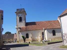 The church in Saint-Cyr | |
Location of Saint-Cyr 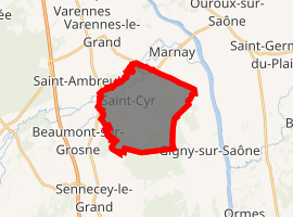
| |
 Saint-Cyr  Saint-Cyr | |
| Coordinates: 46°40′54″N 4°53′26″E | |
| Country | France |
| Region | Bourgogne-Franche-Comté |
| Department | Saône-et-Loire |
| Arrondissement | Chalon-sur-Saône |
| Canton | Tournus |
| Intercommunality | entre Saône et Grosne |
| Government | |
| • Mayor (2001–2008) | Roger Girardin |
| Area 1 | 13.12 km2 (5.07 sq mi) |
| Population (2017-01-01)[1] | 729 |
| • Density | 56/km2 (140/sq mi) |
| Time zone | UTC+01:00 (CET) |
| • Summer (DST) | UTC+02:00 (CEST) |
| INSEE/Postal code | 71402 /71240 |
| Elevation | 173–193 m (568–633 ft) (avg. 138 m or 453 ft) |
| 1 French Land Register data, which excludes lakes, ponds, glaciers > 1 km2 (0.386 sq mi or 247 acres) and river estuaries. | |
Geography
The Grosne forms most of the commune's northwestern border.
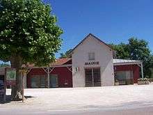
Town hall
gollark: I mean, assuming only genetic factors are at work, probably? But there are other ones.
gollark: Unless you're one of those horseshoe centrists.
gollark: Well, that means their ideological distance from you is lower.
gollark: You could buy tank insurance?
gollark: Well, driving tanks in the streets is entirely compatible with libertarianism.
References
- "Populations légales 2017". INSEE. Retrieved 6 January 2020.
| Wikimedia Commons has media related to Saint-Cyr (Saône-et-Loire). |
| Authority control |
|
|---|
This article is issued from Wikipedia. The text is licensed under Creative Commons - Attribution - Sharealike. Additional terms may apply for the media files.