Lalheue
Lalheue is a commune in the Saône-et-Loire department in the region of Bourgogne in eastern France.
Lalheue | |
|---|---|
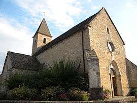 The church in Lalheue | |
Location of Lalheue 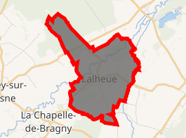
| |
 Lalheue  Lalheue | |
| Coordinates: 46°38′57″N 4°47′43″E | |
| Country | France |
| Region | Bourgogne-Franche-Comté |
| Department | Saône-et-Loire |
| Arrondissement | Chalon-sur-Saône |
| Canton | Tournus |
| Intercommunality | Entre Saône et Grosne |
| Government | |
| • Mayor | Roger Cassard |
| Area 1 | 6.87 km2 (2.65 sq mi) |
| Population (2017-01-01)[1] | 395 |
| • Density | 57/km2 (150/sq mi) |
| Time zone | UTC+01:00 (CET) |
| • Summer (DST) | UTC+02:00 (CEST) |
| INSEE/Postal code | 71252 /71240 |
| Elevation | 181–209 m (594–686 ft) (avg. 185 m or 607 ft) |
| 1 French Land Register data, which excludes lakes, ponds, glaciers > 1 km2 (0.386 sq mi or 247 acres) and river estuaries. | |
Geography
The Grison, a tributary of the Grosne, forms most of the commune's eastern border. The Grosne flows northeast through the northwestern part of the commune.
gollark: Broccoli, more like 1819824 apioform.
gollark: zstd supports custom dictionaries, as I said, and apparently can have really good compression ratios if you tune it right.
gollark: > Brotli is a data format specification[2] for data streams compressed with a specific combination of the general-purpose LZ77 lossless compression algorithm, Huffman coding and 2nd order context modelling. Brotli is a compression algorithm developed by Google and works best for text compression. ħmm, apparently maybe ish?
gollark: Or brotli with a custom dictionary, actually.
gollark: You could use zstd with a custom dictionary?
References
- "Populations légales 2017". INSEE. Retrieved 6 January 2020.
| Wikimedia Commons has media related to Lalheue. |
| Authority control |
|
|---|
This article is issued from Wikipedia. The text is licensed under Creative Commons - Attribution - Sharealike. Additional terms may apply for the media files.