Jalogny
Jalogny is a commune in the Saône-et-Loire department in the region of Bourgogne-Franche-Comté in eastern France.
Jalogny | |
|---|---|
 A general view of Jalogny | |
Location of Jalogny 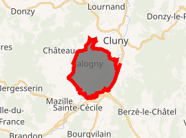
| |
 Jalogny  Jalogny | |
| Coordinates: 46°25′11″N 4°37′53″E | |
| Country | France |
| Region | Bourgogne-Franche-Comté |
| Department | Saône-et-Loire |
| Arrondissement | Mâcon |
| Canton | Cluny |
| Area 1 | 10.15 km2 (3.92 sq mi) |
| Population (2017-01-01)[1] | 359 |
| • Density | 35/km2 (92/sq mi) |
| Time zone | UTC+01:00 (CET) |
| • Summer (DST) | UTC+02:00 (CEST) |
| INSEE/Postal code | 71240 /71250 |
| Elevation | 242–480 m (794–1,575 ft) (avg. 200 m or 660 ft) |
| 1 French Land Register data, which excludes lakes, ponds, glaciers > 1 km2 (0.386 sq mi or 247 acres) and river estuaries. | |
Geography
The Grosne forms most of the commune's southeastern border.
gollark: And yet its channels are actually SUBOPTIMAL in SOME SCENARIOS?!
gollark: If I've learned anything from this, it's to avoid triangle grids since hexagons have much more elegant indexing.
gollark: I did the first thing and one of the written questions there (but not the one which wasn't doable by computer since I have no idea how that can actually be answered), and spent ages working out how to implement the second but ran out of time.
gollark: [REDACTED]
gollark: I didn't really practice and have almost zero experience/knowledge of competitive programming so something.
References
- "Populations légales 2017". INSEE. Retrieved 6 January 2020.
| Wikimedia Commons has media related to Jalogny. |
| Authority control |
|
|---|
This article is issued from Wikipedia. The text is licensed under Creative Commons - Attribution - Sharealike. Additional terms may apply for the media files.