Saint-Étienne-du-Valdonnez
Saint-Étienne-du-Valdonnez (Occitan: Sent Estève) is a commune in the Lozère department in southern France.
Saint-Étienne-du-Valdonnez | |
|---|---|
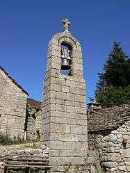 The warning bell of the hamlet of La Fage, in Saint-Etienne-du-Valdonnez | |
Location of Saint-Étienne-du-Valdonnez 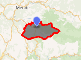
| |
 Saint-Étienne-du-Valdonnez  Saint-Étienne-du-Valdonnez | |
| Coordinates: 44°27′23″N 3°33′48″E | |
| Country | France |
| Region | Occitanie |
| Department | Lozère |
| Arrondissement | Mende |
| Canton | Saint-Étienne-du-Valdonnez |
| Intercommunality | Valdonnez |
| Government | |
| • Mayor (2008–2014) | Claude Feybesse |
| Area 1 | 56.09 km2 (21.66 sq mi) |
| Population (2017-01-01)[1] | 647 |
| • Density | 12/km2 (30/sq mi) |
| Time zone | UTC+01:00 (CET) |
| • Summer (DST) | UTC+02:00 (CEST) |
| INSEE/Postal code | 48147 /48000 |
| Elevation | 754–1,557 m (2,474–5,108 ft) (avg. 808 m or 2,651 ft) |
| 1 French Land Register data, which excludes lakes, ponds, glaciers > 1 km2 (0.386 sq mi or 247 acres) and river estuaries. | |
Demographics
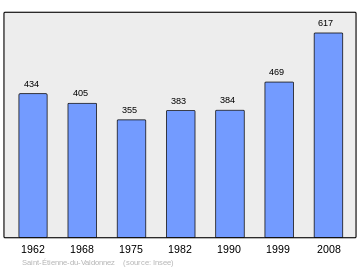
Population Census 1962-2008
This graph shows the population of Saint-Étienne-du-Valdonnez from 1962–2008, showing that the population increased by 183 people over the 46 years.[2]
See also
References
- "Populations légales 2017". INSEE. Retrieved 6 January 2020.
- "48147-Saint-Étienne-du-Valdonnez". Institut national de la statistique et des études économiques. Retrieved 25 July 2015.
| Wikimedia Commons has media related to Saint-Étienne-du-Valdonnez. |
| Authority control |
|
|---|
This article is issued from Wikipedia. The text is licensed under Creative Commons - Attribution - Sharealike. Additional terms may apply for the media files.