Pierrefiche, Lozère
Pierrefiche is a village and commune in the Lozère département in southern France.
Pierrefiche | |
|---|---|
Location of Pierrefiche 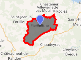
| |
 Pierrefiche  Pierrefiche | |
| Coordinates: 44°41′29″N 3°44′03″E | |
| Country | France |
| Region | Occitanie |
| Department | Lozère |
| Arrondissement | Mende |
| Canton | Grandrieu |
| Intercommunality | Châteauneuf-de-Randon |
| Government | |
| • Mayor (2008–2014) | Michel Pironon[1] |
| Area 1 | 16.82 km2 (6.49 sq mi) |
| Population (2017-01-01)[2] | 163 |
| • Density | 9.7/km2 (25/sq mi) |
| Time zone | UTC+01:00 (CET) |
| • Summer (DST) | UTC+02:00 (CEST) |
| INSEE/Postal code | 48112 /48300 |
| Elevation | 1,074–1,285 m (3,524–4,216 ft) (avg. 1,060 m or 3,480 ft) |
| 1 French Land Register data, which excludes lakes, ponds, glaciers > 1 km2 (0.386 sq mi or 247 acres) and river estuaries. | |
Geography
The Chapeauroux forms most of the commune's western border, then flows northeastward through the commune.
gollark: Is there some reason you can't use "rockwriter"?
gollark: Well, that's safely disabled, so I can enjoy a sensible plaintext box until they force it on everyone.
gollark: In settings.
gollark: Oh here it is, it's under text and images.
gollark: I refreshed this tab and it switched to the shiny Markdown-previewing input box. I don't like it and hope I can go back.
See also
References
- Site du conseil général de la Lozère Archived 2009-02-03 at the Wayback Machine
- "Populations légales 2017". INSEE. Retrieved 6 January 2020.
| Wikimedia Commons has media related to Pierrefiche (Lozère). |
| Authority control |
|
|---|
This article is issued from Wikipedia. The text is licensed under Creative Commons - Attribution - Sharealike. Additional terms may apply for the media files.