Chadenet
Chadenet is a commune in the Lozère department in southern France.
Chadenet | |
|---|---|
Location of Chadenet 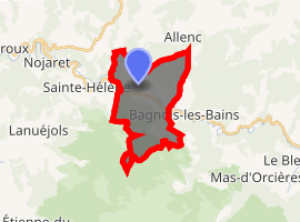
| |
 Chadenet  Chadenet | |
| Coordinates: 44°31′14″N 3°38′05″E | |
| Country | France |
| Region | Occitanie |
| Department | Lozère |
| Arrondissement | Mende |
| Canton | Grandrieu |
| Intercommunality | Goulet-Mont Lozère |
| Government | |
| • Mayor (2008–2014) | Gérard Mandement[1] |
| Area 1 | 12.96 km2 (5.00 sq mi) |
| Population (2017-01-01)[2] | 109 |
| • Density | 8.4/km2 (22/sq mi) |
| Time zone | UTC+01:00 (CET) |
| • Summer (DST) | UTC+02:00 (CEST) |
| INSEE/Postal code | 48037 /48190 |
| Elevation | 859–1,345 m (2,818–4,413 ft) (avg. 882 m or 2,894 ft) |
| 1 French Land Register data, which excludes lakes, ponds, glaciers > 1 km2 (0.386 sq mi or 247 acres) and river estuaries. | |
See also
References
- Site du conseil général de la Lozère Archived 2008-10-24 at the Wayback Machine
- "Populations légales 2017". INSEE. Retrieved 6 January 2020.
| Wikimedia Commons has media related to Chadenet. |
| Authority control |
|
|---|
This article is issued from Wikipedia. The text is licensed under Creative Commons - Attribution - Sharealike. Additional terms may apply for the media files.