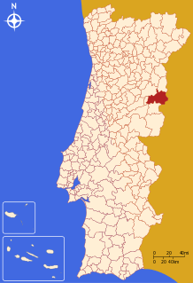
Sabugal
Sabugal (Portuguese pronunciation: [sɐβuˈɣal] (![]()
Sabugal | |
|---|---|
 | |
 Flag  Coat of arms | |
 | |
| Coordinates: 40°21′N 7°05′W | |
| Country | |
| Region | Centro |
| Intermunic. comm. | Beiras e Serra da Estrela |
| District | Guarda |
| Parishes | 30 |
| Government | |
| • President | António Robalo (PSD) |
| Area | |
| • Total | 822.70 km2 (317.65 sq mi) |
| Population (2011) | |
| • Total | 12,544 |
| • Density | 15/km2 (39/sq mi) |
| Time zone | UTC±00:00 (WET) |
| • Summer (DST) | UTC+01:00 (WEST) |
| Local holiday | Monday after Octave of Easter |
| Website | http://www.cm-sabugal.pt |
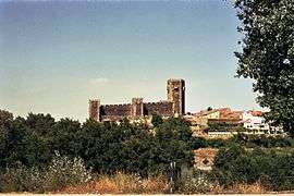
The municipal holiday is the Monday after Octave of Easter. Main monument: Sabugal Castle
History
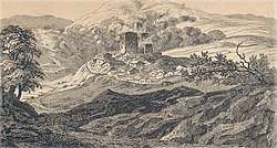
Sabugal was the location of the 1811 Battle of Sabugal, a Peninsular War engagement of British troops under Arthur Wellesley (later the Duke of Wellington) and French troops under the command of Marshal André Masséna, from which the British emerged victorious.
Parishes
Administratively, the municipality is divided into 30 civil parishes (freguesias):[3]
- Águas Belas
- Aldeia da Ponte
- Aldeia da Ribeira, Vilar Maior e Badamalos
- Aldeia do Bispo (Vale dos Caidos)
- Aldeia Velha
- Alfaiates
- Baraçal
- Bendada
- Bismula
- Casteleiro
- Cerdeira
- Fóios
- Lageosa da Raia
- Forcalhos
- Malcata
- Nave
- Pousafoles do Bispo, Pena Lobo e Lomba
- Quadrazais
- Quintas de São Bartolomeu
- Rapoula do Côa
- Rebolosa
- Rendo
- Ruvina, Ruivós e Vale das Éguas
- Sabugal e Aldeia de Santo António
- Santo Estêvão e Moita
- Seixo do Côa e Vale Longo
- Sortelha
- Souto (town)
- Vale de Espinho
- Vila Boa
- Vila do Touro
References
- Instituto Nacional de Estatística
- "Áreas das freguesias, concelhos, distritos e país". Archived from the original on 2018-11-05. Retrieved 2018-11-05.
- Diário da República. "Law nr. 11-A/2013, pages 552 104-105" (pdf) (in Portuguese). Retrieved 29 July 2014.
External links
| Authority control |
|---|