Figueira de Castelo Rodrigo
Figueira de Castelo Rodrigo (Portuguese pronunciation: [fiˈɣɐjɾɐ ðɨ kɐʃˈtɛlu ʁuˈðɾiɣu] (![]()
Figueira de Castelo Rodrigo | |
|---|---|
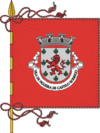
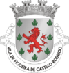
 Flag  Coat of arms | |
 | |
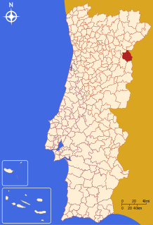
| Coordinates: 40°53′N 6°57′W | |
| Country | |
| Region | Centro |
| Intermunic. comm. | Beiras e Serra da Estrela |
| District | Guarda |
| Parishes | 10 |
| Government | |
| • President | Paulo Langrouva (PS) |
| Area | |
| • Total | 508.57 km2 (196.36 sq mi) |
| Population (2011) | |
| • Total | 6,260 |
| • Density | 12/km2 (32/sq mi) |
| Time zone | UTC±00:00 (WET) |
| • Summer (DST) | UTC+01:00 (WEST) |
| Local holiday | July 7 |
| Website | http://www.cm-fcr.pt |
The municipality borders the frontier with Spain, formed by the Águeda River, a tributary of the Douro, which it joins at Barca D'Alva, approximately 18 km north of Figueira de Castelo Rodrigo town.
The present Mayor is Paulo Langrouva, elected by the Socialist Party. The municipal holiday is July 7.
Figueira de Castelo Rodrigo figures in José Saramago's 2008 novel The Elephant's Journey.[3]
Parishes
Administratively, the municipality is divided into 10 civil parishes (freguesias):[4]
- Algodres, Vale de Alfonsinho e Vilar de Amargo
- Almofala e Escarigo
- Castelo Rodrigo
- Cinco Vilas e Reigada
- Colmeal e Vilar Torpim
- Escalhão
- Figueira de Castelo Rodrigo
- Freixeda do Torrão, Quintã de Pêro Martins e Penha da Águia
- Mata de Lobos
- Vermiosa
See also
- Castelo Rodrigo IPR
- Castelo Rodrigo Castle
References
- Instituto Nacional de Estatística Archived November 15, 2016, at the Wayback Machine
- "Áreas das freguesias, concelhos, distritos e país". Archived from the original on 2018-11-05. Retrieved 2018-11-05.
- José Saramago, The Elephant's Journey, (translated by Margaret Jull Costa), Harvil Secker, London, 2010.
- Diário da República. "Law nr. 11-A/2013, page 552 50" (pdf) (in Portuguese). Retrieved 22 July 2014.