Ruisseau-des-Mineurs, Quebec
Ruisseau-des-Mineurs is an unorganized territory in the Bas-Saint-Laurent region of Quebec, Canada. It is named after the Miners Creek (ruisseau des Mineurs), a tributary of the Cascapédia River via the Branche du Lac River.
Ruisseau-des-Mineurs | |
|---|---|
Unorganized territory | |
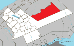 Location within La Matapédia RCM. | |
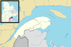 Ruisseau-des-Mineurs Location in eastern Quebec. | |
| Coordinates: 48°35′N 66°40′W[1] | |
| Country | |
| Province | |
| Region | Bas-Saint-Laurent |
| RCM | La Matapédia |
| Constituted | January 1, 1986 |
| Government | |
| • Federal riding | Haute-Gaspésie—La Mitis—Matane—Matapédia |
| • Prov. riding | Matane-Matapédia |
| Area | |
| • Total | 931.70 km2 (359.73 sq mi) |
| • Land | 908.99 km2 (350.96 sq mi) |
| Population (2011)[3] | |
| • Total | 0 |
| • Density | 0.0/km2 (0/sq mi) |
| • Pop 2006-2011 | |
| • Dwellings | 35 |
| Time zone | UTC-5 (EST) |
| • Summer (DST) | UTC-4 (EDT) |
| Highways | No major routes |
The Dunière Wildlife Reserve is located within this territory.
Demographics
Population trend:[4]
- Population in 2011: 0 (2006 to 2011 population change: -100.0%)
- Population in 2006: 5
- Population in 2001: 0
- Population in 1996: 0
- Population in 1991: 0
Private dwellings occupied by usual residents: 0 (total dwellings: 35)
gollark: No you can't.
gollark: What is the problem with that?
gollark: It does yes.
gollark: I'll just disable your sense of smell then.
gollark: If you install it you can be remotely blinded!
References
- Reference number 149685 of the Commission de toponymie du Québec (in French)
- "Ruisseau-des-Mineurs". Répertoire des municipalités (in French). Ministère des Affaires municipales, des Régions et de l'Occupation du territoire. Retrieved 2012-02-01.
- "Ruisseau-des-Mineurs census profile". 2011 Census data. Statistics Canada. Retrieved 2012-02-01.
- Statistics Canada: 1996, 2001, 2006, 2011 census
Adjacent Municipal Subdivisions | ||||||||||
|---|---|---|---|---|---|---|---|---|---|---|
| ||||||||||
| Cities & Towns | |
|---|---|
| Municipalities | |
| Parishes | |
| Villages | |
| Unorganized territories | |
| |
This article is issued from Wikipedia. The text is licensed under Creative Commons - Attribution - Sharealike. Additional terms may apply for the media files.