Lac-Matapédia, Quebec
Lac-Matapédia is an unorganized territory in the Bas-Saint-Laurent region of Quebec, Canada. It is named after and located on the northern shores of Lake Matapedia in the Matapédia Valley.
Lac-Matapédia | |
|---|---|
Unorganized territory | |
 North shore of Lake Matapedia | |
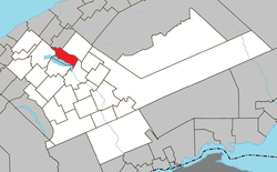 Location within La Matapédia RCM. | |
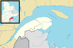 Lac-Matapédia Location in eastern Quebec. | |
| Coordinates: 48°33′N 67°34′W[1] | |
| Country | |
| Province | |
| Region | Bas-Saint-Laurent |
| RCM | La Matapédia |
| Constituted | unspecified |
| Government | |
| • Federal riding | Haute-Gaspésie—La Mitis—Matane—Matapédia |
| • Prov. riding | Matane-Matapédia |
| Area | |
| • Total | 83.00 km2 (32.05 sq mi) |
| • Land | 71.85 km2 (27.74 sq mi) |
| Population (2011)[3] | |
| • Total | 5 |
| • Density | 0.1/km2 (0.3/sq mi) |
| • Pop 2006-2011 | |
| • Dwellings | 34 |
| Time zone | UTC-5 (EST) |
| • Summer (DST) | UTC-4 (EDT) |
| Highways | No major routes |
The territory is home to a small protected area, Lac-Matapédia Forest Refuge (304 hectares (750 acres)) that was established in 2008 to protect three populations of the calypso orchid (Calypso bulbosa), a plant designated as threatened or vulnerable in Quebec.[4] A part of the remainder of the territory is being considered for the creation of a new provincial park.
Demographics
Population trend:[5]
- Population in 2011: 5 (2006 to 2011 population change: -50.0%)
- Population in 2006: 10
- Population in 2001: 0
- Population in 1996: 4
- Population in 1991: 0
Private dwellings occupied by usual residents: 2 (total dwellings: 34)
Gallery
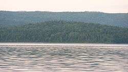
 View of the territory from across Lake Matapedia
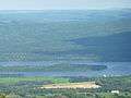
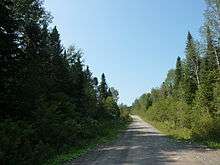 Main road of the territory
gollark: ++apioform
gollark: ++apioform
gollark: ++apioform
gollark: ++apioform
gollark: ++apioform
See also
- Lake Matapédia
- List of unorganized territories in Quebec
References
- Reference number 149684 of the Commission de toponymie du Québec (in French)
- "Lac-Matapédia". Répertoire des municipalités (in French). Ministère des Affaires municipales, des Régions et de l'Occupation du territoire. Retrieved 2012-01-27.
- "Lac-Matapédia census profile". 2011 Census data. Statistics Canada. Retrieved 2012-01-27.
- "Forêt refuge du Lac-Matapédia" (PDF). Écosystèmes forestiers exceptionnels. Ministère des Ressources naturelles et de la Faune du Quebec. Retrieved 27 January 2012.
- Statistics Canada: 1996, 2001, 2006, 2011 census
Adjacent Municipal Subdivisions | ||||||||||
|---|---|---|---|---|---|---|---|---|---|---|
| ||||||||||
| Cities & Towns | |
|---|---|
| Municipalities | |
| Parishes | |
| Villages | |
| Unorganized territories | |
| |
This article is issued from Wikipedia. The text is licensed under Creative Commons - Attribution - Sharealike. Additional terms may apply for the media files.