Rhode Island Route 102
Route 102 is a 44.4-mile-long (71.5 km) numbered state highway in the U.S. state of Rhode Island. Route 102 serves as a non-freeway beltway around the Providence metro area. It begins in the village of Wickford and travels through less developed areas of western Rhode Island. The route ends in the village of Slatersville.
| ||||
|---|---|---|---|---|
| Victory Highway | ||||

Route 102 highlighted in red | ||||
| Route information | ||||
| Maintained by RIDOT | ||||
| Length | 44.4 mi[1] (71.5 km) | |||
| Existed | 1923–present | |||
| Major junctions | ||||
| South end | ||||
| North end | ||||
| Location | ||||
| Counties | Washington, Kent, Providence | |||
| Highway system | ||||
Rhode Island Routes
| ||||

Route 102 is one of the longer Rhode Island state highways, and is longer than the portion of Interstate 95 that runs through the state (43.5 miles).
Route description
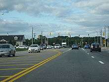
Route 102 begins as Philips Street at Route 1A in the Wickford section of the town of North Kingstown on Narragansett Bay. It proceeds west through the town of Exeter along Ten Rod Road. Route 102 then turns northwest to follow Victory Highway as it goes through the towns of West Greenwich and Coventry. Route 102 soon enters the town of Foster, where it continues north and briefly overlaps with Route 14 (Plainfield Pike) through the town of Scituate. In Scituate, it continues north along Chopmist Hill Road, crossing US 6 as it heads towards the town of Glocester. After crossing US 44 in the Glocester village of Chepachet, Route 102 continues northeast into the town of Burrillville along the Bronco Highway. The route ends in the town of North Smithfield in the village of Slatersville at an intersection with Routes 5 and 146A.
History
Route 102 is an original Rhode Island route designation assigned in 1923. The original route extended beyond North Smithfield into the city of Woonsocket along Victory Highway and Great Road (modern Route 146A), then along South Main Street and Main Street to end at Route 122. The route was truncated to Route 146 (now Route 146A) by 1938.
Major intersections
| County | Location | mi[1] | km | Destinations | Notes |
|---|---|---|---|---|---|
| Washington | North Kingstown | 0.0 | 0.0 | Southern terminus | |
| 0.6 | 0.97 | ||||
| 2.9 | 4.7 | Southern end of Route 2 concurrency | |||
| 3.2 | 5.1 | Exit 3 (Route 4); partial cloverleaf interchange | |||
| 3.9 | 6.3 | Northern end of Route 2 concurrency | |||
| Exeter | 11.2 | 18.0 | Southern end of Route 3 concurrency | ||
| 11.3 | 18.2 | Northern end of Route 3concurrency | |||
| Kent | West Greenwich | 12.1 | 19.5 | Exit 5 on I-95; cloverleaf interchange | |
| Coventry | 18.0 | 29.0 | Western end of Route 118 | ||
| 18.9 | 30.4 | ||||
| Providence | Foster | 22.2 | 35.7 | Southern end of Route 14 concurrency | |
| 25.1 | 40.4 | Southern end of Route 94 | |||
| Scituate | 26.8 | 43.1 | Western end of Route 12 | ||
| 27.4 | 44.1 | Northern end of Route 14 concurrency | |||
| 29.8 | 48.0 | ||||
| 30.9 | 49.7 | ||||
| Chepachet | 35.6 | 57.3 | Southern end of US 44 concurrency | ||
| 36.1 | 58.1 | Northern end of US 44 concurrency | |||
| 36.3 | 58.4 | Southern end of Route 100 | |||
| Oakland | 39.9 | 64.2 | Eastern end of Route 107 | ||
| Nasonville | 41.8 | 67.3 | |||
| Slatersville | 44.4 | 71.5 | Northern terminus | ||
1.000 mi = 1.609 km; 1.000 km = 0.621 mi
| |||||
References
- Google (December 26, 2013). "Route 102" (Map). Google Maps. Google. Retrieved December 26, 2013.
External links

- 2019 Highway Map, Rhode Island