Randall, Indiana
Randall is a former town in Helt Township, Vermillion County, in the U.S. state of Indiana.[2] Randall is also 1.6 miles northwest of another extinct town: Toronto, on W County Road 700 S. The nearest extant community is the town of Dana, to the northeast.
Randall, Indiana | |
|---|---|
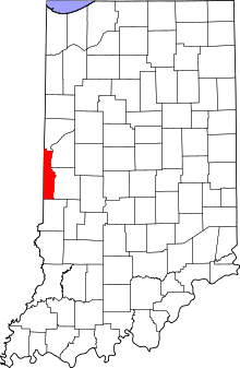 Vermillion County's location in Indiana | |
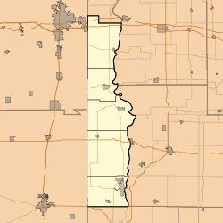 Randall Randall's location in Vermillion County | |
| Coordinates: 39°46′30″N 87°31′21″W | |
| Country | United States |
| State | Indiana |
| County | Vermillion |
| Township | Helt |
| Elevation | 617 ft (188 m) |
| Time zone | UTC-5 (Eastern (EST)) |
| • Summer (DST) | UTC-4 (EDT) |
| ZIP code | 47847 |
| Area code(s) | 765 |
| GNIS feature ID | 441760 |
History
The post office at Randall was established in 1858 and discontinued in 1872.[3] The community was named in honor of the Randall family of settlers.[4]
Geography
Randall is located at 39°46′30″N 87°31′21″W.
gollark: It's actually not.
gollark: Should I add the new lore to the Emu War original page?
gollark: <@!332271551481118732> Can I say that v3 is considered canonical right now?
gollark: It's Emu War. Emuwars was a trashy movie based on it made in 2030.
gollark: I didn't actually program emu war, mind you.
References
- "US Board on Geographic Names". United States Geological Survey. October 25, 2007. Retrieved 2016-07-18.
- "Randall, Indiana". Geographic Names Information System. United States Geological Survey. Retrieved 2016-07-18.
- "Vermillion County". Jim Forte Postal History. Retrieved 1 October 2015.
- Baker, Ronald L. (October 1995). From Needmore to Prosperity: Hoosier Place Names in Folklore and History. Indiana University Press. p. 276. ISBN 978-0-253-32866-3.
...for the local Randall family...
Municipalities and communities of Vermillion County, Indiana, United States | ||
|---|---|---|
| City | Map of Indiana highlighting Vermillion County | |
| Towns | ||
| Townships | ||
| CDPs | ||
| Other unincorporated communities | ||
| Ghost towns | ||
| Footnotes | ‡This populated place also has portions in an adjacent county or counties | |
This article is issued from Wikipedia. The text is licensed under Creative Commons - Attribution - Sharealike. Additional terms may apply for the media files.