Centenary, Indiana
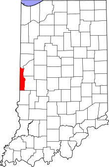
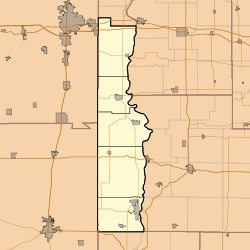
Centenary is an unincorporated community in Clinton Township, Vermillion County, in the U.S. state of Indiana.[2]
Centenary, Indiana | |
|---|---|
 Vermillion County's location in Indiana | |
 Centenary Centenary's location in Vermillion County | |
| Coordinates: 39°39′30″N 87°28′24″W | |
| Country | United States |
| State | Indiana |
| County | Vermillion |
| Township | Clinton |
| Elevation | 604 ft (184 m) |
| Time zone | UTC-5 (Eastern (EST)) |
| • Summer (DST) | UTC-4 (EDT) |
| ZIP code | 47842 |
| Area code(s) | 765 |
| GNIS feature ID | 432301 |
History
The town was laid out in 1910 and may have been named for a local church.[3]
Geography
Centenary is located at 39°39′31″N 87°28′24″W (39.658530, -87.473210).
gollark: I guess 7.1st, as the original one doesn't really count.
gollark: This is only the 8.1st rewrite.
gollark: Fear "Minoteaur", my "application".
gollark: I am currently writing "Rust" code, which is reasonable and not at all annoying.
gollark: Maybe try using unjava.
References
- "US Board on Geographic Names". United States Geological Survey. October 25, 2007. Retrieved 2016-07-15.
- "Centenary, Indiana". Geographic Names Information System. United States Geological Survey. Retrieved July 31, 2017.
- Baker, Ronald L.; Marvin Carmony (1975). Indiana Place Names. Indiana University Press. p. 27. ISBN 0-253-14167-2.
This article is issued from Wikipedia. The text is licensed under Creative Commons - Attribution - Sharealike. Additional terms may apply for the media files.