Crompton Hill, Indiana
Crompton Hill is an unincorporated community in Clinton Township, Vermillion County, in the U.S. state of Indiana.[2]
Crompton Hill, Indiana | |
|---|---|
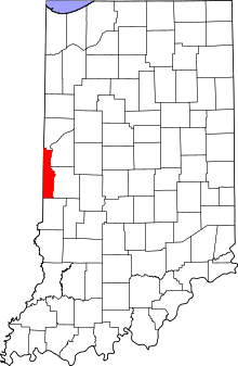 Vermillion County's location in Indiana | |
 Crompton Hill Crompton Hill's location in Vermillion County | |
| Coordinates: 39°39′21″N 87°25′09″W | |
| Country | United States |
| State | Indiana |
| County | Vermillion |
| Township | Clinton |
| Elevation | 610 ft (186 m) |
| Time zone | UTC-5 (Eastern (EST)) |
| • Summer (DST) | UTC-4 (EDT) |
| ZIP code | 47842 |
| Area code(s) | 765 |
| GNIS feature ID | 433146 |
Geography
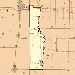
Crompton Hill is located at 39°39′21″N 87°25′09″W at an elevation of approximately 600 feet and overlooks the larger community of Clinton to the east. Indiana State Road 163 (Hazel Bluff Road) runs east-and-west through the town.
gollark: Oh, this is behind an ifdef, it's "fine".
gollark: ... is this thing unironically hardcoding the name to `wlan0`?
gollark: And now `sudo` and `ip addr` hang.
gollark: ```[ 2170.303302] BUG: unable to handle page fault for address: ffffffffffffffc8[ 2170.303311] #PF: supervisor read access in kernel mode[ 2170.303315] #PF: error_code(0x0000) - not-present page```Wondrous.
gollark: `insmod` has caused no implosions, time to plug in the device...
References
- "US Board on Geographic Names". United States Geological Survey. October 25, 2007. Retrieved 2016-07-15.
- "Crompton Hill, Indiana". Geographic Names Information System. United States Geological Survey. Retrieved July 31, 2017.
Municipalities and communities of Vermillion County, Indiana, United States | ||
|---|---|---|
| City | Map of Indiana highlighting Vermillion County | |
| Towns | ||
| Townships | ||
| CDPs | ||
| Other unincorporated communities | ||
| Ghost towns | ||
| Footnotes | ‡This populated place also has portions in an adjacent county or counties | |
This article is issued from Wikipedia. The text is licensed under Creative Commons - Attribution - Sharealike. Additional terms may apply for the media files.