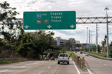
Puerto Rico Highway 52
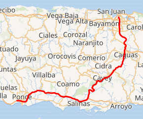
Puerto Rico Highway 52 (PR-52), a major toll road in Puerto Rico, is also known as Autopista Luis A. Ferré. It was formerly called Expreso Las Américas. It runs from PR-1 in southwest Río Piedras and heads south until it intersects with highway PR-2 in Ponce.[3] At its north end, the short PR-18 continues north from PR-52 towards San Juan. This short segment is known as Expreso Las Americas, the only segment of the route still unofficially bearing this name, since PR-18 is officially named Roberto Sánchez Vilella Expressway. The combined route of PR-18 and PR-52 runs concurrent with the unsigned Interstate Highway PRI-1. Toll stations are located in San Juan, Caguas, Salinas, Juana Díaz, and Ponce.
| ||||
|---|---|---|---|---|
| Autopista Luis A. Ferré | ||||
PR-52 highlighted in red | ||||
| Route information | ||||
| Maintained by Puerto Rico DTPW | ||||
| Length | 108.5 km[1] (67.4 mi) | |||
| Existed | 1968[2]–present | |||
| Major junctions | ||||
| South end | ||||
| North end | ||||
| Location | ||||
| Municipalities | Ponce, Juana Díaz, Santa Isabel, Salinas, Cayey, Caguas, Trujillo Alto, San Juan | |||
| Highway system | ||||
| ||||


Route description
.svg.png)
PR-52 is Puerto Rico's longest and second most traveled tollway. The road is mostly a 2-lane road in each direction. The section between the Caguas toll and the town of Salinas crosses the Cordillera Central, resulting in a more curvy and hilly section than the other sections of the highway. It also experiences more fog and lower visibility than the rest of the road due to the altitude. The speed limit is also reduced in the area.
One of Puerto Rico's only 2 rest areas is located on this expressway. map The other rest area is located on PR-53 (northbound only) near Humacao/Naguabo municipality border although it is signed as a scenic zone and thus just like the rest area on PR-52, it has no facilities. map The rest area, however, has no relief, vending, or service facilities such as a restaurant or a gas station. The rest area does include an important monument, the Monumento al Jíbaro Puertorriqueño. The whimsical Tetas de Cayey are visible from this rest area as well.
PR-52 passes extremely close to the central town of Cidra between approximately kilometer markers 34 and 30. In fact, Exit 32 to Guavate is so close to the Cidra border that once the exit is taken and instead of going south to Guavate and Patillas through PR-184, going north it quickly ends at PR-1 and a welcome sign to Cidra is shown. The tollway itself never enters Cidra itself, but PR-1 (the parallel road from Ponce to San Juan) does.
The speed limit from San Juan to Caguas is 55 miles per hour (89 km/h). From Caguas to Salinas, it is 45 miles per hour (72 km/h), and from Salinas to Ponce, it is 65 miles per hour (105 km/h).
History
The building of this 108-kilometer (67 mi)[4] expressway took place during the administration of governor Luis A. Ferré, who was trained as a civil engineer himself. [5] It was built at a cost of $125 million.[6] PR-52 was Puerto Rico's first toll road ever. Construction for this road started in October 1968 during the administration of governor Roberto Sánchez Vilella, also a trained engineer, and continued during Luis Ferre's tenure. It was then named Autopista Las Americas, and it was planned to run from San Juan to Ponce.[7] On December 9, 1993, Law 118 was enacted which renamed the roadway Autopista Luis A. Ferre.[7] The expressway is currently the longest in the island, but this will change when the 83-km-long PR-22 extends to Aguadilla. In March 1969 the roadway became a tolled expressway. The Puerto Rico Highway and Transportation Authority reports that tolls were added to the highway to speed up its construction.[7] The road was completed in 1975 during the first administration of governor Rafael Hernández Colón.[8]
On July 22, 2019, more than half a million Puerto Ricans shut down PR-52 demanding the resignation of the then governor, Ricardo Rosselló, following a leaked Telegram chat between the governor and several members of his cabinet.
Tolls
| Location | Toll | Direction | AutoExpreso acceptance |
AutoExpreso replenishment (R) lane |
|---|---|---|---|---|
| Ponce | $0.75 | Two-way | ||
| Juana Díaz Oeste | $0.50 | Northbound | ||
| Juana Díaz Este | $0.50 | Southbound | ||
| Salinas Rampa Sur | $0.35 | Northbound | ||
| Salinas | $1.75 | Northbound | ||
| Caguas Sur | $1.00 | Southbound | ||
| Caguas Norte | $1.50 | Northbound | ||
| Montehiedra | $0.35 | Northbound (ramp) |
Exit list
| Municipality | Location | km[1] | mi | Exit | Destinations | Notes | ||
|---|---|---|---|---|---|---|---|---|
| Ponce | Canas | 108.5 | 67.4 | 108 | Southern terminus of Interstate PR1 and PR-52. Splits into PR-2. PR-2 exit 224. | |||
| 108.0 | 67.1 | |||||||
| Playa | 105.5 | 65.6 | Ponce Toll Plaza | |||||
| 104.9 | 65.2 | 104 | Signed as exits 104A (north) and 104B (south) | |||||
| Vayas | 100.9– 100.8 | 62.7– 62.6 | 99 | Signed as exits 99A (west) and 99B (east) | ||||
| Sabanetas | 98.0 | 60.9 | 98 | Signed as exits 98A (north) and 98B (south), access to San Lucas Hospital | ||||
| Coto Laurel | 95.5 | 59.3 | 95 | |||||
| Juana Díaz | Sabana Llana | 93.8 | 58.3 | Juana Díaz Oeste Toll Plaza (toll northbound only) | ||||
| Amuelas | 91.2 | 56.7 | 91 | |||||
| Río Cañas Abajo | 85.6 | 53.2 | Juana Díaz Este Toll Plaza (toll southbound only) | |||||
| Santa Isabel | Descalabrado | 81.4 | 50.6 | 80 | Westbound exit and eastbound entrance | |||
| Descalabrado–Felicia 2 line | 77.7 | 48.3 | 77 | |||||
| Felicia 2 | 77.0– 76.9 | 47.8– 47.8 | 76 | |||||
| Salinas | Lapa | 66.2 | 41.1 | 65 | Toll on eastbound off-ramp and westbound on-ramp | |||
| 61.5 | 38.2 | 61 | The northbound exit into the southwestern terminus of PR-53. | |||||
| 60.8 | 37.8 | 60 | Directional T interchange; The left southbound exit into the southwestern terminus of PR-53 | |||||
| 57.9 | 36.0 | Salinas Toll Plaza (toll northbound only) | ||||||
| 57.6– 57.5 | 35.8– 35.7 | 58 | Access via PR-1 / PR-712 | |||||
| Palmas–Lapa line | 49.2 | 30.6 | — | Rest Area | Northbound exit has access to PR-714. | |||
| Cayey | Monte Llano | 38.8 | 24.1 | 39 | Access to Centro Médico Menonita de Cayey | |||
| Beatriz | 32.2 | 20.0 | 32 | This exit is just a few feet away from the border of Cidra and Cayey | ||||
| Caguas | Turabo | 23.5 | 14.6 | Caguas Sur Toll Plaza (toll southbound only) | ||||
| 23.1 | 14.4 | 23 | ||||||
| Turabo–Cañaboncito line | 21.4 | 13.3 | 21 | The direct exit to Menonita Caguas Regional Hospital and Plaza del Carmen Mall | ||||
| Cañaboncito | 20.5– 20.4 | 12.7– 12.7 | 20 | Avenida Federico Degetau (PR-34) | Unsigned | |||
| Caguas barrio-pueblo | 19.3 | 12.0 | 19 | |||||
| Bairoa | 18.4 | 11.4 | 18 | The direct exit to Las Catalinas Mall. | ||||
| 16.1 | 10.0 | 15B | The exit from the southbound direction signed as Exit 14. | |||||
| 15.8 | 9.8 | 15A | The exit from the southbound direction signed as Exit 15. | |||||
| 15.5 | 9.6 | 15 | The exits from the northbound direction signed as 15A (North) and 15B (South). | |||||
| Río Cañas | 14.3– 14.2 | 8.9– 8.8 | Caguas Norte Toll Plaza (toll northbound only) | |||||
| 14.2 | 8.8 | 14 | Southbound exit | |||||
| Trujillo Alto |
No major junctions | |||||||
| San Juan | Caimito | 4.1 | 2.5 | 4 | Avenida Montehiedra / Camino Los Romero – Caimito | Toll on northbound on-ramp; signed as exits 4A and 4B southbound | ||
| Monacillo | 2.4 | 1.5 | 2 | |||||
| Monacillo Urbano | 0.9– 0.8 | 0.56– 0.50 | 1 | Southbound exits signed as 1A (west) and 1B (east) | ||||
| 0.3 | 0.19 | 0B | No northbound access to PR-1 south. | |||||
| 0.0 | 0.0 | 0A | Northern terminus of PR-52; PRI-1 continues northbound via PR-18. Access to Luis Muñoz Marín International Airport and hospitals. | |||||
1.000 mi = 1.609 km; 1.000 km = 0.621 mi
| ||||||||
Gallery
 Puerto Rico Highway 52
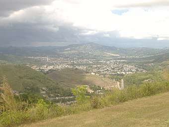 View from PR-52 in Cayey
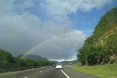
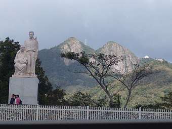 The Monumento al Jíbaro Puertorriqueño and Las Tetas de Cayey
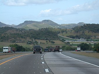 PR-52 near Santa Isabel
.jpg) PR-52 southbound entering Ponce
PR-52 southbound entering Ponce
See also
- Interstate Highways in Puerto Rico
- List of highways in Ponce, Puerto Rico
- List of highways numbered 52
References
- Google (28 February 2020). "PR-52" (Map). Google Maps. Google. Retrieved 28 February 2020.
- Historia. Departamento de Transportacion y Obras Publicas de Puerto Rico. Archived on 16 February 2009. Retrieved 10 August 2020.
- Puerto Rico Department of Transportation and Public Works. "Datos de Transito 2000-2009" (in Spanish). Retrieved 23 April 2019.
- Guía de Carreteras Principales, Expresos y Autopistas. (In Spanish) Puerto Rico Autoridad de Carreteras y Transportacion (ACT).
- Ian James. "Former Puerto Rican Gov. Luis A Ferre dies." The Miami Herald. October 22. 2003
- Historia de las Carreteras de Puerto Rico. Primera Hora. March 13, 2006.
- "Historia". Government of Puerto Rico. Highway and Transportation Authority. Archived from the original on 16 February 2009. Retrieved 2 May 2017.
- Legends of Puerto Rico Archived 2010-09-28 at the Wayback Machine
External links

| Signed | |
|---|---|
| Unsigned | |
| Lists | |
| Other | |
Major Interstates highlighted | |