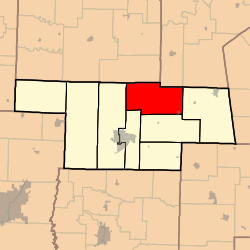
Prairie Township, Audrain County, Missouri
Prairie Township is one of eight townships in Audrain County, Missouri, United States. As of the 2010 census, its population was 932.[3]
Prairie Township | |
|---|---|
 | |
| Coordinates: 39°15′44″N 091°41′41″W | |
| Country | United States |
| State | Missouri |
| County | Audrain |
| Area | |
| • Total | 79.02 sq mi (204.65 km2) |
| • Land | 78.69 sq mi (203.80 km2) |
| • Water | 0.33 sq mi (0.85 km2) 0.42% |
| Elevation | 774 ft (236 m) |
| Population (2010) | |
| • Total | 932 |
| • Density | 12/sq mi (4.6/km2) |
| FIPS code | 29-59474[2] |
| GNIS feature ID | 0766244 |
History
Prairie Township was established in 1837.[4] The township was named for prairie landscape within its borders.[5]
Geography
Prairie Township covers an area of 79.0 square miles (204.6 km2) and contains one incorporated settlement, Laddonia. It contains three cemeteries: Bean Creek, Eubank and Unity.
The streams of Bean Creek, Hazel Creek, Littleby Creek, Sandy Creek, Talleys Branch, Tattys Creek and Wildcat Creek run through this township.
Transportation
Prairie Township contains one airport or landing strip, Schlemmer Airport.
gollark: This sort of "hahahahahahahdajsdhahdjbajhdbajdnasd let us reinvent data structures constantly" is very C.
gollark: Oh, I see. I assumed it was persistent ondisk data.
gollark: What does it actually store?
gollark: Or probably just... waiting on compilers.
gollark: Such as `strlen` (C bad, as they say!).
References
- "US Board on Geographic Names". United States Geological Survey. 2007-10-25. Retrieved 2008-01-31.
- "U.S. Census website". United States Census Bureau. Retrieved 2008-01-31.
- "Geographic Identifiers: 2010 Demographic Profile Data (G001): Prairie township, Audrain County, Missouri". U.S. Census Bureau, American Factfinder. Archived from the original on February 12, 2020. Retrieved June 25, 2013.
- "Audrain County Place Names, 1928-1945 (archived)". The State Historical Society of Missouri. Archived from the original on 24 June 2016. Retrieved 30 August 2016.CS1 maint: BOT: original-url status unknown (link)
- Eaton, David Wolfe (1916). How Missouri Counties, Towns and Streams Were Named. The State Historical Society of Missouri. pp. 204.
External links
Municipalities and communities of Audrain County, Missouri, United States | ||
|---|---|---|
| Cities | 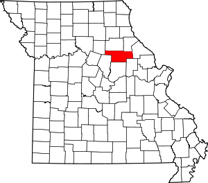 Map of Missouri highlighting Audrain County | |
| Villages | ||
| Townships | ||
| Unincorporated communities | ||
| Ghost town | ||
| Footnotes | ‡This populated place also has portions in an adjacent county or counties | |
This article is issued from Wikipedia. The text is licensed under Creative Commons - Attribution - Sharealike. Additional terms may apply for the media files.