Pohnání
Pohnání is a village and municipality (obec) in Tábor District in the South Bohemian Region of the Czech Republic.
Pohnání | |
|---|---|
Municipality | |
.JPG) | |
 Coat of arms | |
 Pohnání | |
| Coordinates: 49°28′25″N 14°49′10″E | |
| Country | |
| Region | South Bohemian |
| District | Tábor |
| Area | |
| • Total | 3.57 km2 (1.38 sq mi) |
| Elevation | 627 m (2,057 ft) |
| Population (2011) | |
| • Total | 79 |
| • Density | 22/km2 (57/sq mi) |
| Postal code | 391 42 |
The municipality covers an area of 3.57 square kilometres (1.38 sq mi), and has a population of 80 (as at 3 July 2006).
Pohnání lies approximately 14 kilometres (9 mi) north-east of Tábor, 61 km (38 mi) north-east of České Budějovice, and 74 km (46 mi) south-east of Prague.
Gallery
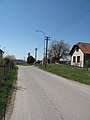 Road
Road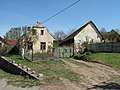 Cottage
 Neighbouring countryside
gollark: And that weird instruction for JS floating point conversion.
gollark: I think they have microcode in the newer core things now.
gollark: But it LIES.
gollark: I see.
gollark: Single board computer.
This article is issued from Wikipedia. The text is licensed under Creative Commons - Attribution - Sharealike. Additional terms may apply for the media files.