Podbranč
Podbranč (Hungarian: Berencsváralja) is a village and municipality in Senica District in the Trnava Region of western Slovakia.
Podbranč | |
|---|---|
Village | |
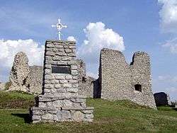 Branč Castle above the village | |
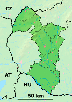 Podbranč Location of Podbranč in the Trnava Region  Podbranč Podbranč (Slovakia) | |
| Coordinates: 48°44′N 17°28′E | |
| Country | Slovakia |
| Region | Trnava |
| District | Senica |
| First mentioned | 1394 |
| Area | |
| • Total | 14.137 km2 (5.458 sq mi) |
| Elevation | 420 m (1,380 ft) |
| Population (2004-12-31) | |
| • Total | 645 |
| • Density | 46/km2 (120/sq mi) |
| Postal code | 906 41 |
| Area code(s) | +421-34 |
| Car plate | SE |
| Website | www.podbranc.sk |
History
In historical records the village was first mentioned in 1297.
Geography
The municipality lies at an altitude of 420 metres and covers an area of 14.137 km². It has a population of about 645 people.
gollark: ↓ graphical representation of palaiologos's C code
gollark: ↓ graphical representation of that C code
gollark: Any sufficiently large collection of data without significant manual curation turns utterly to bees.
gollark: Cover art?
gollark: Advanced apiotechnoloγy.
This article is issued from Wikipedia. The text is licensed under Creative Commons - Attribution - Sharealike. Additional terms may apply for the media files.