Piana Crixia
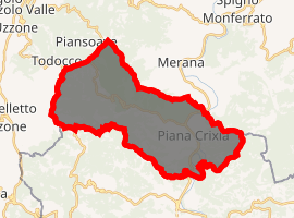
Piana Crixia (Ligurian: A Ciana; Piedmontese: Pion) is a comune (municipality) in the Province of Savona in the Italian region Liguria, located about 50 kilometres (31 mi) west of Genoa and about 25 kilometres (16 mi) northwest of Savona. As of 31 December 2004, it had a population of 826 and an area of 29.6 square kilometres (11.4 sq mi).[3]
Piana Crixia | |
|---|---|
| Comune di Piana Crixia | |
Location of Piana Crixia 
| |
 Piana Crixia Location of Piana Crixia in Italy  Piana Crixia Piana Crixia (Liguria) | |
| Coordinates: 44°28′N 8°19′E | |
| Country | Italy |
| Region | Liguria |
| Province | Province of Savona (SV) |
| Area | |
| • Total | 29.6 km2 (11.4 sq mi) |
| Population (Dec. 2004)[2] | |
| • Total | 826 |
| • Density | 28/km2 (72/sq mi) |
| Time zone | UTC+1 (CET) |
| • Summer (DST) | UTC+2 (CEST) |
| Postal code | 17010 |
| Dialing code | 019 |
Piana Crixia borders the following municipalities: Castelletto Uzzone, Dego, Merana, Pezzolo Valle Uzzone, Serole, and Spigno Monferrato.
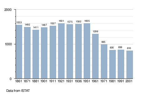
Demographic evolution

Twin towns — sister cities
Piana Crixia is twinned with:

gollark: It is, in fact, made by Google.
gollark: No it isn't.
gollark: Chromium is just slightly rebranded Chrome.
gollark: Firefox, but resentfully.
gollark: Either they don't implement enough of the web standards to be useful, or they're too gigantic and complex to have good code quality and work well.
References
- "Superficie di Comuni Province e Regioni italiane al 9 ottobre 2011". Istat. Retrieved 16 March 2019.
- "Popolazione Residente al 1° Gennaio 2018". Istat. Retrieved 16 March 2019.
- All demographics and other statistics: Italian statistical institute Istat.
This article is issued from Wikipedia. The text is licensed under Creative Commons - Attribution - Sharealike. Additional terms may apply for the media files.