Murialdo
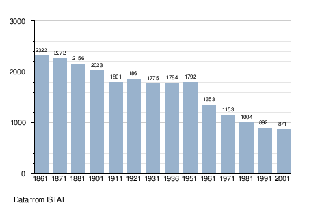
Murialdo (Ligurian: Moriaodo; Piedmontese: Muriaud) is a comune (municipality) in the Province of Savona in the Italian region Liguria, located about 60 kilometres (37 mi) west of Genoa and about 25 kilometres (16 mi) west of Savona. As of 31 December 2004, it had a population of 882 and an area of 37.5 square kilometres (14.5 sq mi).[3]
Murialdo | |
|---|---|
| Comune di Murialdo | |
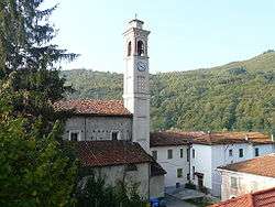 Saint Anthony Church | |
Location of Murialdo 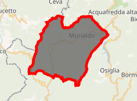
| |
 Murialdo Location of Murialdo in Italy  Murialdo Murialdo (Liguria) | |
| Coordinates: 44°19′N 8°10′E | |
| Country | Italy |
| Region | Liguria |
| Province | Province of Savona (SV) |
| Frazioni | Colle dei Giovetti, Isolagrande, Piano, Ponte, Riofreddo, Valle |
| Area | |
| • Total | 37.5 km2 (14.5 sq mi) |
| Population (Dec. 2004)[2] | |
| • Total | 882 |
| • Density | 24/km2 (61/sq mi) |
| Time zone | UTC+1 (CET) |
| • Summer (DST) | UTC+2 (CEST) |
| Postal code | 17010 |
| Dialing code | 019 |
The municipality of Murialdo contains the "Borgate" (subdivisions, mainly villages and hamlets): Piani, Piavata, Piano, Ponte, Bonetti, Valle, Isolagrande and Riofreddo.
Murialdo borders the following municipalities: Calizzano, Castelnuovo di Ceva, Massimino, Millesimo, Osiglia, Perlo, Priero, and Roccavignale.
Demographic evolution
Twin towns — sister cities
Murialdo is twinned with:

gollark: Put in "I'm very lucky, or you wouldn't have picked up this resume in the first place".
gollark: <#482370338324348932>
gollark: The moderation had better not go all authoritarian.
gollark: Also reading stuff on TVTropes and creating an increasing amount of tabs.
gollark: Currently, reading an (e)book with Discord in the background.
References
- "Superficie di Comuni Province e Regioni italiane al 9 ottobre 2011". Istat. Retrieved 16 March 2019.
- "Popolazione Residente al 1° Gennaio 2018". Istat. Retrieved 16 March 2019.
- All demographics and other statistics: Italian statistical institute Istat.
| Authority control |
|
|---|
This article is issued from Wikipedia. The text is licensed under Creative Commons - Attribution - Sharealike. Additional terms may apply for the media files.