Pho Tak District
Pho Tak District (Thai: โพธิ์ตาก, pronounced [pʰōː tàːk]) is a district (amphoe) of Nong Khai Province, northeastern Thailand.
Pho Tak โพธิ์ตาก | |
|---|---|
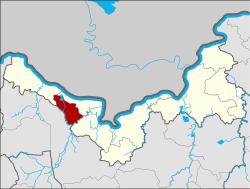 District location in Nong Khai Province | |
| Coordinates: 17°52′36″N 102°24′36″E | |
| Country | Thailand |
| Province | Nong Khai |
| Seat | Pho Tak |
| Area | |
| • Total | 102.5 km2 (39.6 sq mi) |
| Population (2005) | |
| • Total | 14,886 |
| • Density | 145.2/km2 (376/sq mi) |
| Time zone | UTC+7 (ICT) |
| Postal code | 43130 |
| Geocode | 4317 |
Geography
Neighboring districts are (from the west clockwise): Sangkhom, Si Chiang Mai, and Tha Bo of Nong Khai Province, and Ban Phue of Udon Thani Province.
History
The minor district (king amphoe) was created on 1 July 1997 by splitting off the three tambons, Pho Tak, Phon Thong, and Dan Si Suk, from Si Chiang Mai District.[1]
On 15 May 2007, all 81 minor districts were upgraded to full districts.[2] With publication in the Royal Gazette on 24 August, the upgrade became official.[3]
Administration
The district is divided into three sub-districts (tambons), which are further subdivided into 27 villages (mubans). There are no municipal (thesaban) areas. There are three tambon administrative organizations (TAO).
| No. | Name | Thai name | Villages | Pop. | |
|---|---|---|---|---|---|
| 1. | Pho Tak | โพธิ์ตาก | 7 | 4,208 | |
| 2. | Phon Thong | โพนทอง | 11 | 6,441 | |
| 3. | Dan Si Suk | ด่านศรีสุข | 9 | 4,237 |
References
- ประกาศกระทรวงมหาดไทย เรื่อง แบ่งเขตท้องที่อำเภอศรีเชียงใหม่ จังหวัดหนองคาย ตั้งเป็นกิ่งอำเภอโพธิ์ตาก (PDF). Royal Gazette (in Thai). 114 (Special 51 ง): 22. June 24, 1997.
- แถลงผลการประชุม ครม. ประจำวันที่ 15 พ.ค. 2550 (in Thai). Manager Online.
- พระราชกฤษฎีกาตั้งอำเภอฆ้องชัย...และอำเภอเหล่าเสือโก้ก พ.ศ. ๒๕๕๐ (PDF). Royal Gazette (in Thai). 124 (46 ก): 14–21. August 24, 2007.