Rattanawapi District
Rattanawapi (Thai: รัตนวาปี) is a district (amphoe) of Nong Khai Province, northeastern Thailand.
Rattanawapi รัตนวาปี | |
|---|---|
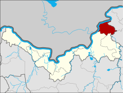 District location in Nong Khai Province | |
| Coordinates: 18°13′12″N 103°10′48″E | |
| Country | Thailand |
| Province | Nong Khai |
| Seat | Rattanawapi |
| Area | |
| • Total | 204.007 km2 (78.768 sq mi) |
| Population (2005) | |
| • Total | 36,920 |
| • Density | 181.0/km2 (469/sq mi) |
| Time zone | UTC+7 (ICT) |
| Postal code | 43120 |
| Geocode | 4316 |
Geography
Neighboring districts are (from the east clockwise): Pak Khat and So Phisai of Bueng Kan Province; Fao Rai and Phon Phisai of Nong Khai Province; and Bolikhamxai Province of Laos.
History
The minor district (king amphoe) was split off from Phon Phisai District on 1 April 1995.[1]
On 15 May 2007, all 81 minor districts were upgraded to full districts.[2] On 24 August the upgrade became official.[3]
Administration
The district is divided into five sub-districts (tambons), which are further subdivided into 61 villages (mubans). There are no municipal (thesaban) areas. There are five tambon administrative organizations (TAO).
| No. | Name | Thai name | Villages | Pop. | |
|---|---|---|---|---|---|
| 1. | Rattanawapi | รัตนวาปี | 12 | 7,699 | |
| 2. | Na Thap Hai | นาทับไฮ | 10 | 8,219 | |
| 3. | Ban Ton | บ้านต้อน | 9 | 3,775 | |
| 4. | Phra Bat Na Sing | พระบาทนาสิงห์ | 17 | 11,044 | |
| 5. | Phon Phaeng | โพนแพง | 13 | 6,183 |
gollark: The original is this, but I subjected it to hyperbeeologistics.
gollark: Descent into the apiohyperdomain.
gollark: I haven't changed it before and I'm not changing it now.
gollark: I see.
gollark: ++experimental_qa coral What is coral's avatar?
References
- ประกาศกระทรวงมหาดไทย เรื่อง แบ่งเขตท้องที่อำเภอโพนพิสัย จังหวัดหนองคายตั้งเป็นกิ่งอำเภอรัตนวาปี (PDF). Royal Gazette (in Thai). 112 (Special 9 ง): 51. March 22, 1995.
- แถลงผลการประชุม ครม. ประจำวันที่ 15 พ.ค. 2550 (in Thai). Manager Online.
- พระราชกฤษฎีกาตั้งอำเภอฆ้องชัย...และอำเภอเหล่าเสือโก้ก พ.ศ. ๒๕๕๐ (PDF). Royal Gazette (in Thai). 124 (46 ก): 14–21. August 24, 2007.
This article is issued from Wikipedia. The text is licensed under Creative Commons - Attribution - Sharealike. Additional terms may apply for the media files.