Fao Rai District
Fao Rai (Thai: เฝ้าไร่, pronounced [fâw râj]) is a district (amphoe) of Nong Khai Province, northeastern Thailand.
Fao Rai เฝ้าไร่ | |
|---|---|
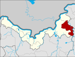 District location in Nong Khai Province | |
| Coordinates: 18°1′8″N 103°18′14″E | |
| Country | Thailand |
| Province | Nong Khai |
| Seat | Fao Rai |
| Area | |
| • Total | 255.9 km2 (98.8 sq mi) |
| Population (2005) | |
| • Total | 50,481 |
| • Density | 197.3/km2 (511/sq mi) |
| Time zone | UTC+7 (ICT) |
| Postal code | 43230 |
| Geocode | 4315 |
Geography
Neighboring districts are (from the west clockwise): Phon Phisai and Rattanawapi of Nong Khai Province; So Phisai of Bueng Kan Province; Ban Muang of Sakon Nakhon Province; and Ban Dung of Udon Thani Province.
History
The minor district (king amphoe) was split off from Phon Phisai District on 1 April 1995.[1]
On 15 May 2007, all 81 minor districts were upgraded to full districts.[2] With publication in the Royal Gazette on 24 August the upgrade became official.[3]
Administration
The district is divided into five sub-districts (tambons), which are further subdivided into 69 villages (mubans). There are no municipal (thesaban) areas. There are five tambon administrative organizations (TAO).
| No. | Name | Thai name | Villages | Pop. | |
|---|---|---|---|---|---|
| 1. | Fao Rai | เฝ้าไร่ | 17 | 10,689 | |
| 2. | Na Di | นาดี | 7 | 3,884 | |
| 3. | Nong Luang | หนองหลวง | 18 | 15,301 | |
| 4. | Wang Luang | วังหลวง | 14 | 12,962 | |
| 5. | Udom Phon | อุดมพร | 13 | 7,645 |
References
- ประกาศกระทรวงมหาดไทย เรื่อง แบ่งเขตท้องที่อำเภอโพนพิสัย จังหวัดหนองคายตั้งเป็นกิ่งอำเภอเฝ้าไร่ (PDF). Royal Gazette (in Thai). 112 (Special 9 ง): 50. March 22, 1995.
- แถลงผลการประชุม ครม. ประจำวันที่ 15 พ.ค. 2550 (in Thai). Manager Online.
- พระราชกฤษฎีกาตั้งอำเภอฆ้องชัย...และอำเภอเหล่าเสือโก้ก พ.ศ. ๒๕๕๐ (PDF). Royal Gazette (in Thai). 124 (46 ก): 14–21. August 24, 2007.