Park River, North Dakota
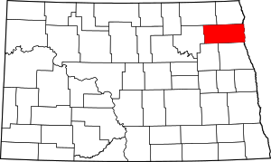
Park River is a city in Walsh County, North Dakota, United States. The population was 1,403 at the 2010 census.[5] Park River was founded in 1884.
Park River, North Dakota | |
|---|---|
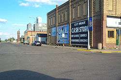
 Downtown Park River with grain elevators in the background | |
| Motto(s): "The Town With a Heart" | |
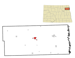
 Location of Park River, North Dakota | |
| Coordinates: 48°23′44″N 97°44′43″W | |
| Country | United States |
| State | North Dakota |
| County | Walsh |
| Area | |
| • Total | 2.59 sq mi (6.71 km2) |
| • Land | 2.59 sq mi (6.71 km2) |
| • Water | 0.00 sq mi (0.00 km2) |
| Elevation | 994 ft (303 m) |
| Population | |
| • Total | 1,403 |
| • Estimate (2019)[3] | 1,338 |
| • Density | 516.60/sq mi (199.46/km2) |
| Time zone | UTC−6 (Central (CST)) |
| • Summer (DST) | UTC−5 (CDT) |
| ZIP code | 58270 |
| Area code(s) | 701 |
| FIPS code | 38-60900 |
| GNIS feature ID | 1030633[4] |
| Highways | ND 17 |
| Website | ParkRiverND.gov |
Geography
Park River is located at 48°23′44″N 97°44′43″W (48.395443, -97.745375).[6]
According to the United States Census Bureau, the city has a total area of 2.17 square miles (5.62 km2), all of it land.[7]
Demographics
| Historical population | |||
|---|---|---|---|
| Census | Pop. | %± | |
| 1890 | 534 | — | |
| 1900 | 1,088 | 103.7% | |
| 1910 | 1,008 | −7.4% | |
| 1920 | 1,114 | 10.5% | |
| 1930 | 1,131 | 1.5% | |
| 1940 | 1,408 | 24.5% | |
| 1950 | 1,692 | 20.2% | |
| 1960 | 1,813 | 7.2% | |
| 1970 | 1,680 | −7.3% | |
| 1980 | 1,844 | 9.8% | |
| 1990 | 1,725 | −6.5% | |
| 2000 | 1,535 | −11.0% | |
| 2010 | 1,403 | −8.6% | |
| Est. 2019 | 1,338 | [3] | −4.6% |
| U.S. Decennial Census[8] 2018 Estimate[9] | |||
2010 census
At the 2010 census there were 1,403 people, 643 households, and 360 families living in the city. The population density was 646.5 inhabitants per square mile (249.6/km2). There were 734 housing units at an average density of 338.2 per square mile (130.6/km2). The racial makup of the city was 97.0% White, 1.3% Native American, 0.2% Asian, 0.4% from other races, and 1.1% from two or more races. Hispanic or Latino of any race were 2.4%.[2]
Of the 643 households 23.5% had children under the age of 18 living with them, 44.6% were married couples living together, 8.6% had a female householder with no husband present, 2.8% had a male householder with no wife present, and 44.0% were non-families. 39.7% of households were one person and 20.6% were one person aged 65 or older. The average household size was 2.07 and the average family size was 2.80.
The median age was 49.4 years. 21.2% of residents were under the age of 18; 4.3% were between the ages of 18 and 24; 19.1% were from 25 to 44; 28.1% were from 45 to 64; and 27.5% were 65 or older. The gender makeup of the city was 49.0% male and 51.0% female.
2000 census
At the 2000 census, there were 1,535 people, 660 households, and 390 families living in the city. The population density was 772.6 people per square mile (297.8/km2). There were 760 housing units at an average density of 382.5 per square mile (147.5/km2). The racial makup of the city was 95.57% White, 0.07% African American, 1.63% Native American, 0.07% Asian, 1.56% from other races, and 1.11% from two or more races. Hispanic or Latino of any race were 2.61% of the population.
Of the 660 households 27.0% had children under the age of 18 living with them, 47.9% were married couples living together, 8.8% had a female householder with no husband present, and 40.8% were non-families. 38.0% of households were one person and 20.8% were one person aged 65 or older. The average household size was 2.18 and the average family size was 2.88.
The age distribution was 22.1% under the age of 18, 6.3% from 18 to 24, 20.9% from 25 to 44, 22.1% from 45 to 64, and 28.5% 65 or older. The median age was 45 years. For every 100 females, there were 87.4 males. For every 100 females age 18 and over, there were 78.9 males.
The median household income was $30,347 and the median family income was $40,000. Males had a median income of $26,154 versus $20,769 for females. The per capita income for the city was $15,990. About 6.8% of families and 7.8% of the population were below the poverty line, including 9.1% of those under age 18 and 7.2% of those age 65 or over.
Notable people
- Al McIntosh, distinguished newspaper editor whose columns are featured in Ken Burns' The War
- William Rockefeller Sr., father of John D. Rockefeller, lived in Park River for a period of time
- Roger Allin, 4th Governor of North Dakota
- Paul Thorlakson- Canadian doctor
Climate
This climatic region is typified by large seasonal temperature differences, with warm to hot (and often humid) summers and cold (sometimes severely cold) winters. According to the Köppen Climate Classification system, Park River has a humid continental climate, abbreviated "Dfb" on climate maps.[10]
References
- "2019 U.S. Gazetteer Files". United States Census Bureau. Retrieved July 27, 2020.
- "U.S. Census website". United States Census Bureau. Retrieved June 14, 2012.
- "Population and Housing Unit Estimates". United States Census Bureau. May 24, 2020. Retrieved May 27, 2020.
- "US Board on Geographic Names". United States Geological Survey. October 25, 2007. Retrieved January 31, 2008.
- "2010 Census Redistricting Data (Public Law 94-171) Summary File". American FactFinder. United States Census Bureau. Retrieved May 2, 2011.
- "US Gazetteer files: 2010, 2000, and 1990". United States Census Bureau. 2011-02-12. Retrieved 2011-04-23.
- "US Gazetteer files 2010". United States Census Bureau. Archived from the original on July 2, 2012. Retrieved 2012-06-14.
- United States Census Bureau. "Census of Population and Housing". Retrieved August 7, 2013.
- "Population Estimates". United States Census Bureau. Retrieved June 8, 2019.
- Climate Summary for Park River, North Dakota

