Papradno
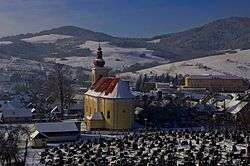
Papradno (Hungarian: Kosárfalva) is a village and municipality in Považská Bystrica District in the Trenčín Region of north-western Slovakia.
Papradno | |
|---|---|
Municipality | |
 Papradno | |
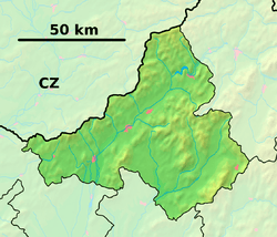
 Papradno Location of Papradno in the Trenčín Region  Papradno Papradno (Slovakia) | |
| Coordinates: 49°14′N 18°25′E | |
| Country | Slovakia |
| Region | Trenčiansky |
| District | Považská Bystrica |
| First written mention | 1525 |
| Government | |
| • Mayor | Ing. Roman Španihel |
| Area | |
| • Total | 55.97 km2 (21.61 sq mi) |
| Population (30.08.2010) | |
| • Total | 2,516 |
| • Density | 45/km2 (120/sq mi) |
| Time zone | UTC+1 (SEČ) |
| • Summer (DST) | UTC+2 (SELČ) |
| Postal code | 018 13 |
| Area code(s) | 421-42 |
| ŠÚJ | 513466 |
| Car plate | PB |
| Address of municipal authority | Obec Papradno č. 315, 018 13 Papradno |
| papradno@papradno.sk | |
| Telefón | 042/439 33 31 |
| Website | www.papradno.sk |
History
In historical records the village was first mentioned in 1525. In the past it belonged to the feudal dominion Bytča. Until 1918, the district was part of the Hungarian county of Trenčín.
Geography
The municipality lies at an altitude of 398 metres and covers an area of 55.816 km². It has a population of about 2540 people.
Tourism
gollark: No, it is a recipe for agreement, thus good.
gollark: You could form a Razetime Council and dictate all world affairs.
gollark: There would be Razetime messaging apps and Linux distributions and backpacks and laptops.
gollark: Why? You would get good, optimal products.
gollark: All kinds of goods and services would be tailored to them.
References
This article is issued from Wikipedia. The text is licensed under Creative Commons - Attribution - Sharealike. Additional terms may apply for the media files.