Ďurďové
Ďurďové (Hungarian: Gergőfalva) is a village and municipality in Považská Bystrica District in the Trenčín Region of north-western Slovakia.
Ďurďové | |
|---|---|
Municipality | |
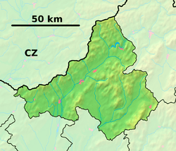 Ďurďové Location of Ďurďové in the Trenčín Region  Ďurďové Ďurďové (Slovakia) | |
| Coordinates: 49°01′41″N 18°29′52″E | |
| Country | Slovakia |
| Region | Trenčín |
| District | Považská Bystrica |
| First mentioned | 1393 |
| Area | |
| • Total | 4.815 km2 (1.859 sq mi) |
| Elevation | 381 m (1,250 ft) |
| Population | |
| • Total | 192 |
| • Density | 40/km2 (100/sq mi) |
| Postal code | 018 22 (pošta Pružina) |
| Area code(s) | 421-42 |
| Car plate | PB |
| Website | durdove.eu |
History
In historical records the village was first mentioned in 1393.
Geography
The municipality lies at an elevation of 381 metres (1,250 ft) and covers an area of 4.815 km² (1.859 mi²). It has a population of about 192.
Genealogical resources
The records for genealogical research are available at the state archive "Statny Archiv in Bytca, Slovakia"
- Roman Catholic church records (births/marriages/deaths): 1788-1948 (parish B)
gollark: I can't retrieve it right now so suffer.
gollark: There's an internal GTech™ one which prints 3dm files.
gollark: You just need to adjust filesystem and peripheral code.
gollark: Yes.
gollark: We have a hallway which is only traversable in one direction.
This article is issued from Wikipedia. The text is licensed under Creative Commons - Attribution - Sharealike. Additional terms may apply for the media files.